


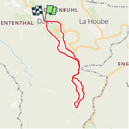


14.5 km | 22 km-effort


User


FREE GPS app for hiking
 SityTrail
IGN / Geographical institutes
SityTrail World
The world is yours!
Trail Walking of 11.8 km to be discovered at Grand Est, Moselle, Dabo. This trail is proposed by tracegps.
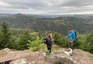
Promenade depuis le village de Dabo en Moselle vers le col de la Schleif et retour par le rocher St-Léon à travers les forêts du massif des Vosges. D’autres informations et photos sur le site des Balades de Stéphane.


Walking

Walking

Walking

Walking

Mountain bike

Walking

Horseback riding
Walking
Walking