![](/images/other/stat-length.png)
![Trail Walking La Bollène-Vésubie - Via Alpina - D61: Col de Turini > Sospel - Photo](https://media.geolcdn.com/t/1900/400/ext.pjpeg?maxdim=2&url=https%3A%2F%2Fservices.sitytrail.com%2FGeolivesWS%2FDownloadMedia.ashx%3FTrailID%3D109717%26Media%3D4426_1.jpg)
Via Alpina - D61: Col de Turini > Sospel
tracegps
User
![Length](/images/other/stat-length.png)
![Max alt](https://static1.geolcdn.com/siteimages/upload/files/1508320355ic_sort_altitude_max_24dp.png)
![Uphill gradient](https://static1.geolcdn.com/siteimages/upload/files/1508320355ic_sort_den_pos_24dp.png)
![Km-Effort](/images/other/stat-length.png)
![Min alt](https://static1.geolcdn.com/siteimages/upload/files/1508320355ic_sort_altitude_min_24dp.png)
![Downhill gradient](https://static1.geolcdn.com/siteimages/upload/files/1508320355ic_sort_den_neg_24dp.png)
![Boucle](https://static1.geolcdn.com/siteimages/upload/files/16400158638029165_repeat_loop_refresh_sync_direction_icon.png)
![Walking](https://static1.geolcdn.com/sitytour/trail-icons/101.png)
8h45
Difficulty : Difficult
![Scan this QR Code to open this trail in the SityTrail application](https://capi.geolives.com/qq0zvz2zws4bq2lad0pu/sitytour/trails/109717/qr.png?size=200)
FREE GPS app for hiking
About
Trail Walking of 19.3 km to be discovered at Provence-Alpes-Côte d'Azur, Maritime Alps, La Bollène-Vésubie. This trail is proposed by tracegps.
Description
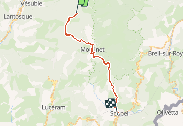
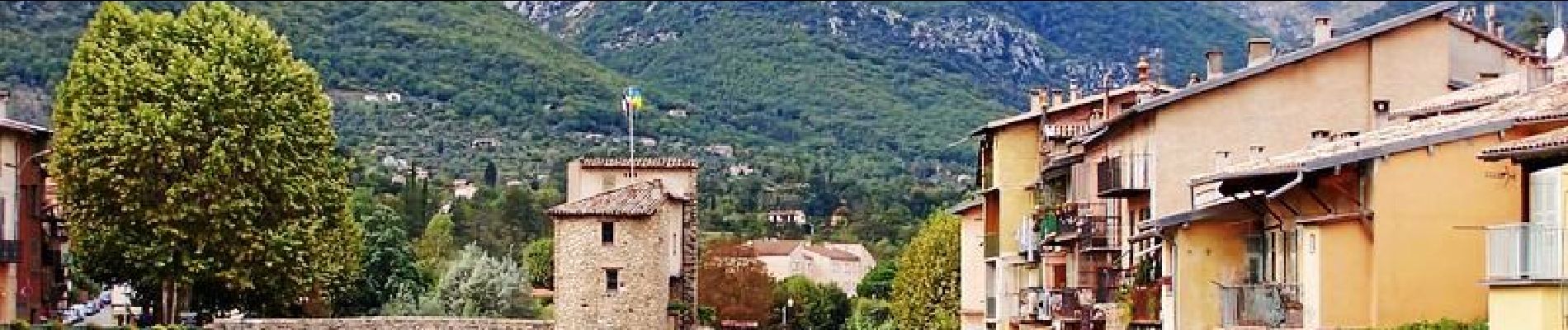
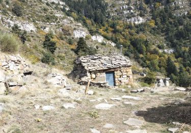
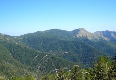
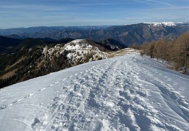
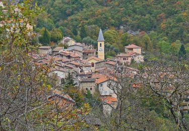
Via Alpina - D61: Col de Turini > Sospel. Cette dernière étape de l’itinéraire bleu, de basse altitude, emprunte le GR 52A. Elle pénètre dans la zone centrale du parc national du Mercantour juste après le village de Moulinet pour en sortir au lieu-dit « Bandita de Barrins », limite sud du parc. Une descente permet ensuite d’atteindre Sospel, village médiéval au cœur de la vallée de la Bévéra et point d’étape. Randonnée (sentier de montagne, parfois étroit et exposé). Description complète de l’étape sur Via-Alpina.org.
Positioning
Comments
Trails nearby
![Trail Walking Lantosque - cime de Suorcas en boucle - Photo](https://media.geolcdn.com/t/375/260/0ecdc4ca-4a6f-455e-849d-12769607394f.jpg&format=jpg&maxdim=2)
![Walking Walking](https://static1.geolcdn.com/sitytour/trail-icons/101.png)
Walking
![](/images/other/stat-length.png)
![](https://static1.geolcdn.com/siteimages/upload/files/16400158638029165_repeat_loop_refresh_sync_direction_icon.png)
![Trail On foot Moulinet - Crêtes de l'Arpiha - Photo](https://media.geolcdn.com/t/375/260/c07cc7b3-d5b2-4e51-bdf4-03929243643c.jpeg&format=jpg&maxdim=2)
![On foot On foot](https://static1.geolcdn.com/sitytour/trail-icons/100.png)
On foot
![](/images/other/stat-length.png)
![](https://static1.geolcdn.com/siteimages/upload/files/16400158638029165_repeat_loop_refresh_sync_direction_icon.png)
![Trail On foot Moulinet - Tour de la Calmette - Photo](https://media.geolcdn.com/t/375/260/f1319e6f-f58e-4543-ba7d-7f850f27f51a.jpeg&format=jpg&maxdim=2)
![On foot On foot](https://static1.geolcdn.com/sitytour/trail-icons/100.png)
On foot
![](/images/other/stat-length.png)
![](https://static1.geolcdn.com/siteimages/upload/files/16400158638029165_repeat_loop_refresh_sync_direction_icon.png)
![Trail On foot Moulinet - Cime du Diable - Photo](https://media.geolcdn.com/t/375/260/94134920-c5fc-4b95-a9f6-aeabb0ba95c2.jpeg&format=jpg&maxdim=2)
![On foot On foot](https://static1.geolcdn.com/sitytour/trail-icons/100.png)
On foot
![](/images/other/stat-length.png)
![](https://static1.geolcdn.com/siteimages/upload/files/16400158638029165_repeat_loop_refresh_sync_direction_icon.png)
![Trail Snowshoes Moulinet - Baisse Cavaline - Photo](https://media.geolcdn.com/t/375/260/b5a21962-1dcd-409b-822e-6e34602431de.jpg&format=jpg&maxdim=2)
![Snowshoes Snowshoes](https://static1.geolcdn.com/sitytour/trail-icons/504.png)
Snowshoes
![](/images/other/stat-length.png)
![](https://static1.geolcdn.com/siteimages/upload/files/16400158638029165_repeat_loop_refresh_sync_direction_icon.png)
![Trail Walking Moulinet - Grand Tour de Lauthion - Photo](https://media.geolcdn.com/t/375/260/fc421b10-23aa-4b7a-b4cf-80322f7edc29.jpg&format=jpg&maxdim=2)
![Walking Walking](https://static1.geolcdn.com/sitytour/trail-icons/101.png)
Walking
![](/images/other/stat-length.png)
![](https://static1.geolcdn.com/siteimages/upload/files/16400158638029165_repeat_loop_refresh_sync_direction_icon.png)
![Trail On foot Moulinet - Baisse de Peira Cava - Photo](https://media.geolcdn.com/t/375/260/dbec6e0a-5512-4263-b11e-6e8d3e38cd6e.jpeg&format=jpg&maxdim=2)
![On foot On foot](https://static1.geolcdn.com/sitytour/trail-icons/100.png)
On foot
![](/images/other/stat-length.png)
![](https://static1.geolcdn.com/siteimages/upload/files/16400158638029165_repeat_loop_refresh_sync_direction_icon.png)
![Trail Walking Moulinet - Turini- tour de la Calmette - Photo](https://media.geolcdn.com/t/375/260/65c623cf-7185-4ec8-a258-6191b868284a.jpg&format=jpg&maxdim=2)
![Walking Walking](https://static1.geolcdn.com/sitytour/trail-icons/101.png)
Walking
![](/images/other/stat-length.png)
![](https://static1.geolcdn.com/siteimages/upload/files/16400158638029165_repeat_loop_refresh_sync_direction_icon.png)
![Trail Walking Moulinet - Baisse de Bécass - Photo](https://media.geolcdn.com/t/375/260/10e54f39-88d4-4b84-9364-47a11d8f39f0.jpg&format=jpg&maxdim=2)
![Walking Walking](https://static1.geolcdn.com/sitytour/trail-icons/101.png)
Walking
![](/images/other/stat-length.png)
![](https://static1.geolcdn.com/siteimages/upload/files/16400158638029165_repeat_loop_refresh_sync_direction_icon.png)