Trail Walking Lanta - Le Lac St Sernin - Photo

Le Lac St Sernin

 tracegps
tracegps

User

© OpenStreetMap contributors
Length
Length
8.5 km
Max alt
Max alt
246 m
Uphill gradient
Uphill gradient
145 m
Km-Effort
Km-Effort  
10.5 km
Min alt
Min alt
168 m
Downhill gradient
Downhill gradient
145 m
Boucle
Boucle
Yes
Creation date :
2014-12-10 00:00:00.0
Updated on :
2014-12-10 00:00:00.0

(0 Reviews)

Walking
Walking
2h34
Difficulty : Medium

Scan this QR Code to open this trail in the SityTrail application

FREE GPS app for hiking

Logo SityTrail SityTrail

IGN / Geographical institutes

Download SityTrail from the App Store Download SityTrail from Google Play

Logo SityTrail SityTrail World

The world is yours!

Download SityTrail from the App Store Download SityTrail from Google Play Download SityTrail on Huawei AppGallery

About

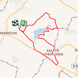
Trail Walking of 8.5 km to be discovered at Occitania, Haute-Garonne, Lanta. This trail is proposed by tracegps.

Description

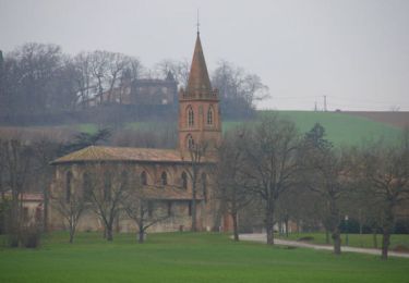
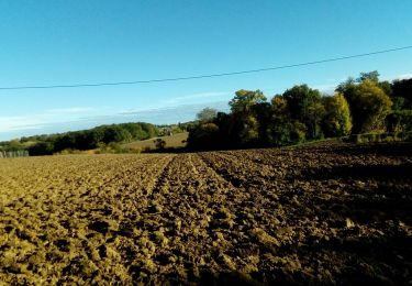
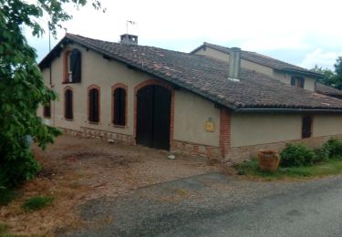
La balade commence au niveau de l'église de St Sernin en continuant la route vers les maisons du petit village de St Sernin. Après 150m, on tourne à gauche et on suit la route sur environ 1.5km. Après un large virage à droite, on continue sur le chemin de droite au croisement. Une petite descente de 1km et on traverse le ruisseau l'Avelanet. 50 après le pont, on trouve un chemin sur la droite menant à un champ de tir. On laisse le ball trap sur la droite pour suivre un petit chemin dans la forêt sur 500m. Le chemin se perd peu à peu et on longe un champ cultivé (naturellement, on ne passe pas à travers champ...). On retrouve le chemin plus loin lorsque l'on quitte l'orée de la forêt. On longe alors le lac sur sa rive gauche jusqu'au barrage où l'on rattrape une petite route. On remonte cette route sur 800m en direction opposée au barrage vers "Le Sartre" puis on arrive sur le chemin de Ragnère où l'on tourne à droite. Après 200m on arrive sur la D97A au petit village de Ste Appolinie que l'on traverse. Au centre du village, il y a un petit chemin sur la droite que l'on pourrait prendre mais une pancarte nous annonce: "Propriété Privée"... on fait un peu plus de goudron... On marche environ 700m pour retrouver la D18 où l'on tourne à droite. Il faut être prudent car cette départementale est très fréquentée et pas très large, il faudra en plus la remonter sur 1.2km avant de tourner à droite en direction de St Sernin. Après une pente de 1.2km un peu raide au début, on retrouve la voiture près de l'église St Sernin.

Elevation profile

Positioning

Country:
France
Region :
Occitania
Department/Province :
Haute-Garonne
Municipality :
Lanta
Location:
Unknown
Start:(UTM)
390861 ; 4822139 (31T) N.

Trails nearby

Trail Walking Sainte-Foy-d'Aigrefeuille - Ste Foy d'Aigrefeuille - Photo
Walking
tracegps

Walking

Easy
Sainte-Foy-d'Aigrefeuille, Occitania, Haute-Garonne, France
5.1 km | 5.6 km-effort
1h 19min
Yes
Trail Running Aurin - Autour du Lac de St Sernin - Photo
Running
tracegps

Running

Difficult
Aurin, Occitania, Haute-Garonne, France
15.7 km | 19.5 km-effort
1h 45min
Yes
Trail Walking Aurin - Autour du Lac de St Sernin - Photo
Walking
tracegps

Walking

Difficult
Aurin, Occitania, Haute-Garonne, France
15.7 km | 19.5 km-effort
3h 0min
Yes
Trail Walking Odars - Un beau paquet d'Auzielle - Photo
Walking
tracegps

Walking

Medium
(1)
Odars, Occitania, Haute-Garonne, France
14.5 km | 16.5 km-effort
4h 21min
Yes
Trail Walking Préserville - c2pa_lenclas_280622 - Photo
Walking
arnoultjf

Walking

Very difficult
Préserville, Occitania, Haute-Garonne, France
37 km | 42 km-effort
2h 51min
No
Trail On foot Odars - Boucle de la Marcaissonne - Photo
On foot
GUIDE+

On foot

Easy
Odars, Occitania, Haute-Garonne, France
3.6 km | 4.5 km-effort
1h 1min
No
Trail Walking Saint-Pierre-de-Lages - saint pierre 2_11_21 - Photo
Walking
arnoultjf

Walking

Very difficult
Saint-Pierre-de-Lages, Occitania, Haute-Garonne, France
15.8 km | 19.5 km-effort
2h 23min
No
Trail Walking Lanta - 270421 - Photo
Walking
arnoultjf

Walking

Very easy
Lanta, Occitania, Haute-Garonne, France
11.5 km | 14 km-effort
2h 35min
Yes
Trail Walking Préserville - l'enclave st mail et du 30062020 - Photo
Walking
arnoultjf

Walking

Very easy
Préserville, Occitania, Haute-Garonne, France
31 km | 37 km-effort
1h 32min
No


Close
My subscriptions