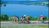
Trail Cycle Pontarlier - Les 2 lacs - Lac Saint-Point et Lac de Remoray - Doubs - Photo

Les 2 lacs - Lac Saint-Point et Lac de Remoray - Doubs

 tracegps
tracegps

User

© OpenStreetMap contributors
Length
Length
70 km
Max alt
Max alt
1057 m
Uphill gradient
Uphill gradient
819 m
Km-Effort
Km-Effort  
81 km
Min alt
Min alt
827 m
Downhill gradient
Downhill gradient
819 m
Boucle
Boucle
Yes
Creation date :
2014-12-10 00:00:00.0
Updated on :
2014-12-10 00:00:00.0

(0 Reviews)

Cycle
Cycle
3h00
Difficulty : Medium

Scan this QR Code to open this trail in the SityTrail application

FREE GPS app for hiking

Logo SityTrail SityTrail

IGN / Geographical institutes

Download SityTrail from the App Store Download SityTrail from Google Play

Logo SityTrail SityTrail World

The world is yours!

Download SityTrail from the App Store Download SityTrail from Google Play Download SityTrail on Huawei AppGallery

About

Trail Cycle of 70 km to be discovered at Bourgogne-Franche-Comté, Doubs, Pontarlier. This trail is proposed by tracegps.

Description

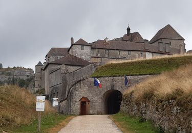
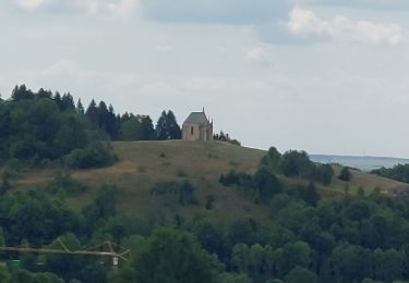
Le Doubs, réserve naturelle d’idées neuves ! Les 2 lacs -Lac Saint-Point et Lac de Remoray Office de tourisme à Pontarlier (03 81 46 48 33) - Musée municipal (03 81 38 82 14) - Eglise Saint-Bénigne - Porte Saint-Pierre - Distilleries Pierre Guy (03 81 39 04 70) et Les Fils d’Emile Pernot (03 81 39 04 28) : fabrication artisanale d’absinthe, apéritifs anisés, liqueurs et eaux de vie… A proximité Château de Joux (03 81 69 47 95) à la Cluse et Mijoux Lac Saint-Point (3e plus grand lac naturel de France), activités nautiques, plages… La Source bleue (entre Chaudron et Malbuisson) Syndicat d’initiative à Malbuisson (03 81 69 31 21) A proximité - Fort Saint-Antoine, cave d’affinage de 65000 meules de comté (OT : 03 81 69 31 21) Lac de Remoray (réserve naturelle) Maison de la Réserve (03 81 69 35 99) à Labergement-Sainte-Marie : interprétation des précieux milieux naturels du Haut-Doubs, découverte de la faune et de la flore, visites accompagnées sur le terrain… Fonderie de cloches Obertino (03 81 69 30 72) à Labergement-Sainte-Marie Entrée dans le Parc naturel régional du Haut-Jura à Gellin OT à Mouthe (03 81 69 22 78) Source du Doubs et tourbières à Mouthe Tremplins de saut à ski (03 81 69 16 09 – 03 81 69 29 88) à Chaux-Neuve : visite du site, exposition sur l’histoire du saut à ski, possibilités d’initiation au saut à ski… A proximité - Parc polaire (03 81 69 47 95) à Chaux-Neuve - Village et site de Chapelle-des-Bois Retour vers les lacs par une vallée parallèle : villages typiques du Haut-Doubs, fermes, scieries, clochers comtois (petite église de Boujeons)…

Elevation profile

Photos

Positioning

Country:
France
Region :
Bourgogne-Franche-Comté
Department/Province :
Doubs
Municipality :
Pontarlier
Location:
Unknown
Start:(UTM)
298446 ; 5197592 (32T) N.

Trails nearby

Trail Mountain bike Pontarlier - favrotte 2013 - Photo
Mountain bike
Erik25

Mountain bike

Medium
(2)
Pontarlier, Bourgogne-Franche-Comté, Doubs, France
40 km | 53 km-effort
3h 42min
Yes
Trail Snowshoes Pontarlier - Pontarlier Gounfay Grand Taureau 2021-01-19 CAF - Photo
Snowshoes
TRIMAILLE

Snowshoes

Medium
Pontarlier, Bourgogne-Franche-Comté, Doubs, France
9.5 km | 12.8 km-effort
3h 16min
Yes
Trail Walking La Cluse-et-Mijoux - le grand taureau, la Cluse et Mijoux - Photo
Walking
eltonnermou

Walking

Medium
La Cluse-et-Mijoux, Bourgogne-Franche-Comté, Doubs, France
24 km | 34 km-effort
5h 26min
Yes
Trail Walking Pontarlier - le grand taureau, Pontarlier - Photo
Walking
eltonnermou

Walking

Difficult
Pontarlier, Bourgogne-Franche-Comté, Doubs, France
20 km | 29 km-effort
3h 36min
Yes
Trail Walking Pontarlier - le grand taureau - Photo
Walking
GUILLETCORDIER

Walking

Medium
Pontarlier, Bourgogne-Franche-Comté, Doubs, France
8.8 km | 12.1 km-effort
2h 38min
Yes
Trail Walking Pontarlier - Le Grand Taureau 19.3 km D+661 m 20240512 - Photo
Walking
cmike39

Walking

Very difficult
Pontarlier, Bourgogne-Franche-Comté, Doubs, France
19.3 km | 28 km-effort
5h 5min
Yes
Trail Walking La Cluse-et-Mijoux - GTJ 2 La Cluse et Mijoux, Metabief - Photo
Walking
Praff

Walking

Medium
La Cluse-et-Mijoux, Bourgogne-Franche-Comté, Doubs, France
21 km | 29 km-effort
6h 18min
No
Trail Walking Pontarlier - GTJ 1 Pontarlier, La Cluse et Mijoux - Photo
Walking
Praff

Walking

Easy
Pontarlier, Bourgogne-Franche-Comté, Doubs, France
10.8 km | 15.6 km-effort
3h 14min
No
Trail Walking Pontarlier - FORT MALHER DEPUIS LE CAMPING DU LARMONT - Photo
Walking
walrou63

Walking

Difficult
Pontarlier, Bourgogne-Franche-Comté, Doubs, France
10 km | 14.5 km-effort
2h 30min
Yes


Close
My subscriptions