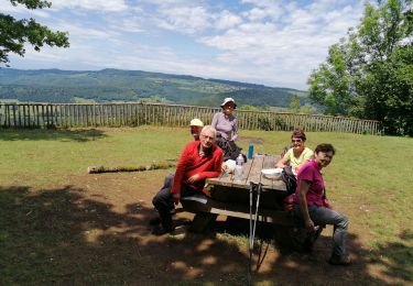
Trail Cycle Maîche - La Cendrée - Doubs - Photo
 tracegps
tracegps

User

© OpenStreetMap contributors
Length
Length
77 km
Max alt
Max alt
1018 m
Uphill gradient
Uphill gradient
1391 m
Km-Effort
Km-Effort  
95 km
Min alt
Min alt
781 m
Downhill gradient
Downhill gradient
1391 m
Boucle
Boucle
Yes
Creation date :
2014-12-10 00:00:00.0
Updated on :
2014-12-10 00:00:00.0

(0 Reviews)

Cycle
Cycle
3h45
Difficulty : Difficult

Scan this QR Code to open this trail in the SityTrail application

FREE GPS app for hiking

Logo SityTrail SityTrail

IGN / Geographical institutes

Download SityTrail from the App Store Download SityTrail from Google Play

Logo SityTrail SityTrail World

The world is yours!

Download SityTrail from the App Store Download SityTrail from Google Play Download SityTrail on Huawei AppGallery

About

Trail Cycle of 77 km to be discovered at Bourgogne-Franche-Comté, Doubs, Maîche. This trail is proposed by tracegps.

Description

Le Doubs, réserve naturelle d’idées neuves ! La Cendrée OT à Maiche (03 81 64 11 88), berceau du cheval comtois Belvédère de la Crampoulotte Parc-aventure de la Combe Saint-Pierre, parcours aventure, dévalkart, rollherbe, descente VTT, via ferrata aux Echelles de la Mort … (03 81 68 65 50 ou 06 37 91 90 42) A proximité Les Echelles de la Mort (accès au pied du site via Fournet-Blancheroche) La vallée du Doubs Belvédère de la Cendrée à Charquemont Ferme des Guinots, produits régionaux à Bonnétage (03 81 68 62 54) Site des 3 sapins au Russey Eglise Saint-Georges du Bizot (XVIe) Tourbière des Seignes au Bizot Belvédère de la Roche du Prêtre, panorama sur le cirque de Consolation A proximité Site de Consolation (Fondation, parc, tyrolienne géante…) Ferme-musée du Montagnon à Fournets- Luisans (03 81 43 57 86) L’étang du Moulin à Bonnétage Horlogerie Frésard à Charquemont : collection et fabrication de montres mécaniques et automatiques d'origine des années 1920 à nos jours (03 81 44 03 54)

Elevation profile

Photos

Positioning

Country:
France
Region :
Bourgogne-Franche-Comté
Department/Province :
Doubs
Municipality :
Maîche
Location:
Unknown
Start:(UTM)
333683 ; 5235540 (32T) N.

Trails nearby

Trail Walking Mancenans-Lizerne - Mancenans Lizerne, château hermitage - Photo
Walking
eltonnermou

Walking

Easy
Mancenans-Lizerne, Bourgogne-Franche-Comté, Doubs, France
13.3 km | 18.8 km-effort
3h 49min
Yes
Trail Walking Orgeans-Blanchefontaine - Orgeans Rocher du Boubet et Grottes de Waroly (IBP 89 ) 26 avril 2021 CAF - Photo
Walking
TRIMAILLE

Walking

Very difficult
Orgeans-Blanchefontaine, Bourgogne-Franche-Comté, Doubs, France
20 km | 30 km-effort
6h 40min
Yes
Trail Walking Vauclusotte - Rocher du Boubet et Grottes de Waroly - Photo
Walking
TRIMAILLE

Walking

Difficult
Vauclusotte, Bourgogne-Franche-Comté, Doubs, France
23 km | 33 km-effort
7h 29min
Yes
Trail Walking Vauclusotte - Dessoubre Pat Mimi - Photo
Walking
klopbill

Walking

Medium
(1)
Vauclusotte, Bourgogne-Franche-Comté, Doubs, France
16.5 km | 24 km-effort
7h 12min
Yes
Trail On foot Mancenans-Lizerne - Mancenans Lizerne - Photo
On foot
Danielfaivre

On foot

Medium
Mancenans-Lizerne, Bourgogne-Franche-Comté, Doubs, France
15.1 km | 21 km-effort
Unknown
Yes
Trail Mountain bike Thiébouhans - Pascal Loic  - Photo
Mountain bike
pepebru

Mountain bike

Medium
Thiébouhans, Bourgogne-Franche-Comté, Doubs, France
48 km | 62 km-effort
2h 59min
Yes
Trail Walking Mancenans-Lizerne - 2020 06 12 Mancenans Lizerne  - Photo
Walking
BIDOCHONP

Walking

Very easy
Mancenans-Lizerne, Bourgogne-Franche-Comté, Doubs, France
12.9 km | 18.4 km-effort
6h 2min
Yes
Trail Cycle Charquemont - Charquemont - Morteau - Photo
Cycle
lbguigui

Cycle

Difficult
Charquemont, Bourgogne-Franche-Comté, Doubs, France
35 km | 44 km-effort
2h 31min
No
Trail Walking Trévillers - trévillers-les plains - Photo
Walking
fredfred

Walking

Easy
Trévillers, Bourgogne-Franche-Comté, Doubs, France
13.3 km | 16.8 km-effort
3h 37min
Yes


Close
My subscriptions