Trail Walking Étourvy - Chemin de Compostelle, Voie de Vézelay GR654® De Etourvy à Tonnerre - Photo

Chemin de Compostelle, Voie de Vézelay GR654® De Etourvy à Tonnerre

 tracegps
tracegps

User

© OpenStreetMap contributors
Length
Length
24 km
Max alt
Max alt
311 m
Uphill gradient
Uphill gradient
343 m
Km-Effort
Km-Effort  
29 km
Min alt
Min alt
132 m
Downhill gradient
Downhill gradient
409 m
Boucle
Boucle
No
Creation date :
2014-12-10 00:00:00.0
Updated on :
2014-12-10 00:00:00.0

(0 Reviews)

Walking
Walking
4h55
Difficulty : Difficult

Scan this QR Code to open this trail in the SityTrail application

FREE GPS app for hiking

Logo SityTrail SityTrail

IGN / Geographical institutes

Download SityTrail from the App Store Download SityTrail from Google Play

Logo SityTrail SityTrail World

The world is yours!

Download SityTrail from the App Store Download SityTrail from Google Play Download SityTrail on Huawei AppGallery

About

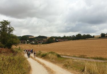
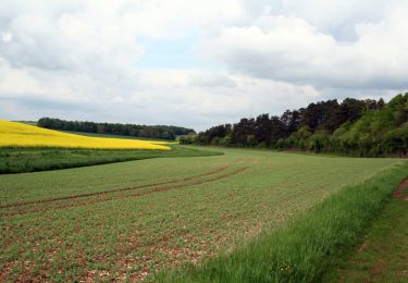
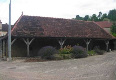
Trail Walking of 24 km to be discovered at Grand Est, Aube, Étourvy. This trail is proposed by tracegps.

Description

Le Chemin de Compostelle, voie de Vézelay GR654® présenté par le Comité Régional du Tourisme de Champagne-Ardenne. Chemin de Compostelle, Voie de Vézelay GR654® De Etourvy à Tonnerre. Vingtième et dernière étape. Entre la Champagne et la Bourgogne, cette dernière étape quitte l’Aube pour rejoindre l’Yonne à Tonnerre. Vous trouverez le descriptif détaillé de cette randonnée dans le Topo-guide® de la Fédération Française de la Randonnée Pédestre.

Elevation profile

Photos

Positioning

Country:
France
Region :
Grand Est
Department/Province :
Aube
Municipality :
Étourvy
Location:
Unknown
Start:(UTM)
584423 ; 5312157 (31T) N.

Trails nearby

Trail Walking Étourvy - ETOURVY  - Photo
Walking
Michel Sommesous

Walking

Very easy
Étourvy, Grand Est, Aube, France
59 km | 67 km-effort
6h 54min
No
Trail Mountain bike Étourvy - Circuit des Coteaux - Etourvy - Photo
Mountain bike
tracegps

Mountain bike

Medium
Étourvy, Grand Est, Aube, France
20 km | 24 km-effort
2h 15min
Yes
Trail Walking Étourvy - Circuit des 5 Vallées - Etourvy - Photo
Walking
tracegps

Walking

Difficult
(2)
Étourvy, Grand Est, Aube, France
15.5 km | 19.8 km-effort
4h 0min
Yes
Trail Mountain bike Étourvy - Erourvy Tonnerre - Photo
Mountain bike
ajpbm

Mountain bike

Medium
Étourvy, Grand Est, Aube, France
43 km | 54 km-effort
2h 57min
Yes
Trail Walking Étourvy - Etourvy 2023 - Photo
Walking
randobe

Walking

Very difficult
Étourvy, Grand Est, Aube, France
23 km | 29 km-effort
6h 36min
Yes
Trail Walking Étourvy - etourvy - Photo
Walking
randoam

Walking

Very easy
Étourvy, Grand Est, Aube, France
23 km | 29 km-effort
7h 7min
Yes


Close
My subscriptions