![](/images/other/stat-length.png)
![Trail Walking Merville - Circuit des rivières - Merville - Photo](https://media.geolcdn.com/t/1900/400/ext.pjpeg?maxdim=2&url=https%3A%2F%2Fservices.sitytrail.com%2FGeolivesWS%2FDownloadMedia.ashx%3FTrailID%3D109344%26Media%3D3611_6.jpg)
Circuit des rivières - Merville
tracegps
User
![Length](/images/other/stat-length.png)
Length
16.7 km
![Max alt](https://static1.geolcdn.com/siteimages/upload/files/1508320355ic_sort_altitude_max_24dp.png)
Max alt
30 m
![Uphill gradient](https://static1.geolcdn.com/siteimages/upload/files/1508320355ic_sort_den_pos_24dp.png)
Uphill gradient
73 m
![Km-Effort](/images/other/stat-length.png)
Km-Effort
17.6 km
![Min alt](https://static1.geolcdn.com/siteimages/upload/files/1508320355ic_sort_altitude_min_24dp.png)
Min alt
13 m
![Downhill gradient](https://static1.geolcdn.com/siteimages/upload/files/1508320355ic_sort_den_neg_24dp.png)
Downhill gradient
74 m
![Boucle](https://static1.geolcdn.com/siteimages/upload/files/16400158638029165_repeat_loop_refresh_sync_direction_icon.png)
Boucle
Yes
Creation date :
2014-12-10 00:00:00.0
Updated on :
2014-12-10 00:00:00.0
![Walking](https://static1.geolcdn.com/sitytour/trail-icons/101.png)
4h15
Difficulty : Difficult
![Scan this QR Code to open this trail in the SityTrail application](https://capi.geolives.com/qq0zvz2zws4bq2lad0pu/sitytour/trails/109344/qr.png?size=200)
FREE GPS app for hiking
About
Trail Walking of 16.7 km to be discovered at Hauts-de-France, Nord, Merville. This trail is proposed by tracegps.
Description
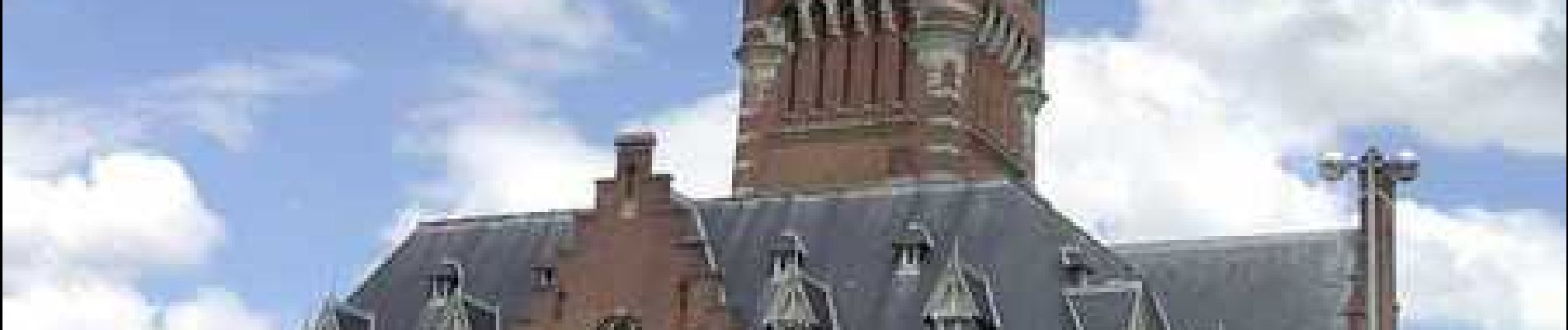
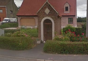
Départ de la mairie de Merville. Sur ce circuit se succèdent les petites routes, les chemins agricoles et les lisières de forêts. Retrouvez cette randonnée sur le site du Comité Départemental du Tourisme du Nord.
Positioning
Country:
France
Region :
Hauts-de-France
Department/Province :
Nord
Municipality :
Merville
Location:
Unknown
Start:(Dec)
Start:(UTM)
474419 ; 5610111 (31U) N.
Comments
Trails nearby
![Trail Walking La Gorgue - Chemin de randonnée des Magots (Version longue) - La Gorgue - Photo](https://media.geolcdn.com/t/375/260/ext.jpg?maxdim=2&url=https%3A%2F%2Fservices.sitytrail.com%2FGeolivesWS%2FDownloadMedia.ashx%3FTrailID%3D129826%26Media%3D13377_5.jpg)
![Walking Walking](https://static1.geolcdn.com/sitytour/trail-icons/101.png)
Chemin de randonnée des Magots (Version longue) - La Gorgue
Walking
Difficult
(1)
La Gorgue,
Hauts-de-France,
Nord,
France
![](/images/other/stat-length.png)
13.7 km | 14.3 km-effort
3h 25min
![](https://static1.geolcdn.com/siteimages/upload/files/16400158638029165_repeat_loop_refresh_sync_direction_icon.png)
Yes
![Trail Walking La Gorgue - Chemin de randonnée des Magots (Version Courte) - La Gorgue - Photo](https://media.geolcdn.com/t/375/260/ext.jpg?maxdim=2&url=https%3A%2F%2Fservices.sitytrail.com%2FGeolivesWS%2FDownloadMedia.ashx%3FTrailID%3D129825%26Media%3D13376_5.jpg)
![Walking Walking](https://static1.geolcdn.com/sitytour/trail-icons/101.png)
Chemin de randonnée des Magots (Version Courte) - La Gorgue
Walking
Easy
La Gorgue,
Hauts-de-France,
Nord,
France
![](/images/other/stat-length.png)
6.2 km | 6.5 km-effort
1h 30min
![](https://static1.geolcdn.com/siteimages/upload/files/16400158638029165_repeat_loop_refresh_sync_direction_icon.png)
Yes
![Walking Walking](https://static1.geolcdn.com/sitytour/trail-icons/101.png)
Lestrem des calvaires et chapelles 12 km
Walking
Easy
Lestrem,
Hauts-de-France,
Pas-de-Calais,
France
![](/images/other/stat-length.png)
12.2 km | 12.8 km-effort
17min
![](https://static1.geolcdn.com/siteimages/upload/files/16400158638029165_repeat_loop_refresh_sync_direction_icon.png)
Yes
![Trail Walking Lestrem - lestrem benb 13.11.2022 - Photo](https://media.geolcdn.com/t/375/260/8963e277-9835-43ac-88be-a7b70e17a1e2.jpg&format=jpg&maxdim=2)
![Walking Walking](https://static1.geolcdn.com/sitytour/trail-icons/101.png)
lestrem benb 13.11.2022
Walking
Difficult
Lestrem,
Hauts-de-France,
Pas-de-Calais,
France
![](/images/other/stat-length.png)
11.6 km | 12.2 km-effort
2h 36min
![](https://static1.geolcdn.com/siteimages/upload/files/16400158638029165_repeat_loop_refresh_sync_direction_icon.png)
Yes
![Trail Walking Morbecque - En passant par Caudescure - Photo](https://media.geolcdn.com/t/375/260/ext.jpg?maxdim=2&url=https%3A%2F%2Fstatic1.geolcdn.com%2Fsiteimages%2Fupload%2Ffiles%2F1553511878bg_sport_marche.png)
![Walking Walking](https://static1.geolcdn.com/sitytour/trail-icons/101.png)
En passant par Caudescure
Walking
Difficult
Morbecque,
Hauts-de-France,
Nord,
France
![](/images/other/stat-length.png)
12.4 km | 13.5 km-effort
3h 3min
![](https://static1.geolcdn.com/siteimages/upload/files/16400158638029165_repeat_loop_refresh_sync_direction_icon.png)
Yes
![Trail Nordic walking Merville - Merville, au fil de l'eau - Photo](https://media.geolcdn.com/t/375/260/ext.jpg?maxdim=2&url=https%3A%2F%2Fstatic1.geolcdn.com%2Fsiteimages%2Fupload%2Ffiles%2F1545311037marcheuse_200dpi.jpg)
![Nordic walking Nordic walking](https://static1.geolcdn.com/sitytour/trail-icons/102.png)
Merville, au fil de l'eau
Nordic walking
Easy
Merville,
Hauts-de-France,
Nord,
France
![](/images/other/stat-length.png)
4.2 km | 4.5 km-effort
55min
![](https://static1.geolcdn.com/siteimages/upload/files/16400158638029165_repeat_loop_refresh_sync_direction_icon.png)
Yes
![Trail Walking Lestrem - 12km La Fosse à Lestrem - Photo](https://media.geolcdn.com/t/375/260/ext.jpg?maxdim=2&url=https%3A%2F%2Fstatic1.geolcdn.com%2Fsiteimages%2Fupload%2Ffiles%2F1553511878bg_sport_marche.png)
![Walking Walking](https://static1.geolcdn.com/sitytour/trail-icons/101.png)
12km La Fosse à Lestrem
Walking
Very easy
Lestrem,
Hauts-de-France,
Pas-de-Calais,
France
![](/images/other/stat-length.png)
11.9 km | 12.5 km-effort
2h 50min
![](https://static1.geolcdn.com/siteimages/upload/files/16400158638029165_repeat_loop_refresh_sync_direction_icon.png)
Yes
![Trail Walking Saint-Floris - Saint Floris LO - Photo](https://media.geolcdn.com/t/375/260/ext.jpg?maxdim=2&url=https%3A%2F%2Fstatic1.geolcdn.com%2Fsiteimages%2Fupload%2Ffiles%2F1553511878bg_sport_marche.png)
![Walking Walking](https://static1.geolcdn.com/sitytour/trail-icons/101.png)
Saint Floris LO
Walking
Medium
Saint-Floris,
Hauts-de-France,
Pas-de-Calais,
France
![](/images/other/stat-length.png)
10.1 km | 10.7 km-effort
2h 7min
![](https://static1.geolcdn.com/siteimages/upload/files/16400158638029165_repeat_loop_refresh_sync_direction_icon.png)
Yes
![Trail Car Neuf-Berquin - es3 5 - Photo](https://media.geolcdn.com/t/375/260/ext.jpg?maxdim=2&url=https%3A%2F%2Fstatic1.geolcdn.com%2Fsiteimages%2Fupload%2Ffiles%2F15247431544x4.jpg)
![Car Car](https://static1.geolcdn.com/sitytour/trail-icons/401.png)
berrias