![](/images/other/stat-length.png)
![Trail Walking Champfromier - Pont du Dragon en vallée de la Valserine - Pays de Gex - Photo](https://media.geolcdn.com/t/1900/400/ext.pjpeg?maxdim=2&url=https%3A%2F%2Fservices.sitytrail.com%2FGeolivesWS%2FDownloadMedia.ashx%3FTrailID%3D109285%26Media%3D3481_1.jpg)
Pont du Dragon en vallée de la Valserine - Pays de Gex
tracegps
User
![Length](/images/other/stat-length.png)
![Max alt](https://static1.geolcdn.com/siteimages/upload/files/1508320355ic_sort_altitude_max_24dp.png)
![Uphill gradient](https://static1.geolcdn.com/siteimages/upload/files/1508320355ic_sort_den_pos_24dp.png)
![Km-Effort](/images/other/stat-length.png)
![Min alt](https://static1.geolcdn.com/siteimages/upload/files/1508320355ic_sort_altitude_min_24dp.png)
![Downhill gradient](https://static1.geolcdn.com/siteimages/upload/files/1508320355ic_sort_den_neg_24dp.png)
![Boucle](https://static1.geolcdn.com/siteimages/upload/files/16400158638029165_repeat_loop_refresh_sync_direction_icon.png)
![Walking](https://static1.geolcdn.com/sitytour/trail-icons/101.png)
2h30
Difficulty : Medium
![Scan this QR Code to open this trail in the SityTrail application](https://capi.geolives.com/qq0zvz2zws4bq2lad0pu/sitytour/trails/109285/qr.png?size=200)
FREE GPS app for hiking
About
Trail Walking of 7.9 km to be discovered at Auvergne-Rhône-Alpes, Ain, Champfromier. This trail is proposed by tracegps.
Description
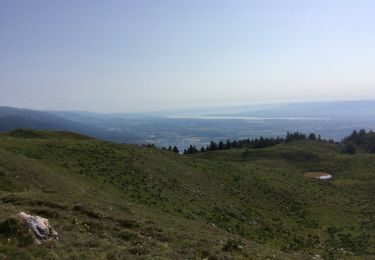
Balades en Pays de Gex. Communauté de communes du Pays de Gex - Bellegarde. En toutes saisons, entre Jura et Léman, laissez libre court à toutes vos envies de sensations fortes et de détente ! Ski de piste ou de fond dans les montagnes du Jura, randonnées pédestres sur le Balcon du Léman, VTT, parapente au coeur du Parc Naturel Régional du Haut-Jura, golf … Il y en a pour tous les goûts au Pays de Gex-Bellegarde, et pour toute la famille, pour des vacances adaptées à vos besoins.. Le Pont du Dragon en vallée de Valserine La variété des paysages encaissés puis très ouverts, la découverte du patrimoine lié à l’électricité et à la zone franche contribuent à la richesse de cette promenade. Les crêtes de Monts Jura offrent un panorama admirable sur le bassin du Léman et des Alpes. Le randonneur est à une altitude parfaite pour admirer les grands 4000 et les 400 km de chaînes des Alpes, de l'Oberland aux Alpes du sud en passant par le Massif du Mont Blanc ! Les paysages jurassiens typiques ne sont pas épargnés,entre vallée de la Valserine et sommets, prairies et forêts, vous irez à la rencontre d'une faune et d'une flore variées. Vous pourrez également profiter des étapes pour vous familiariser avec les traditions locales lors de visites prévues pendant le parcours. Retrouvez d’autres idées de randonnées ICI.
Positioning
Comments
Trails nearby
![Trail Walking Confort - Le Crêt de la Goutte, Grand Crêt d'Eau - Photo](https://media.geolcdn.com/t/375/260/ext.jpg?maxdim=2&url=https%3A%2F%2Fservices.sitytrail.com%2FGeolivesWS%2FDownloadMedia.ashx%3FTrailID%3D118827%26Media%3D13039_1.jpg)
![Walking Walking](https://static1.geolcdn.com/sitytour/trail-icons/101.png)
Walking
![](/images/other/stat-length.png)
![](https://static1.geolcdn.com/siteimages/upload/files/16400158638029165_repeat_loop_refresh_sync_direction_icon.png)
![Trail Walking Chézery-Forens - menthiere cret de la goutte pierre à fromag cret de l'eguillon - Photo](https://media.geolcdn.com/t/375/260/d20d4006-742e-4449-aa15-f76203f38e7a.jpg&format=jpg&maxdim=2)
![Walking Walking](https://static1.geolcdn.com/sitytour/trail-icons/101.png)
Walking
![](/images/other/stat-length.png)
![](https://static1.geolcdn.com/siteimages/upload/files/16400158638029165_repeat_loop_refresh_sync_direction_icon.png)
![Trail Snowshoes Confort - Menthières chalet du sac - Photo](https://media.geolcdn.com/t/375/260/c2795393-5b1a-488c-8937-125bdbc94e78.jpg&format=jpg&maxdim=2)
![Snowshoes Snowshoes](https://static1.geolcdn.com/sitytour/trail-icons/504.png)
Snowshoes
![](/images/other/stat-length.png)
![](https://static1.geolcdn.com/siteimages/upload/files/16400158638029165_repeat_loop_refresh_sync_direction_icon.png)
![Trail Walking Giron - giron - Photo](https://media.geolcdn.com/t/375/260/99f491d7-7281-4330-b0aa-0f336dca16fb.jpg&format=jpg&maxdim=2)
![Walking Walking](https://static1.geolcdn.com/sitytour/trail-icons/101.png)
![Trail Walking Chézery-Forens - Chezery Crêt Chalam (IBP 95) 7 mai 2021 CAF - Photo](https://media.geolcdn.com/t/375/260/a99d2394-153c-496a-94ce-d79cd22af376.jpg&format=jpg&maxdim=2)
![Walking Walking](https://static1.geolcdn.com/sitytour/trail-icons/101.png)
Walking
![](/images/other/stat-length.png)
![](https://static1.geolcdn.com/siteimages/upload/files/16400158638029165_repeat_loop_refresh_sync_direction_icon.png)
![Trail Walking Chézery-Forens - GR 9 - Étape 10 - Menthière - Bellegarde sur Valserine - Photo](https://media.geolcdn.com/t/375/260/11f7a143-4d57-4dbc-b9b0-0d689d8b45b0.jpg&format=jpg&maxdim=2)
![Walking Walking](https://static1.geolcdn.com/sitytour/trail-icons/101.png)
Walking
![](/images/other/stat-length.png)
![](https://static1.geolcdn.com/siteimages/upload/files/16400158638029165_repeat_loop_refresh_sync_direction_icon.png)
![Trail Walking Chézery-Forens - Chézery Chalam La Pesse - Photo](https://media.geolcdn.com/t/375/260/ext.jpg?maxdim=2&url=https%3A%2F%2Fservices.sitytrail.com%2FGeolivesWS%2FDownloadMedia.ashx%3FTrailID%3D423481%26Media%3Dfix__20150517161250.jpg)
![Walking Walking](https://static1.geolcdn.com/sitytour/trail-icons/101.png)
Walking
![](/images/other/stat-length.png)
![](https://static1.geolcdn.com/siteimages/upload/files/16400158638029165_repeat_loop_refresh_sync_direction_icon.png)
![Trail Snowshoes Giron - giron - Photo](https://media.geolcdn.com/t/375/260/ffd83a0d-f23c-4dee-bfbc-162b2a4ae3d4.jpg&format=jpg&maxdim=2)
![Snowshoes Snowshoes](https://static1.geolcdn.com/sitytour/trail-icons/504.png)
Snowshoes
![](/images/other/stat-length.png)
![](https://static1.geolcdn.com/siteimages/upload/files/16400158638029165_repeat_loop_refresh_sync_direction_icon.png)
![Trail Walking Chézery-Forens - Au fil de la Valserine - Photo](https://media.geolcdn.com/t/375/260/514a687a-00bc-4c43-ac62-1ee163dfe412.jpg&format=jpg&maxdim=2)
![Walking Walking](https://static1.geolcdn.com/sitytour/trail-icons/101.png)
Walking
![](/images/other/stat-length.png)
![](https://static1.geolcdn.com/siteimages/upload/files/16400158638029165_repeat_loop_refresh_sync_direction_icon.png)
Facile