![](/images/other/stat-length.png)
![Trail Walking Dehlingen - DehlingenRahling - Photo](https://media.geolcdn.com/t/1900/400/ext.pjpeg?maxdim=2&url=https%3A%2F%2Fservices.sitytrail.com%2FGeolivesWS%2FDownloadMedia.ashx%3FTrailID%3D1092058%26Media%3Dfix__20181229151503.jpg)
DehlingenRahling
helmut68
User
![Length](/images/other/stat-length.png)
Length
12.5 km
![Max alt](https://static1.geolcdn.com/siteimages/upload/files/1508320355ic_sort_altitude_max_24dp.png)
Max alt
355 m
![Uphill gradient](https://static1.geolcdn.com/siteimages/upload/files/1508320355ic_sort_den_pos_24dp.png)
Uphill gradient
180 m
![Km-Effort](/images/other/stat-length.png)
Km-Effort
14.9 km
![Min alt](https://static1.geolcdn.com/siteimages/upload/files/1508320355ic_sort_altitude_min_24dp.png)
Min alt
242 m
![Downhill gradient](https://static1.geolcdn.com/siteimages/upload/files/1508320355ic_sort_den_neg_24dp.png)
Downhill gradient
183 m
![Boucle](https://static1.geolcdn.com/siteimages/upload/files/16400158638029165_repeat_loop_refresh_sync_direction_icon.png)
Boucle
Yes
Creation date :
2019-01-15 20:26:25.346
Updated on :
2019-01-15 20:26:25.346
![Walking](https://static1.geolcdn.com/sitytour/trail-icons/101.png)
3h01
Difficulty : Easy
![Scan this QR Code to open this trail in the SityTrail application](https://capi.geolives.com/qq0zvz2zws4bq2lad0pu/sitytour/trails/1092058/qr.png?size=200)
FREE GPS app for hiking
About
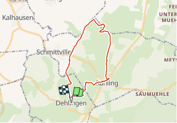
Trail Walking of 12.5 km to be discovered at Grand Est, Bas-Rhin, Dehlingen. This trail is proposed by helmut68.
Description
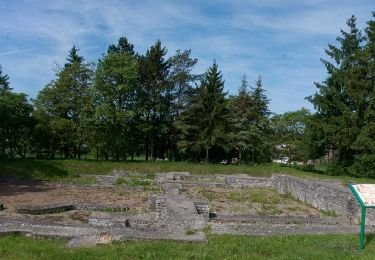
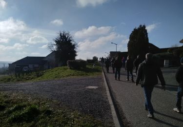
Départ fontaine de Dehlingen, direction Schmittwiller jusqu'au château d'eau,prendre le chemin en face jusqu'au Mohrenhof,puis la chapelle d'Altkich, ensuite Rahling et pour finir rejoindre Dehlingen par les fouilles romaines.
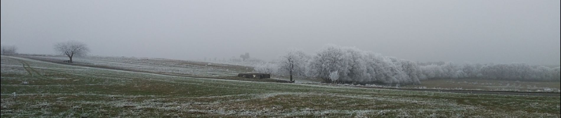
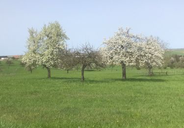
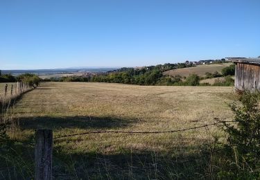
Ballade agréable avec de très belles vues ...
Positioning
Country:
France
Region :
Grand Est
Department/Province :
Bas-Rhin
Municipality :
Dehlingen
Location:
Unknown
Start:(Dec)
Start:(UTM)
367756 ; 5427033 (32U) N.
Comments
Trails nearby
![Trail On foot Diemeringen - Mackwiller la romaine - Photo](https://media.geolcdn.com/t/375/260/6e42945c-7f24-4443-aff5-37264c5394f0.jpeg&format=jpg&maxdim=2)
![On foot On foot](https://static1.geolcdn.com/sitytour/trail-icons/100.png)
Mackwiller la romaine
On foot
Easy
Diemeringen,
Grand Est,
Bas-Rhin,
France
![](/images/other/stat-length.png)
4.6 km | 5.4 km-effort
1h 14min
![](https://static1.geolcdn.com/siteimages/upload/files/16400158638029165_repeat_loop_refresh_sync_direction_icon.png)
Yes
![Trail On foot Diemeringen - Croix bleue - Photo](https://media.geolcdn.com/t/375/260/038b5fbd-ad7d-4d8f-a6b9-4f60e8eebeb8.jpeg&format=jpg&maxdim=2)
![On foot On foot](https://static1.geolcdn.com/sitytour/trail-icons/100.png)
Croix bleue
On foot
Easy
Diemeringen,
Grand Est,
Bas-Rhin,
France
![](/images/other/stat-length.png)
12.3 km | 16.1 km-effort
3h 39min
![](https://static1.geolcdn.com/siteimages/upload/files/16400158638029165_repeat_loop_refresh_sync_direction_icon.png)
No
![Trail On foot Diemeringen - Triangle bleu - Photo](https://media.geolcdn.com/t/375/260/d4b9e7be-1430-47f3-af7c-96cdacf9298e.jpeg&format=jpg&maxdim=2)
![On foot On foot](https://static1.geolcdn.com/sitytour/trail-icons/100.png)
Triangle bleu
On foot
Easy
Diemeringen,
Grand Est,
Bas-Rhin,
France
![](/images/other/stat-length.png)
7.6 km | 9.6 km-effort
2h 10min
![](https://static1.geolcdn.com/siteimages/upload/files/16400158638029165_repeat_loop_refresh_sync_direction_icon.png)
No
![Trail On foot Diemeringen - Comtesse Sophie de Nassau - Photo](https://media.geolcdn.com/t/375/260/8c2b8556-e0a8-4065-811c-0a8a71e07fa2.jpeg&format=jpg&maxdim=2)
![On foot On foot](https://static1.geolcdn.com/sitytour/trail-icons/100.png)
Comtesse Sophie de Nassau
On foot
Easy
Diemeringen,
Grand Est,
Bas-Rhin,
France
![](/images/other/stat-length.png)
6.9 km | 8.1 km-effort
1h 50min
![](https://static1.geolcdn.com/siteimages/upload/files/16400158638029165_repeat_loop_refresh_sync_direction_icon.png)
Yes
![Trail On foot Diemeringen - Yellow triangle - Photo](https://media.geolcdn.com/t/375/260/d4b9e7be-1430-47f3-af7c-96cdacf9298e.jpeg&format=jpg&maxdim=2)
![On foot On foot](https://static1.geolcdn.com/sitytour/trail-icons/100.png)
Yellow triangle
On foot
Medium
Diemeringen,
Grand Est,
Bas-Rhin,
France
![](/images/other/stat-length.png)
21 km | 27 km-effort
6h 11min
![](https://static1.geolcdn.com/siteimages/upload/files/16400158638029165_repeat_loop_refresh_sync_direction_icon.png)
No
![Trail sport Butten - 2024-04-07 Les vergers de Butten - Photo](https://media.geolcdn.com/t/375/260/21e8b322-75c7-495e-aaf5-acea1f138e8c.jpg&format=jpg&maxdim=2)
2024-04-07 Les vergers de Butten
sport
Very easy
Butten,
Grand Est,
Bas-Rhin,
France
![](/images/other/stat-length.png)
4.3 km | 5.5 km-effort
Unknown
![](https://static1.geolcdn.com/siteimages/upload/files/16400158638029165_repeat_loop_refresh_sync_direction_icon.png)
Yes
![Trail Walking Dehlingen - Speckfest Dehlingen 2023 - Photo](https://media.geolcdn.com/t/375/260/50343618-1039-4cc2-8cba-88bb57992e6e.jpg&format=jpg&maxdim=2)
![Walking Walking](https://static1.geolcdn.com/sitytour/trail-icons/101.png)
Speckfest Dehlingen 2023
Walking
Easy
Dehlingen,
Grand Est,
Bas-Rhin,
France
![](/images/other/stat-length.png)
4.8 km | 6.2 km-effort
1h 10min
![](https://static1.geolcdn.com/siteimages/upload/files/16400158638029165_repeat_loop_refresh_sync_direction_icon.png)
Yes
![Trail On foot Ratzwiller - Chevalet vert - Photo](https://media.geolcdn.com/t/375/260/e1ca6c5c-ec16-4e6c-a9bf-b3aef84f04a4.jpeg&format=jpg&maxdim=2)
![On foot On foot](https://static1.geolcdn.com/sitytour/trail-icons/100.png)
Chevalet vert
On foot
Easy
Ratzwiller,
Grand Est,
Bas-Rhin,
France
![](/images/other/stat-length.png)
6.1 km | 8.2 km-effort
1h 51min
![](https://static1.geolcdn.com/siteimages/upload/files/16400158638029165_repeat_loop_refresh_sync_direction_icon.png)
No
![Trail Walking Dehlingen - Dehlingen Remelfing - Photo](https://media.geolcdn.com/t/375/260/4e1a1449-9bb3-41eb-9ea3-e127d0b3e233.jpg&format=jpg&maxdim=2)
![Walking Walking](https://static1.geolcdn.com/sitytour/trail-icons/101.png)
Dehlingen Remelfing
Walking
Easy
Dehlingen,
Grand Est,
Bas-Rhin,
France
![](/images/other/stat-length.png)
22 km | 27 km-effort
4h 32min
![](https://static1.geolcdn.com/siteimages/upload/files/16400158638029165_repeat_loop_refresh_sync_direction_icon.png)
No