


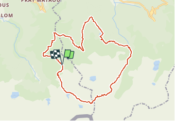

15.3 km | 28 km-effort

User


FREE GPS app for hiking
 SityTrail
IGN / Geographical institutes
SityTrail World
The world is yours!
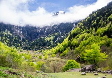
Trail Walking of 20 km to be discovered at Occitania, Ariège, Ustou. This trail is proposed by tracegps.
Grand comme trois fois la ville de Paris, le Haut-Couserans se situe au coeur des Pyrénées Ariègeoises à 1h30 de Toulouse. Son environnement naturel et bâtit exceptionnellement préservé, variant de 463m à 2865m, est à découvrir. Les hautes vallées de Turguilla et d’Ars Cette balade relativement longue présente un inventaire complet de nos montagnes. De Seix, direction Guzet Neige jusqu’au site de Prat Mataou. Juste avant le terminus de la route, prendre à droite direction « Col d’Escots » par une piste sur 2km jusqu’au Col d’Escots (restaurant d’altitude).

Walking

Walking
Walking

Walking
Walking
Walking
Walking
Walking
On foot