Trail Walking Garrebourg - Circulaire du Plan Incliné - Phalsbourg - Photo

Circulaire du Plan Incliné - Phalsbourg

 tracegps
tracegps

User

© OpenStreetMap contributors
Length
Length
11.9 km
Max alt
Max alt
364 m
Uphill gradient
Uphill gradient
349 m
Km-Effort
Km-Effort  
16.5 km
Min alt
Min alt
227 m
Downhill gradient
Downhill gradient
349 m
Boucle
Boucle
Yes
Creation date :
2014-12-10 00:00:00.0
Updated on :
2014-12-10 00:00:00.0

(0 Reviews)

Walking
Walking
3h30
Difficulty : Difficult

Scan this QR Code to open this trail in the SityTrail application

FREE GPS app for hiking

Logo SityTrail SityTrail

IGN / Geographical institutes

Download SityTrail from the App Store Download SityTrail from Google Play

Logo SityTrail SityTrail World

The world is yours!

Download SityTrail from the App Store Download SityTrail from Google Play Download SityTrail on Huawei AppGallery

About

Trail Walking of 11.9 km to be discovered at Grand Est, Moselle, Garrebourg. This trail is proposed by tracegps.

Description

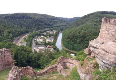
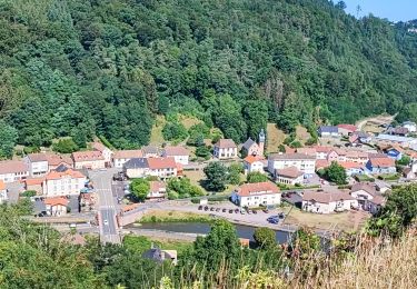
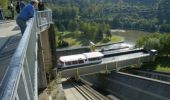
Le circulaire du Plan Incliné au Pays de Phalsbourg permet de découvrir l'un des fleurons du tourisme de la région qui est le Plan Incliné de Saint-Louis-Arzviller. Cet ouvrage, unique en Europe, construit sur le canal de la Marne au Rhin, permet depuis 1969 d'éviter une succession de 17 écluses et d'économiser une journée de navigation. L'itinéraire permet de voir également l'ancien canal avec son échelle de 17 écluses ainsi que le village de Saint-Louis: village "rue" typique de la région. Retrouvez d’autres informations sur Phalsbourg , lieu de départ privilégié pour vos promenades et randonnées !

Elevation profile

Photos

Positioning

Country:
France
Region :
Grand Est
Department/Province :
Moselle
Municipality :
Garrebourg
Location:
Unknown
Start:(UTM)
368835 ; 5396874 (32U) N.

Trails nearby

Trail Walking Lutzelbourg - Lutzelbourg - Hultehouse - Wasserwald - Photo
Walking
VacheKiri67

Walking

Medium
(2)
Lutzelbourg, Grand Est, Moselle, France
15.9 km | 21 km-effort
4h 53min
Yes
Trail Walking Lutzelbourg - 2019-11-11 Marche Lutzelbourg Sentier des bornes - Photo
Walking
GUIDE
holtzv

Walking

Very easy
Lutzelbourg, Grand Est, Moselle, France
16.9 km | 23 km-effort
4h 49min
Yes
Trail Walking Lutzelbourg - Lutzelbourg Gobain 2015 - Photo
Walking
mirkojmb

Walking

Easy
(3)
Lutzelbourg, Grand Est, Moselle, France
18.3 km | 25 km-effort
5h 22min
Yes
Trail Walking Haselbourg - De Haselbourg au Rocher de Falkenfels - Photo
Walking
GUIDE
Desrumaux

Walking

Easy
(2)
Haselbourg, Grand Est, Moselle, France
6.4 km | 9.7 km-effort
2h 6min
Yes
Trail Walking Henridorff - lutzbourg - Photo
Walking
didier cornelius

Walking

Medium
Henridorff, Grand Est, Moselle, France
16.1 km | 23 km-effort
6h 26min
Yes
Trail Walking Henridorff - lutzelbourg - Photo
Walking
didier cornelius

Walking

Medium
Henridorff, Grand Est, Moselle, France
16.8 km | 24 km-effort
4h 33min
Yes
Trail Mountain bike Lutzelbourg - 20150823 - Photo
Mountain bike
fredodlageo

Mountain bike

Medium
Lutzelbourg, Grand Est, Moselle, France
15.8 km | 21 km-effort
1h 34min
No
Trail Walking Hommert - Entre Schaeferhof et Dabo - Photo
Walking
markrei

Walking

Easy
Hommert, Grand Est, Moselle, France
11.4 km | 16.6 km-effort
3h 30min
Yes
Trail Walking Danne-et-Quatre-Vents - grotte de danne - Photo
Walking
fredodlageo

Walking

Medium
Danne-et-Quatre-Vents, Grand Est, Moselle, France
3.1 km | 4.5 km-effort
1h 10min
Yes


Close
My subscriptions