![](/images/other/stat-length.png)
![Trail Walking Bormes-les-Mimosas - Cabasson, Tour du cap Bénat - Photo](https://media.geolcdn.com/t/1900/400/ext.pjpeg?maxdim=2&url=https%3A%2F%2Fservices.sitytrail.com%2FGeolivesWS%2FDownloadMedia.ashx%3FTrailID%3D1090894%26Media%3Dfix__20190101153808.jpg)
Cabasson, Tour du cap Bénat
francisdean
User
![Length](/images/other/stat-length.png)
Length
15.8 km
![Max alt](https://static1.geolcdn.com/siteimages/upload/files/1508320355ic_sort_altitude_max_24dp.png)
Max alt
176 m
![Uphill gradient](https://static1.geolcdn.com/siteimages/upload/files/1508320355ic_sort_den_pos_24dp.png)
Uphill gradient
414 m
![Km-Effort](/images/other/stat-length.png)
Km-Effort
21 km
![Min alt](https://static1.geolcdn.com/siteimages/upload/files/1508320355ic_sort_altitude_min_24dp.png)
Min alt
0 m
![Downhill gradient](https://static1.geolcdn.com/siteimages/upload/files/1508320355ic_sort_den_neg_24dp.png)
Downhill gradient
415 m
![Boucle](https://static1.geolcdn.com/siteimages/upload/files/16400158638029165_repeat_loop_refresh_sync_direction_icon.png)
Boucle
Yes
Creation date :
2019-01-16 10:49:23.829
Updated on :
2019-01-16 10:49:23.829
![Walking](https://static1.geolcdn.com/sitytour/trail-icons/101.png)
4h31
Difficulty : Difficult
![Scan this QR Code to open this trail in the SityTrail application](https://capi.geolives.com/qq0zvz2zws4bq2lad0pu/sitytour/trails/1090894/qr.png?size=200)
FREE GPS app for hiking
About
Trail Walking of 15.8 km to be discovered at Provence-Alpes-Côte d'Azur, Var, Bormes-les-Mimosas. This trail is proposed by francisdean.
Description
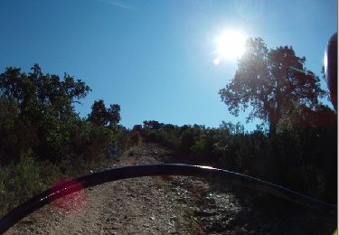
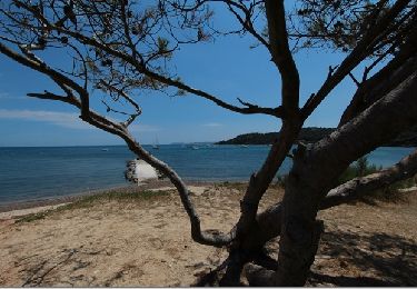
Randonnée parcourue le 01/01/2019. Le parcours est parfois écroulé et le chemin est souvent inexistant ou presque des Fouirades à la Reine Jeanne. Ensuite le tracé est pénible dans les rochers jusqu'au fort de Brégançon. Ceci dit , le paysage est magnifique!
Positioning
Country:
France
Region :
Provence-Alpes-Côte d'Azur
Department/Province :
Var
Municipality :
Bormes-les-Mimosas
Location:
Unknown
Start:(Dec)
Start:(UTM)
282676 ; 4775896 (32T) N.
Comments
Trails nearby
![Trail Walking Le Lavandou - Du Lavandou à la Pointe de l'Esquillette - Photo](https://media.geolcdn.com/t/375/260/ext.jpg?maxdim=2&url=https%3A%2F%2Fservices.sitytrail.com%2FGeolivesWS%2FDownloadMedia.ashx%3FTrailID%3D105657%26Media%3D9466_6.jpg)
![Walking Walking](https://static1.geolcdn.com/sitytour/trail-icons/101.png)
Du Lavandou à la Pointe de l'Esquillette
Walking
Easy
(1)
Le Lavandou,
Provence-Alpes-Côte d'Azur,
Var,
France
![](/images/other/stat-length.png)
5.9 km | 7.2 km-effort
3h 0min
![](https://static1.geolcdn.com/siteimages/upload/files/16400158638029165_repeat_loop_refresh_sync_direction_icon.png)
No
![Trail Walking Bormes-les-Mimosas - Tour de Bormes - Photo](https://media.geolcdn.com/t/375/260/ext.jpg?maxdim=2&url=https%3A%2F%2Fstatic1.geolcdn.com%2Fsiteimages%2Fupload%2Ffiles%2F1553511878bg_sport_marche.png)
![Walking Walking](https://static1.geolcdn.com/sitytour/trail-icons/101.png)
Tour de Bormes
Walking
Medium
(1)
Bormes-les-Mimosas,
Provence-Alpes-Côte d'Azur,
Var,
France
![](/images/other/stat-length.png)
11.5 km | 14.8 km-effort
2h 50min
![](https://static1.geolcdn.com/siteimages/upload/files/16400158638029165_repeat_loop_refresh_sync_direction_icon.png)
Yes
![Trail Trail Bormes-les-Mimosas - Pointe du Diable et de Estagnol - Photo](https://media.geolcdn.com/t/375/260/ea478b0f-bf14-4a5a-bcc7-6189a705ccc7.jpg&format=jpg&maxdim=2)
![Trail Trail](https://static1.geolcdn.com/sitytour/trail-icons/104.png)
Pointe du Diable et de Estagnol
Trail
Medium
Bormes-les-Mimosas,
Provence-Alpes-Côte d'Azur,
Var,
France
![](/images/other/stat-length.png)
14.1 km | 17.8 km-effort
1h 48min
![](https://static1.geolcdn.com/siteimages/upload/files/16400158638029165_repeat_loop_refresh_sync_direction_icon.png)
Yes
![Trail Walking Bormes-les-Mimosas - Le lac du Trapan - Photo](https://media.geolcdn.com/t/375/260/ext.jpg?maxdim=2&url=https%3A%2F%2Fservices.sitytrail.com%2FGeolivesWS%2FDownloadMedia.ashx%3FTrailID%3D452325%26Media%3D9e2d6742-85b3-4012-991e-d22c6e0c5c2a.jpg)
![Walking Walking](https://static1.geolcdn.com/sitytour/trail-icons/101.png)
Le lac du Trapan
Walking
Medium
Bormes-les-Mimosas,
Provence-Alpes-Côte d'Azur,
Var,
France
![](/images/other/stat-length.png)
7.3 km | 9.4 km-effort
2h 0min
![](https://static1.geolcdn.com/siteimages/upload/files/16400158638029165_repeat_loop_refresh_sync_direction_icon.png)
No
![Trail Walking Bormes-les-Mimosas - Pointe de l'Esquillette - Photo](https://media.geolcdn.com/t/375/260/ext.jpg?maxdim=2&url=https%3A%2F%2Fservices.sitytrail.com%2FGeolivesWS%2FDownloadMedia.ashx%3FTrailID%3D452318%26Media%3D2547c89e-032f-46f3-adb2-742ec3878938.jpg)
![Walking Walking](https://static1.geolcdn.com/sitytour/trail-icons/101.png)
Pointe de l'Esquillette
Walking
Medium
Bormes-les-Mimosas,
Provence-Alpes-Côte d'Azur,
Var,
France
![](/images/other/stat-length.png)
7.3 km | 9.6 km-effort
2h 2min
![](https://static1.geolcdn.com/siteimages/upload/files/16400158638029165_repeat_loop_refresh_sync_direction_icon.png)
No
![Trail Mountain bike Bormes-les-Mimosas - lavandou5 - Photo](https://media.geolcdn.com/t/375/260/ext.jpg?maxdim=2&url=https%3A%2F%2Fstatic1.geolcdn.com%2Fsiteimages%2Fupload%2Ffiles%2F1524743154velo.jpg)
![Mountain bike Mountain bike](https://static1.geolcdn.com/sitytour/trail-icons/202.png)
lavandou5
Mountain bike
Very easy
(1)
Bormes-les-Mimosas,
Provence-Alpes-Côte d'Azur,
Var,
France
![](/images/other/stat-length.png)
33 km | 44 km-effort
2h 7min
![](https://static1.geolcdn.com/siteimages/upload/files/16400158638029165_repeat_loop_refresh_sync_direction_icon.png)
Yes
![Trail Walking Bormes-les-Mimosas - Barrage du Trapan 10-01-2025 - Photo](https://media.geolcdn.com/t/375/260/bbd7ee92-d814-40ba-8b63-839249d00720.jpg&format=jpg&maxdim=2)
![Walking Walking](https://static1.geolcdn.com/sitytour/trail-icons/101.png)
Barrage du Trapan 10-01-2025
Walking
Medium
Bormes-les-Mimosas,
Provence-Alpes-Côte d'Azur,
Var,
France
![](/images/other/stat-length.png)
7 km | 9.1 km-effort
1h 40min
![](https://static1.geolcdn.com/siteimages/upload/files/16400158638029165_repeat_loop_refresh_sync_direction_icon.png)
Yes
![Trail Walking Bormes-les-Mimosas - Bormes Les Mimosas Tour de la Berle - Photo](https://media.geolcdn.com/t/375/260/4a054b46-625f-47d8-89f6-dde42bf69cb6.jpg&format=jpg&maxdim=2)
![Walking Walking](https://static1.geolcdn.com/sitytour/trail-icons/101.png)
Bormes Les Mimosas Tour de la Berle
Walking
Very difficult
Bormes-les-Mimosas,
Provence-Alpes-Côte d'Azur,
Var,
France
![](/images/other/stat-length.png)
16.8 km | 25 km-effort
5h 23min
![](https://static1.geolcdn.com/siteimages/upload/files/16400158638029165_repeat_loop_refresh_sync_direction_icon.png)
Yes
![Trail Walking Bormes-les-Mimosas - Bregancon 29/10/22 - Photo](https://media.geolcdn.com/t/375/260/8ea0b813-33ac-4a96-88ea-fec74cebff55.jpg&format=jpg&maxdim=2)
![Walking Walking](https://static1.geolcdn.com/sitytour/trail-icons/101.png)
Bregancon 29/10/22
Walking
Medium
Bormes-les-Mimosas,
Provence-Alpes-Côte d'Azur,
Var,
France
![](/images/other/stat-length.png)
8.5 km | 9.4 km-effort
2h 7min
![](https://static1.geolcdn.com/siteimages/upload/files/16400158638029165_repeat_loop_refresh_sync_direction_icon.png)
Yes