


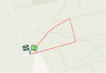

15.7 km | 18.4 km-effort


User


FREE GPS app for hiking
 SityTrail
IGN / Geographical institutes
SityTrail World
The world is yours!
Trail Walking of 1.3 km to be discovered at Hauts-de-France, Aisne, Mennevret. This trail is proposed by tracegps.
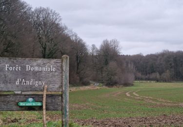
La forêt domaniale d'Andigny, relique de la vaste forêt médiévale d'Arrouaise, est devenue un domaine d'Etat en 1791. Après bien des vicissitudes liées aux guerres, la forêt a retrouvé un aspect engageant, propice aux balades : en témoigne le sentier d'interprétation, jalonné de panonceaux didactiques à but pédagogique. Retrouvez toutes les informations nécessaires ICI

Walking

Walking

Other activity
Other activity

Coupling