Trail Walking Guillon-les-Bains - Le Mont de Guillon - Doubs - Photo
 tracegps
tracegps

User

© OpenStreetMap contributors
Length
Length
5.4 km
Max alt
Max alt
514 m
Uphill gradient
Uphill gradient
237 m
Km-Effort
Km-Effort  
8.5 km
Min alt
Min alt
296 m
Downhill gradient
Downhill gradient
237 m
Boucle
Boucle
Yes
Creation date :
2014-12-10 00:00:00.0
Updated on :
2014-12-10 00:00:00.0

(0 Reviews)

Walking
Walking
2h00
Difficulty : Easy

Scan this QR Code to open this trail in the SityTrail application

FREE GPS app for hiking

Logo SityTrail SityTrail

IGN / Geographical institutes

Download SityTrail from the App Store Download SityTrail from Google Play

Logo SityTrail SityTrail World

The world is yours!

Download SityTrail from the App Store Download SityTrail from Google Play Download SityTrail on Huawei AppGallery

About

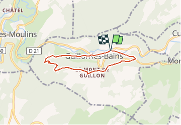
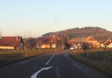
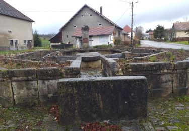
Trail Walking of 5.4 km to be discovered at Bourgogne-Franche-Comté, Doubs, Guillon-les-Bains. This trail is proposed by tracegps.

Description

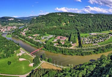
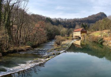
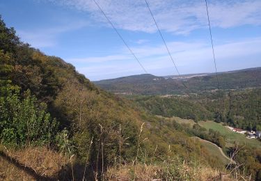
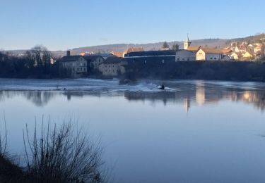
Le Doubs, réserve naturelle d’idées neuves ! Secteur géographique : Guillon-les-Bains Intérêt du parcours : Sites naturels : vallée du Cusancin, belvédère, forêt. A voir dans les environs : Source du Cusancin. Source bleue. Chapelle St Erminfroid. Château de Belvoir. Abbaye de la Grâce-Dieu. Baumes-les-Dames (abbaye, écomusée des pipes Ropp…)

Elevation profile

Photos

Positioning

Country:
France
Region :
Bourgogne-Franche-Comté
Department/Province :
Doubs
Municipality :
Guillon-les-Bains
Location:
Unknown
Start:(UTM)
303386 ; 5243983 (32T) N.

Trails nearby

Trail Walking Villers-Saint-Martin - Villers st Martin
Walking
eltonnermou

Walking

Medium
(1)
Villers-Saint-Martin, Bourgogne-Franche-Comté, Doubs, France
11.5 km | 16.5 km-effort
7h 18min
Yes
Trail Other activity Cusance - Val de Cusance, source bleue - Photo
Other activity
eltonnermou

Other activity

Easy
(2)
Cusance, Bourgogne-Franche-Comté, Doubs, France
14.5 km | 21 km-effort
2h 14min
Yes
Trail On foot Esnans - Mont Dommage - Photo
On foot
GUIDE+

On foot

Easy
Esnans, Bourgogne-Franche-Comté, Doubs, France
8.6 km | 13 km-effort
2h 57min
No
Trail On foot Baume-les-Dames - La Croix de Châtard - Photo
On foot
GUIDE+

On foot

Easy
Baume-les-Dames, Bourgogne-Franche-Comté, Doubs, France
6.4 km | 9.1 km-effort
2h 3min
Yes
Trail On foot Baume-les-Dames - La Fente de Babre - Photo
On foot
GUIDE+

On foot

Easy
Baume-les-Dames, Bourgogne-Franche-Comté, Doubs, France
7.7 km | 11.4 km-effort
2h 35min
Yes
Trail Walking Pont-les-Moulins - pont les moulins - Photo
Walking
eltonnermou

Walking

Easy
(1)
Pont-les-Moulins, Bourgogne-Franche-Comté, Doubs, France
16.8 km | 23 km-effort
2h 49min
Yes
Trail Walking Baume-les-Dames - Baume les dames, fente de Babre - Photo
Walking
eltonnermou

Walking

Easy
Baume-les-Dames, Bourgogne-Franche-Comté, Doubs, France
10.4 km | 14.7 km-effort
1h 39min
Yes
Trail On foot Adam-lès-Passavant - Bois de Rodolphe par Adam-lès-Passavant - Photo
On foot
GUIDE+

On foot

Easy
Adam-lès-Passavant, Bourgogne-Franche-Comté, Doubs, France
7.5 km | 9.1 km-effort
2h 3min
Yes
Trail Walking Lanans - Lanans - Photo
Walking
eltonnermou

Walking

Easy
(1)
Lanans, Bourgogne-Franche-Comté, Doubs, France
15.1 km | 18.9 km-effort
2h 33min
Yes


Close
My subscriptions