Trail Walking Rougemont - La Croix de Rognon - Doubs - Photo

La Croix de Rognon - Doubs

 tracegps
tracegps

User

© OpenStreetMap contributors
Length
Length
16.8 km
Max alt
Max alt
409 m
Uphill gradient
Uphill gradient
418 m
Km-Effort
Km-Effort  
22 km
Min alt
Min alt
245 m
Downhill gradient
Downhill gradient
417 m
Boucle
Boucle
Yes
Creation date :
2014-12-10 00:00:00.0
Updated on :
2014-12-10 00:00:00.0

(1 Reviews)

Walking
Walking
5h00
Difficulty : Difficult

Scan this QR Code to open this trail in the SityTrail application

FREE GPS app for hiking

Logo SityTrail SityTrail

IGN / Geographical institutes

Download SityTrail from the App Store Download SityTrail from Google Play

Logo SityTrail SityTrail World

The world is yours!

Download SityTrail from the App Store Download SityTrail from Google Play Download SityTrail on Huawei AppGallery

About

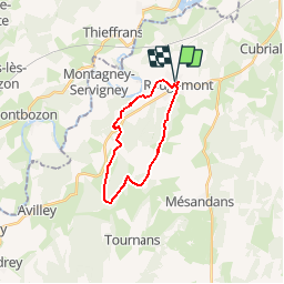
Trail Walking of 16.8 km to be discovered at Bourgogne-Franche-Comté, Doubs, Rougemont. This trail is proposed by tracegps.

Description

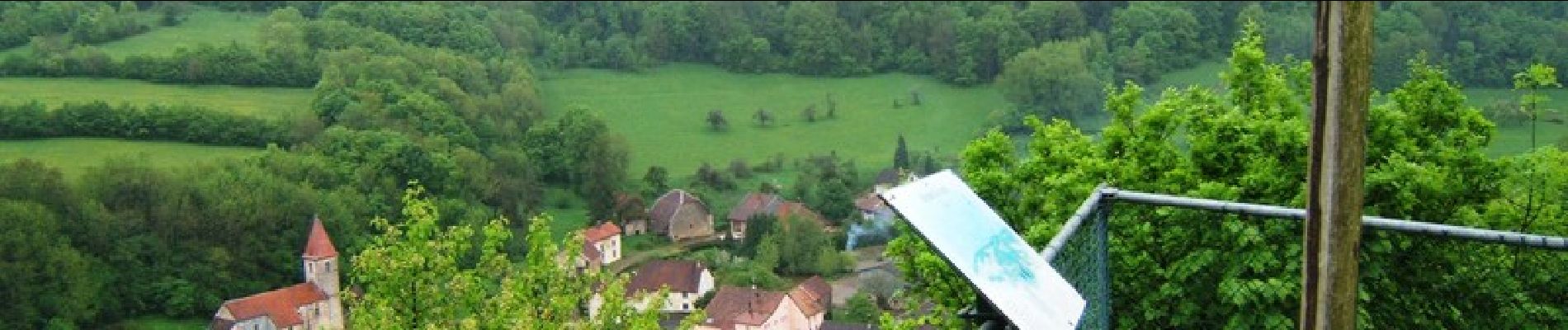
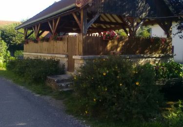
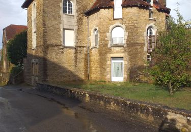
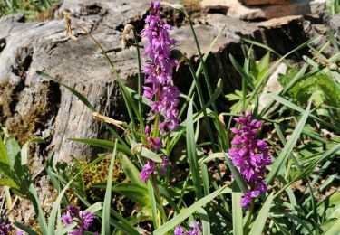
Le Doubs, réserve naturelle d’idées neuves ! Secteur géographique : Rougemont Intérêt du parcours : Environnement naturel : point de vue, cheminement entre prés et forêts. Patrimoine : Rougemont (église, lavoir, anciennes halles aux grains…) Chapelle, vue sur le Château de Montmartin. A voir dans les environs : Vallée de l’Ognon. Base de loisirs de la Forge (Montagney-Servigney). Plan d’eau de Bonnal. Golf du château de Bournel (Cubry). Baumes-les-Dames (Musées, halte nautique…)

Elevation profile

Photos

Positioning

Country:
France
Region :
Bourgogne-Franche-Comté
Department/Province :
Doubs
Municipality :
Rougemont
Location:
Unknown
Start:(UTM)
300695 ; 5261919 (32T) N.

Comments

Please log in to post a review or rate the element


Trails nearby

Trail Walking Rougemont - Rougemont 130919 - Photo
Walking
legios84

Walking

Easy
(1)
Rougemont, Bourgogne-Franche-Comté, Doubs, France
27 km | 36 km-effort
8h 21min
Yes
Trail Mountain bike Chassey-lès-Montbozon - Bonnal, piste cyclable en famille.  - Photo
Mountain bike
Raphaël K

Mountain bike

Medium
Chassey-lès-Montbozon, Bourgogne-Franche-Comté, Haute-Saône, France
20 km | 23 km-effort
1h 31min
No
Trail Walking Rougemont - Rougemont - Photo
Walking
eltonnermou

Walking

Medium
Rougemont, Bourgogne-Franche-Comté, Doubs, France
23 km | 30 km-effort
3h 21min
Yes
Trail Walking Chassey-lès-Montbozon - Chassey les Montbozon  9 janv 2020 CAF - Photo
Walking
TRIMAILLE

Walking

Difficult
Chassey-lès-Montbozon, Bourgogne-Franche-Comté, Haute-Saône, France
24 km | 31 km-effort
6h 53min
Yes
Trail Walking Nans - roches de Nans  - Photo
Walking
fbienmuller

Walking

Medium
Nans, Bourgogne-Franche-Comté, Doubs, France
10.2 km | 13.7 km-effort
2h 43min
Yes
Trail Walking Rougemont - Rougemont - Photo
Walking
TRIMAILLE

Walking

Very easy
Rougemont, Bourgogne-Franche-Comté, Doubs, France
23 km | 30 km-effort
7h 4min
Yes
Trail Walking Nans - Nan s Bournel - Photo
Walking
patch134

Walking

Very easy
Nans, Bourgogne-Franche-Comté, Doubs, France
10.9 km | 15.1 km-effort
3h 21min
Yes
Trail Mountain bike Huanne-Montmartin - m-frankrijk-huanne - Photo
Mountain bike
gpstracks

Mountain bike

Very easy
Huanne-Montmartin, Bourgogne-Franche-Comté, Doubs, France
38 km | 47 km-effort
Unknown
Yes
Trail Road bike Chassey-lès-Montbozon - bonal Devecey  - Photo
Road bike
Denis Roussel

Road bike

Very difficult
Chassey-lès-Montbozon, Bourgogne-Franche-Comté, Haute-Saône, France
42 km | 49 km-effort
2h 40min
No


Close
My subscriptions