![](/images/other/stat-length.png)
![Trail Mountain bike Rosis - Haute vallée de la Mare, le Castélas - variante courte - Photo](https://media.geolcdn.com/t/1900/400/ext.pjpeg?maxdim=2&url=https%3A%2F%2Fservices.sitytrail.com%2FGeolivesWS%2FDownloadMedia.ashx%3FTrailID%3D108897%26Media%3D2473_1.jpg)
Haute vallée de la Mare, le Castélas - variante courte
tracegps
User
![Length](/images/other/stat-length.png)
![Max alt](https://static1.geolcdn.com/siteimages/upload/files/1508320355ic_sort_altitude_max_24dp.png)
![Uphill gradient](https://static1.geolcdn.com/siteimages/upload/files/1508320355ic_sort_den_pos_24dp.png)
![Km-Effort](/images/other/stat-length.png)
![Min alt](https://static1.geolcdn.com/siteimages/upload/files/1508320355ic_sort_altitude_min_24dp.png)
![Downhill gradient](https://static1.geolcdn.com/siteimages/upload/files/1508320355ic_sort_den_neg_24dp.png)
![Boucle](https://static1.geolcdn.com/siteimages/upload/files/16400158638029165_repeat_loop_refresh_sync_direction_icon.png)
![Mountain bike](https://static1.geolcdn.com/sitytour/trail-icons/202.png)
2h00
Difficulty : Medium
![Scan this QR Code to open this trail in the SityTrail application](https://capi.geolives.com/qq0zvz2zws4bq2lad0pu/sitytour/trails/108897/qr.png?size=200)
FREE GPS app for hiking
About
Trail Mountain bike of 15 km to be discovered at Occitania, Hérault, Rosis. This trail is proposed by tracegps.
Description
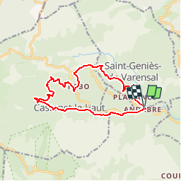
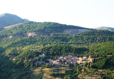
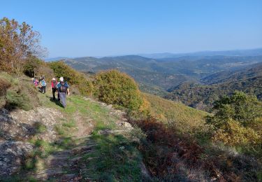
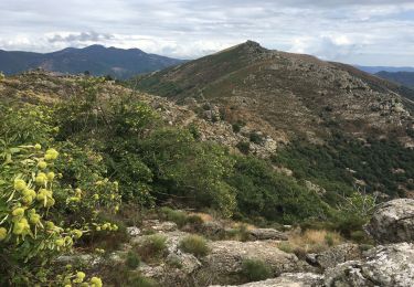
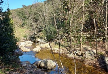
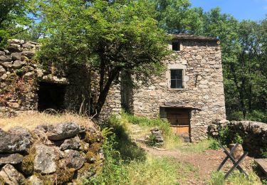
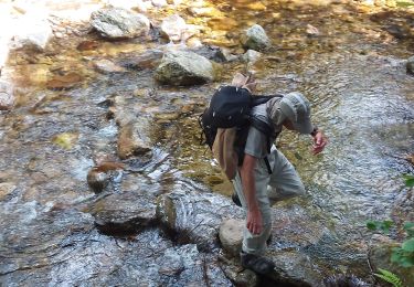
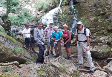
Source La Maison Cévenole des Arts et Traditions Populaires Saint Gervais sur Mare est situé dans le haut Hérault, aux confins du Tarn et de l'Aveyron. Le village qui se trouve à environ 350m d'altitude est entouré de sommets qui atteignent 1000 mètres et qui font la limite de partage des eaux entre les versants méditerranéen et atlantique. Circuit n°20 – variante courte. Randonnée assez longue permettant de découvrir la haute vallée de la Mare, et le bassin houiller de Plaisance. Vue rapprochée sur l’Espinouse et le Castélas. Toutes les infos sont disponibles sur fiches téléchargeables ICI
Positioning
Comments
Trails nearby
![Trail Walking Saint-Gervais-sur-Mare - Les Nières et ses anciennes découvertes de houille - Photo](https://media.geolcdn.com/t/375/260/ext.jpg?maxdim=2&url=https%3A%2F%2Fservices.sitytrail.com%2FGeolivesWS%2FDownloadMedia.ashx%3FTrailID%3D108891%26Media%3D2468_1.jpg)
![Walking Walking](https://static1.geolcdn.com/sitytour/trail-icons/101.png)
Walking
![](/images/other/stat-length.png)
![](https://static1.geolcdn.com/siteimages/upload/files/16400158638029165_repeat_loop_refresh_sync_direction_icon.png)
![Trail Walking Saint-Gervais-sur-Mare - Tour du Caroux Arsel - Photo](https://media.geolcdn.com/t/375/260/38436cc7-eed3-45cf-a5b1-a12f25d9e4ac.jpeg&format=jpg&maxdim=2)
![Walking Walking](https://static1.geolcdn.com/sitytour/trail-icons/101.png)
Walking
![](/images/other/stat-length.png)
![](https://static1.geolcdn.com/siteimages/upload/files/16400158638029165_repeat_loop_refresh_sync_direction_icon.png)
![Trail Walking Rosis - Les cinq cols - Photo](https://media.geolcdn.com/t/375/260/10f3b19b-e07b-4b83-a9da-a43d19300d46.jpg&format=jpg&maxdim=2)
![Walking Walking](https://static1.geolcdn.com/sitytour/trail-icons/101.png)
![Trail Walking Saint-Gervais-sur-Mare - St Gervais / Mecle - Photo](https://media.geolcdn.com/t/375/260/44a3a381-c5a0-422f-9207-70c1fc116558.jpg&format=jpg&maxdim=2)
![Walking Walking](https://static1.geolcdn.com/sitytour/trail-icons/101.png)
Walking
![](/images/other/stat-length.png)
![](https://static1.geolcdn.com/siteimages/upload/files/16400158638029165_repeat_loop_refresh_sync_direction_icon.png)
![Trail Walking Rosis - Andabre - Portail de Roquandouïre - Caissenols-le-Haut - Photo](https://media.geolcdn.com/t/375/260/a7f312f0-5400-4beb-b0c0-92123c0aa91f.jpg&format=jpg&maxdim=2)
![Walking Walking](https://static1.geolcdn.com/sitytour/trail-icons/101.png)
Walking
![](/images/other/stat-length.png)
![](https://static1.geolcdn.com/siteimages/upload/files/16400158638029165_repeat_loop_refresh_sync_direction_icon.png)
![Trail Walking Saint-Gervais-sur-Mare - compeyre arsel - Photo](https://media.geolcdn.com/t/375/260/6d5dd05e-d2b6-47cc-acd4-44d9ab3855de.jpg&format=jpg&maxdim=2)
![Walking Walking](https://static1.geolcdn.com/sitytour/trail-icons/101.png)
Walking
![](/images/other/stat-length.png)
![](https://static1.geolcdn.com/siteimages/upload/files/16400158638029165_repeat_loop_refresh_sync_direction_icon.png)
![Trail Walking Rosis - Col de lourdTigas - Photo](https://media.geolcdn.com/t/375/260/f2da17c1-c586-4087-b4a8-a530c958ee71.jpg&format=jpg&maxdim=2)
![Walking Walking](https://static1.geolcdn.com/sitytour/trail-icons/101.png)
Walking
![](/images/other/stat-length.png)
![](https://static1.geolcdn.com/siteimages/upload/files/16400158638029165_repeat_loop_refresh_sync_direction_icon.png)
![Trail Walking Saint-Gervais-sur-Mare - de compter au col aussieres - Photo](https://media.geolcdn.com/t/375/260/4602b779-ce6c-42c8-974b-8dd2fe531ba4.jpg&format=jpg&maxdim=2)
![Walking Walking](https://static1.geolcdn.com/sitytour/trail-icons/101.png)
Walking
![](/images/other/stat-length.png)
![](https://static1.geolcdn.com/siteimages/upload/files/16400158638029165_repeat_loop_refresh_sync_direction_icon.png)
![Trail Walking Saint-Geniès-de-Varensal - col du Marcou a partir de Plaisance - Photo](https://media.geolcdn.com/t/375/260/07d3e210-25c8-483d-a597-9b676b29012c.jpg&format=jpg&maxdim=2)
![Walking Walking](https://static1.geolcdn.com/sitytour/trail-icons/101.png)
Walking
![](/images/other/stat-length.png)
![](https://static1.geolcdn.com/siteimages/upload/files/16400158638029165_repeat_loop_refresh_sync_direction_icon.png)