


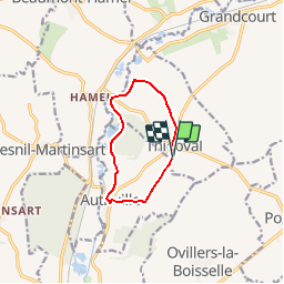

14.1 km | 16.9 km-effort


User


FREE GPS app for hiking
 SityTrail
IGN / Geographical institutes
SityTrail World
The world is yours!
Trail Walking of 7.6 km to be discovered at Hauts-de-France, Somme, Thiepval. This trail is proposed by tracegps.
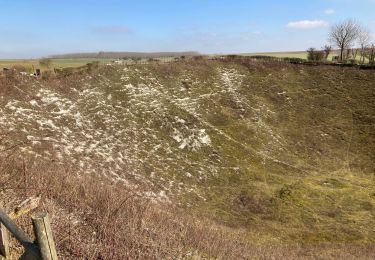
Paisible aujourd'hui, ce coin de terre picarde est devenu une étape incontournable du Circuit du Souvenir. Pour télécharger la fiche du circuit en format pdf.
 - Photo 1")
Walking

Walking
Walking

Walking

On foot

Hybrid bike
Hybrid bike
Bicycle tourism