Trail Walking Fontaine-le-Sec - Le bois de la Faude - Photo
 tracegps
tracegps

User

© OpenStreetMap contributors
Length
Length
13.6 km
Max alt
Max alt
131 m
Uphill gradient
Uphill gradient
213 m
Km-Effort
Km-Effort  
16.4 km
Min alt
Min alt
55 m
Downhill gradient
Downhill gradient
212 m
Boucle
Boucle
Yes
Creation date :
2014-12-10 00:00:00.0
Updated on :
2014-12-10 00:00:00.0

(0 Reviews)

Walking
Walking
4h30
Difficulty : Difficult

Scan this QR Code to open this trail in the SityTrail application

FREE GPS app for hiking

Logo SityTrail SityTrail

IGN / Geographical institutes

Download SityTrail from the App Store Download SityTrail from Google Play

Logo SityTrail SityTrail World

The world is yours!

Download SityTrail from the App Store Download SityTrail from Google Play Download SityTrail on Huawei AppGallery

About

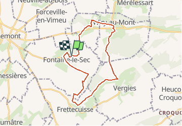
Trail Walking of 13.6 km to be discovered at Hauts-de-France, Somme, Fontaine-le-Sec. This trail is proposed by tracegps.

Description

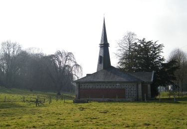
Aujourd'hui, les Fontenois ne craignent plus la réputation de ce bois, hanté jadis, dit-on, par une maléfique sorcière !

Elevation profile

Photos

Positioning

Country:
France
Region :
Hauts-de-France
Department/Province :
Somme
Municipality :
Fontaine-le-Sec
Location:
Unknown
Start:(UTM)
414623 ; 5533385 (31U) N.

Trails nearby

Trail On foot Vaux-Marquenneville - Le Moulin de Frucourt - Photo
On foot
PRO

On foot

Easy
Vaux-Marquenneville, Hauts-de-France, Somme, France
8.9 km | 10.4 km-effort
2h 21min
Yes
Trail On foot Vergies - Le Bois de la Faude - Photo
On foot
PRO

On foot

Easy
Vergies, Hauts-de-France, Somme, France
13.6 km | 16.5 km-effort
3h 45min
Yes


Close
My subscriptions