Trail Walking Belloy-Saint-Léonard - Le bois Renouard - Photo
 tracegps
tracegps

User

© OpenStreetMap contributors
Length
Length
12.1 km
Max alt
Max alt
140 m
Uphill gradient
Uphill gradient
184 m
Km-Effort
Km-Effort  
14.5 km
Min alt
Min alt
51 m
Downhill gradient
Downhill gradient
187 m
Boucle
Boucle
Yes
Creation date :
2014-12-10 00:00:00.0
Updated on :
2014-12-10 00:00:00.0

(0 Reviews)

Walking
Walking
4h00
Difficulty : Medium

Scan this QR Code to open this trail in the SityTrail application

FREE GPS app for hiking

Logo SityTrail SityTrail

IGN / Geographical institutes

Download SityTrail from the App Store Download SityTrail from Google Play

Logo SityTrail SityTrail World

The world is yours!

Download SityTrail from the App Store Download SityTrail from Google Play Download SityTrail on Huawei AppGallery

About

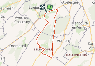
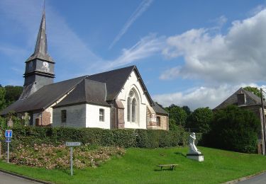
Trail Walking of 12.1 km to be discovered at Hauts-de-France, Somme, Belloy-Saint-Léonard. This trail is proposed by tracegps.

Description

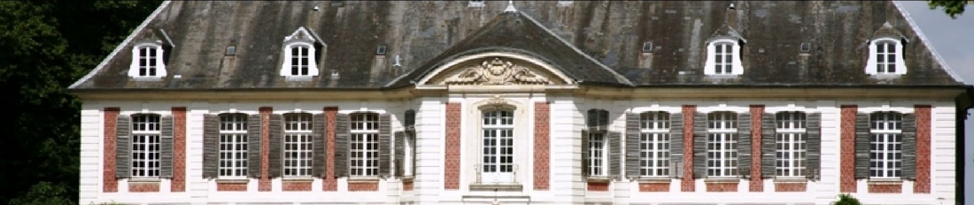
Un circuit par les bois et le parc du chateau qui vit naître au siècle dernier un Maréchal de France.

Elevation profile

Photos

Positioning

Country:
France
Region :
Hauts-de-France
Department/Province :
Somme
Municipality :
Belloy-Saint-Léonard
Location:
Unknown
Start:(Dec)
Start:(UTM)
421360 ; 5528911 (31U) N.

Trails nearby

Trail On foot Vergies - Le Bois de la Faude - Photo
On foot
GUIDE+

On foot

Easy
Vergies, Hauts-de-France, Somme, France
13.6 km | 16.5 km-effort
3h 45min
Yes
Trail Mountain bike Warlus - Circuit des mangeurs de lentilles - Warlus - Photo
Mountain bike
tracegps

Mountain bike

Medium
Warlus, Hauts-de-France, Somme, France
9.3 km | 11.5 km-effort
45min
Yes
Trail On foot Heucourt-Croquoison - L'Arbre à Mouches - Photo
On foot
GUIDE+

On foot

Easy
Heucourt-Croquoison, Hauts-de-France, Somme, France
12.8 km | 15.2 km-effort
3h 27min
No
Trail Walking Heucourt-Croquoison - L'arbre à mouches - Photo
Walking
tracegps

Walking

Medium
Heucourt-Croquoison, Hauts-de-France, Somme, France
14.5 km | 17.5 km-effort
3h 49min
Yes
Trail Walking Méricourt-en-Vimeu - la craonnière - Photo
Walking
Cheyenne80

Walking

Medium
Méricourt-en-Vimeu, Hauts-de-France, Somme, France
13.1 km | 15.4 km-effort
3h 20min
Yes


Close
My subscriptions