![](/images/other/stat-length.png)
![Trail Walking Saint-Léger-lès-Domart - L'arbre de la Croix - Photo](https://media.geolcdn.com/t/1900/400/ext.pjpeg?maxdim=2&url=https%3A%2F%2Fservices.sitytrail.com%2FGeolivesWS%2FDownloadMedia.ashx%3FTrailID%3D108841%26Media%3D2385_2.jpg)
L'arbre de la Croix
tracegps
User
![Length](/images/other/stat-length.png)
Length
6.5 km
![Max alt](https://static1.geolcdn.com/siteimages/upload/files/1508320355ic_sort_altitude_max_24dp.png)
Max alt
116 m
![Uphill gradient](https://static1.geolcdn.com/siteimages/upload/files/1508320355ic_sort_den_pos_24dp.png)
Uphill gradient
111 m
![Km-Effort](/images/other/stat-length.png)
Km-Effort
7.9 km
![Min alt](https://static1.geolcdn.com/siteimages/upload/files/1508320355ic_sort_altitude_min_24dp.png)
Min alt
30 m
![Downhill gradient](https://static1.geolcdn.com/siteimages/upload/files/1508320355ic_sort_den_neg_24dp.png)
Downhill gradient
112 m
![Boucle](https://static1.geolcdn.com/siteimages/upload/files/16400158638029165_repeat_loop_refresh_sync_direction_icon.png)
Boucle
Yes
Creation date :
2014-12-10 00:00:00.0
Updated on :
2014-12-10 00:00:00.0
![Walking](https://static1.geolcdn.com/sitytour/trail-icons/101.png)
2h00
Difficulty : Medium
![Scan this QR Code to open this trail in the SityTrail application](https://capi.geolives.com/qq0zvz2zws4bq2lad0pu/sitytour/trails/108841/qr.png?size=200)
FREE GPS app for hiking
About
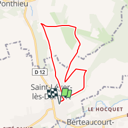
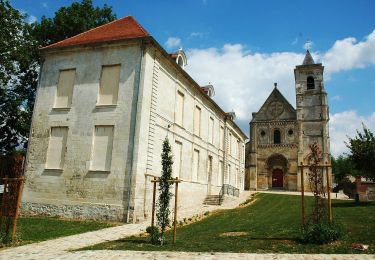
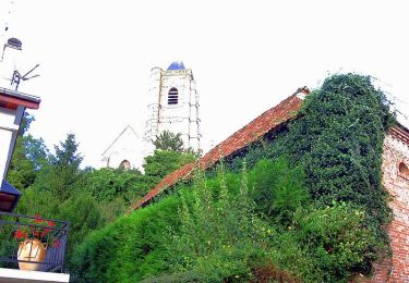
Trail Walking of 6.5 km to be discovered at Hauts-de-France, Somme, Saint-Léger-lès-Domart. This trail is proposed by tracegps.
Description
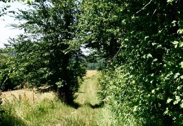
Une promenade dans la campagne boisée autour d'un arbre séculaire à l'ombre duquel veillait la Vierge. Pour télécharger la fiche du circuit en format pdf.
Positioning
Country:
France
Region :
Hauts-de-France
Department/Province :
Somme
Municipality :
Saint-Léger-lès-Domart
Location:
Unknown
Start:(Dec)
Start:(UTM)
438623 ; 5544629 (31U) N.
Comments
Trails nearby
![Trail Walking Ville-le-Marclet - ville le marclet - Photo](https://media.geolcdn.com/t/375/260/ext.jpg?maxdim=2&url=https%3A%2F%2Fstatic1.geolcdn.com%2Fsiteimages%2Fupload%2Ffiles%2F1553511878bg_sport_marche.png)
![Walking Walking](https://static1.geolcdn.com/sitytour/trail-icons/101.png)
ville le marclet
Walking
Very easy
Ville-le-Marclet,
Hauts-de-France,
Somme,
France
![](/images/other/stat-length.png)
10 km | 11.5 km-effort
2h 32min
![](https://static1.geolcdn.com/siteimages/upload/files/16400158638029165_repeat_loop_refresh_sync_direction_icon.png)
Yes
![Trail On foot Saint-Léger-lès-Domart - Circuit du Bois des Dames - Photo](https://media.geolcdn.com/t/375/260/dad39f03-37d8-4eec-b319-bf262ccd5aeb.jpeg&format=jpg&maxdim=2)
![On foot On foot](https://static1.geolcdn.com/sitytour/trail-icons/100.png)
Circuit du Bois des Dames
On foot
Easy
Saint-Léger-lès-Domart,
Hauts-de-France,
Somme,
France
![](/images/other/stat-length.png)
11.5 km | 13.2 km-effort
2h 59min
![](https://static1.geolcdn.com/siteimages/upload/files/16400158638029165_repeat_loop_refresh_sync_direction_icon.png)
Yes
![Trail Cycle Domart-en-Ponthieu - Les Muches - Domart en Ponthieu - Photo](https://media.geolcdn.com/t/375/260/ext.jpg?maxdim=2&url=https%3A%2F%2Fservices.sitytrail.com%2FGeolivesWS%2FDownloadMedia.ashx%3FTrailID%3D109919%26Media%3D4936_1.jpg)
![Cycle Cycle](https://static1.geolcdn.com/sitytour/trail-icons/200.png)
Les Muches - Domart en Ponthieu
Cycle
Difficult
Domart-en-Ponthieu,
Hauts-de-France,
Somme,
France
![](/images/other/stat-length.png)
60 km | 69 km-effort
3h 0min
![](https://static1.geolcdn.com/siteimages/upload/files/16400158638029165_repeat_loop_refresh_sync_direction_icon.png)
Yes
![Trail Walking Halloy-lès-Pernois - Circuit du bois des dames - Photo](https://media.geolcdn.com/t/375/260/ext.jpg?maxdim=2&url=https%3A%2F%2Fservices.sitytrail.com%2FGeolivesWS%2FDownloadMedia.ashx%3FTrailID%3D108842%26Media%3D2386_2.jpg)
![Walking Walking](https://static1.geolcdn.com/sitytour/trail-icons/101.png)
Circuit du bois des dames
Walking
Medium
Halloy-lès-Pernois,
Hauts-de-France,
Somme,
France
![](/images/other/stat-length.png)
12 km | 13.7 km-effort
4h 0min
![](https://static1.geolcdn.com/siteimages/upload/files/16400158638029165_repeat_loop_refresh_sync_direction_icon.png)
Yes
![Trail Mountain bike Vignacourt - VTT Vignacourt - Photo](https://media.geolcdn.com/t/375/260/ext.jpg?maxdim=2&url=https%3A%2F%2Fstatic1.geolcdn.com%2Fsiteimages%2Fupload%2Ffiles%2F1524743154velo.jpg)
![Mountain bike Mountain bike](https://static1.geolcdn.com/sitytour/trail-icons/202.png)
VTT Vignacourt
Mountain bike
Medium
Vignacourt,
Hauts-de-France,
Somme,
France
![](/images/other/stat-length.png)
19.3 km | 22 km-effort
1h 25min
![](https://static1.geolcdn.com/siteimages/upload/files/16400158638029165_repeat_loop_refresh_sync_direction_icon.png)
Yes