Trail Walking Pontarlier - Montagne du Larmont (1323 m) - Photo

Montagne du Larmont (1323 m)

 tracegps
tracegps

User

© OpenStreetMap contributors
Length
Length
18.3 km
Max alt
Max alt
1318 m
Uphill gradient
Uphill gradient
613 m
Km-Effort
Km-Effort  
26 km
Min alt
Min alt
873 m
Downhill gradient
Downhill gradient
602 m
Boucle
Boucle
Yes
Creation date :
2014-12-10 00:00:00.0
Updated on :
2014-12-10 00:00:00.0

(1 Reviews)

Walking
Walking
4h30
Difficulty : Difficult

Scan this QR Code to open this trail in the SityTrail application

FREE GPS app for hiking

Logo SityTrail SityTrail

IGN / Geographical institutes

Download SityTrail from the App Store Download SityTrail from Google Play

Logo SityTrail SityTrail World

The world is yours!

Download SityTrail from the App Store Download SityTrail from Google Play Download SityTrail on Huawei AppGallery

About

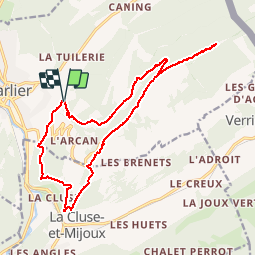
Trail Walking of 18.3 km to be discovered at Bourgogne-Franche-Comté, Doubs, Pontarlier. This trail is proposed by tracegps.

Description

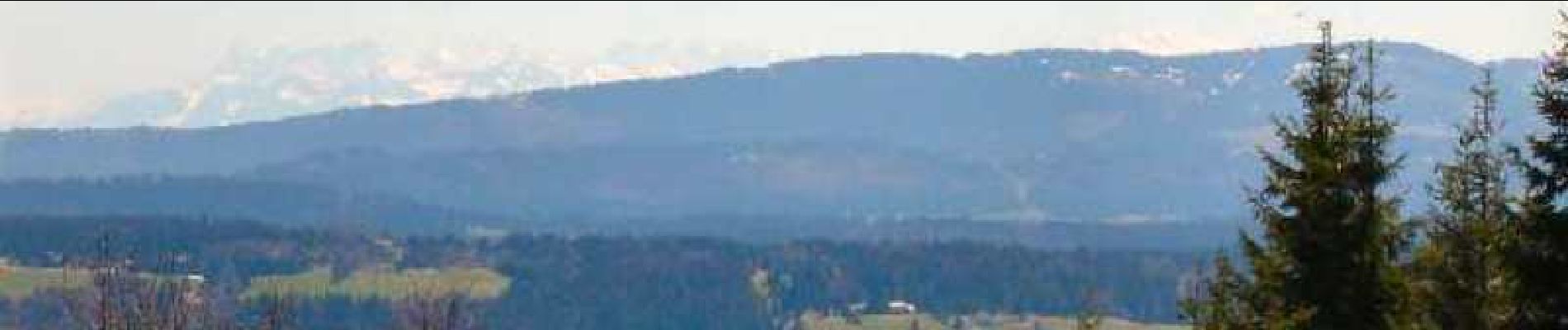
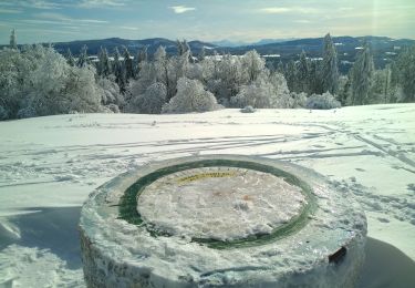
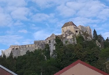
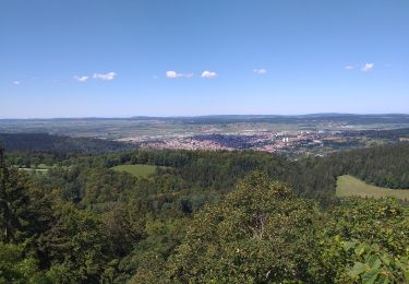
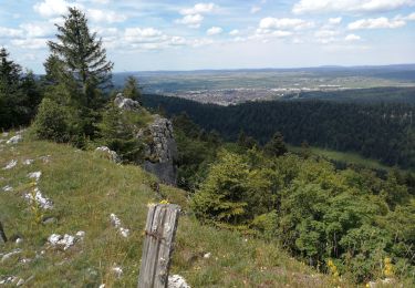
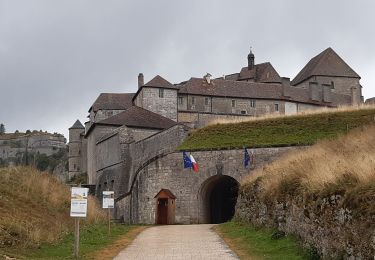
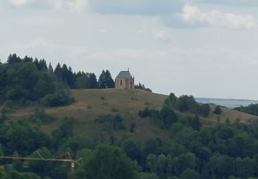
Très belle randonnée à travers des alpages jurassiens typiques. Belle récompense au sommet, avec par temps clair vue sur les Alpes bernoises et vaudoises, le Mont-Blanc, les sommets du Chasseron et du Suchet, le lac Saint-Point. Rencontre fréquente avec des chamois et magnifiques parterres bleus de gentianes printanières début mai. Ce parcours emprunte entre les deux forts du Larmont de nombreuses pâtures hors sentiers balisés. Merci de les respecter et de les éviter durant la saison de pacage ou de fenaison. Une variante est proposée en fin de descriptif. La suite avec d’autres informations et photos est ICI

Elevation profile

Photos

Positioning

Country:
France
Region :
Bourgogne-Franche-Comté
Department/Province :
Doubs
Municipality :
Pontarlier
Location:
Unknown
Start:(UTM)
300281 ; 5197540 (32T) N.

Comments

Please log in to post a review or rate the element


inutilisable


Trails nearby

Trail Mountain bike Pontarlier - favrotte 2013 - Photo
Mountain bike
Erik25

Mountain bike

Medium
(2)
Pontarlier, Bourgogne-Franche-Comté, Doubs, France
40 km | 53 km-effort
3h 42min
Yes
Trail Snowshoes Pontarlier - Pontarlier Gounfay Grand Taureau 2021-01-19 CAF - Photo
Snowshoes
TRIMAILLE

Snowshoes

Medium
Pontarlier, Bourgogne-Franche-Comté, Doubs, France
9.5 km | 12.8 km-effort
3h 16min
Yes
Trail Walking La Cluse-et-Mijoux - le grand taureau, la Cluse et Mijoux - Photo
Walking
eltonnermou

Walking

Medium
La Cluse-et-Mijoux, Bourgogne-Franche-Comté, Doubs, France
24 km | 34 km-effort
5h 26min
Yes
Trail Walking Pontarlier - le grand taureau, Pontarlier - Photo
Walking
eltonnermou

Walking

Difficult
Pontarlier, Bourgogne-Franche-Comté, Doubs, France
20 km | 29 km-effort
3h 36min
Yes
Trail Walking Pontarlier - le grand taureau - Photo
Walking
GUILLETCORDIER

Walking

Medium
Pontarlier, Bourgogne-Franche-Comté, Doubs, France
8.8 km | 12.1 km-effort
2h 38min
Yes
Trail Walking Pontarlier - Le Grand Taureau 19.3 km D+661 m 20240512 - Photo
Walking
cmike39

Walking

Very difficult
Pontarlier, Bourgogne-Franche-Comté, Doubs, France
19.3 km | 28 km-effort
5h 5min
Yes
Trail Walking La Cluse-et-Mijoux - GTJ 2 La Cluse et Mijoux, Metabief - Photo
Walking
Praff

Walking

Medium
La Cluse-et-Mijoux, Bourgogne-Franche-Comté, Doubs, France
21 km | 29 km-effort
6h 18min
No
Trail Walking Pontarlier - GTJ 1 Pontarlier, La Cluse et Mijoux - Photo
Walking
Praff

Walking

Easy
Pontarlier, Bourgogne-Franche-Comté, Doubs, France
10.8 km | 15.6 km-effort
3h 14min
No
Trail Walking Pontarlier - FORT MALHER DEPUIS LE CAMPING DU LARMONT - Photo
Walking
walrou63

Walking

Difficult
Pontarlier, Bourgogne-Franche-Comté, Doubs, France
10 km | 14.5 km-effort
2h 30min
Yes


Close
My subscriptions