Trail Walking Tannières - Par Horle et Larris - Photo

Par Horle et Larris

 tracegps
tracegps

User

© OpenStreetMap contributors
Length
Length
7.7 km
Max alt
Max alt
133 m
Uphill gradient
Uphill gradient
159 m
Km-Effort
Km-Effort  
9.8 km
Min alt
Min alt
67 m
Downhill gradient
Downhill gradient
160 m
Boucle
Boucle
Yes
Creation date :
2014-12-10 00:00:00.0
Updated on :
2014-12-10 00:00:00.0

(0 Reviews)

Walking
Walking
1h30
Difficulty : Medium

Scan this QR Code to open this trail in the SityTrail application

FREE GPS app for hiking

Logo SityTrail SityTrail

IGN / Geographical institutes

Download SityTrail from the App Store Download SityTrail from Google Play

Logo SityTrail SityTrail World

The world is yours!

Download SityTrail from the App Store Download SityTrail from Google Play Download SityTrail on Huawei AppGallery

About

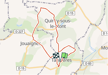
Trail Walking of 7.7 km to be discovered at Hauts-de-France, Aisne, Tannières. This trail is proposed by tracegps.

Description

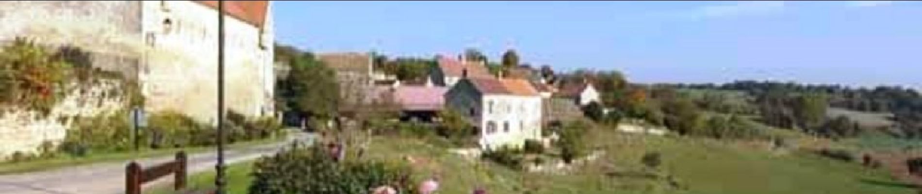
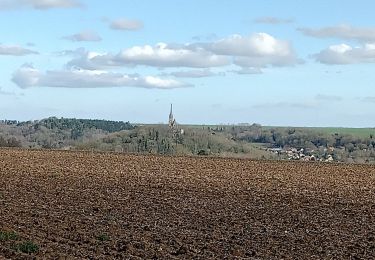
Au programme de cette petite boucle champêtre dans la vallée du Murton, deux églises (l'une avec un porche roman à Jouaignes et l'autre, gothique, à Tannières) et trois châteaux (celui de Jouaignes, de Virly, et celui de Quincy-sous-le-Mont devenu une ferme) Toutes les infos sont ICI

Elevation profile

Photos

Positioning

Country:
France
Region :
Hauts-de-France
Department/Province :
Aisne
Municipality :
Tannières
Location:
Unknown
Start:(UTM)
540195 ; 5459944 (31U) N.

Trails nearby

Trail Walking Mont-Notre-Dame - La Gorge aux loups - Photo
Walking
tracegps

Walking

Very difficult
(2)
Mont-Notre-Dame, Hauts-de-France, Aisne, France
28 km | 35 km-effort
7h 0min
Yes
Trail Walking Tannières - Tannières du 04-03-2024 - Photo
Walking
GUIDE
VANDERPUTTENMi

Walking

Difficult
Tannières, Hauts-de-France, Aisne, France
10.6 km | 13 km-effort
2h 56min
Yes
Trail Mountain bike Mont-Notre-Dame - La Gorge aux loups - Photo
Mountain bike
tracegps

Mountain bike

Very difficult
Mont-Notre-Dame, Hauts-de-France, Aisne, France
28 km | 35 km-effort
4h 30min
Yes
Trail Walking Mont-Notre-Dame - Mont Notre Dame - Photo
Walking
explorateur

Walking

Very difficult
Mont-Notre-Dame, Hauts-de-France, Aisne, France
30 km | 37 km-effort
6h 52min
Yes


Close
My subscriptions