


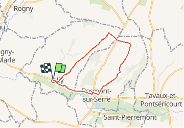

22 km | 26 km-effort

User


FREE GPS app for hiking
 SityTrail
IGN / Geographical institutes
SityTrail World
The world is yours!
Trail Walking of 10.6 km to be discovered at Hauts-de-France, Aisne, Cilly. This trail is proposed by tracegps.
Depuis l'église Saint-Martin de Cilly jusqu'à celle fortifiée de Bosmont, l'itinéraire emprunte, après une faible montée continue, la crête d'une large croupe que viennent couronner les fermes de Balthazard et de Labry. Après les nombreux points de vue dominant la vallée de la Serre, le chemin descend vers le bourg de Bosmont, fief de Jacques de Chambly, qui colonisa en 1665 le Canada sur un ordre de Colbert. Toutes les infos sont ICI


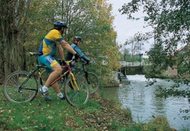
Mountain bike
Walking
Passage dans des fermes et non sur chemin public mais gens sympas !