![](/images/other/stat-length.png)
![Trail Walking Humes-Jorquenay - Le Val de Mouche - Humes - Photo](https://media.geolcdn.com/t/1900/400/ext.pjpeg?maxdim=2&url=https%3A%2F%2Fservices.sitytrail.com%2FGeolivesWS%2FDownloadMedia.ashx%3FTrailID%3D108730%26Media%3D1823_2.jpg)
Le Val de Mouche - Humes
tracegps
User
![Length](/images/other/stat-length.png)
![Max alt](https://static1.geolcdn.com/siteimages/upload/files/1508320355ic_sort_altitude_max_24dp.png)
![Uphill gradient](https://static1.geolcdn.com/siteimages/upload/files/1508320355ic_sort_den_pos_24dp.png)
![Km-Effort](/images/other/stat-length.png)
![Min alt](https://static1.geolcdn.com/siteimages/upload/files/1508320355ic_sort_altitude_min_24dp.png)
![Downhill gradient](https://static1.geolcdn.com/siteimages/upload/files/1508320355ic_sort_den_neg_24dp.png)
![Boucle](https://static1.geolcdn.com/siteimages/upload/files/16400158638029165_repeat_loop_refresh_sync_direction_icon.png)
![Walking](https://static1.geolcdn.com/sitytour/trail-icons/101.png)
5h00
Difficulty : Very difficult
![Scan this QR Code to open this trail in the SityTrail application](https://capi.geolives.com/qq0zvz2zws4bq2lad0pu/sitytour/trails/108730/qr.png?size=200)
FREE GPS app for hiking
About
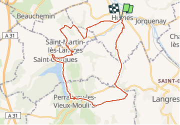
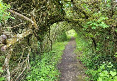
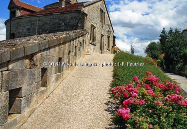
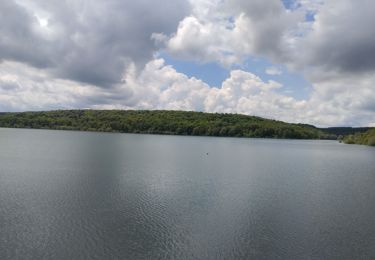
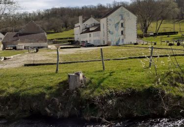
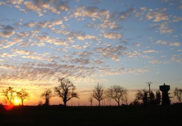
Trail Walking of 18.7 km to be discovered at Grand Est, Haute-Marne, Humes-Jorquenay. This trail is proposed by tracegps.
Description
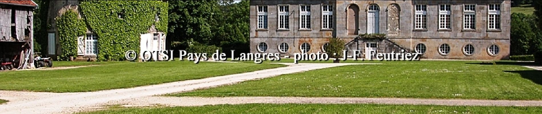
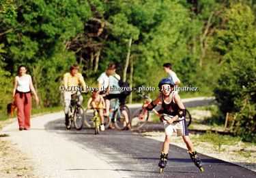
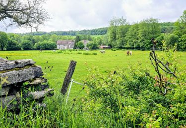
Office de Tourisme du Pays de Langres Circuit balisé. La randonnée est le plus sûr moyen pour découvrir les secrets du Pays de Langres et des 4 lacs, ses villages entre Champagne et Bourgogne, ses légendes, sa nature généreuse, et bien d’autres surprises encore… Circuit entre vallée de la Mouche, lac et plateau dominant la vallée de la Bonnelle. Au programme : - La vallée de la Mouche et son lac (barrage en semi viaduc). - Saint-Ciergues et son panorama sur le lac, Perrancey. - Le fort de la Pointe de Diamant et la Batterie de Hûmes, dominant tout le nord du pays de Langres. La fiche est téléchargeable ICI Nota : Les données de l'OT du Pays de Langres sont officielles et restent la référence; toute différence dans le kilométrage provient d'un décalage de calcul entre les différents logiciels.
Positioning
Comments
Trails nearby
![Trail Cycle Langres - Boucle 1 autour de la Voie Verte - Langres - Photo](https://media.geolcdn.com/t/375/260/ext.jpg?maxdim=2&url=https%3A%2F%2Fservices.sitytrail.com%2FGeolivesWS%2FDownloadMedia.ashx%3FTrailID%3D109253%26Media%3D3357_1.jpg)
![Cycle Cycle](https://static1.geolcdn.com/sitytour/trail-icons/200.png)
Cycle
![](/images/other/stat-length.png)
![](https://static1.geolcdn.com/siteimages/upload/files/16400158638029165_repeat_loop_refresh_sync_direction_icon.png)
![Trail Walking Humes-Jorquenay - Boucle 26 km autour de Humes - Photo](https://media.geolcdn.com/t/375/260/cf6c3e45-eb31-488c-9d40-076bc7c5c86d.jpg&format=jpg&maxdim=2)
![Walking Walking](https://static1.geolcdn.com/sitytour/trail-icons/101.png)
Walking
![](/images/other/stat-length.png)
![](https://static1.geolcdn.com/siteimages/upload/files/16400158638029165_repeat_loop_refresh_sync_direction_icon.png)
![Trail Walking Langres - Boucle 32 km autour de Langres - Photo](https://media.geolcdn.com/t/375/260/0bf94ea6-f335-44d7-a6b3-b3c8b14da8e8.jpg&format=jpg&maxdim=2)
![Walking Walking](https://static1.geolcdn.com/sitytour/trail-icons/101.png)
Walking
![](/images/other/stat-length.png)
![](https://static1.geolcdn.com/siteimages/upload/files/16400158638029165_repeat_loop_refresh_sync_direction_icon.png)
![Trail Walking Saint-Ciergues - Tour du lac de la mouche - Photo](https://media.geolcdn.com/t/375/260/f321c8fd-aefd-46d6-832c-fdc1bac2c57f.jpg&format=jpg&maxdim=2)
![Walking Walking](https://static1.geolcdn.com/sitytour/trail-icons/101.png)
Walking
![](/images/other/stat-length.png)
![](https://static1.geolcdn.com/siteimages/upload/files/16400158638029165_repeat_loop_refresh_sync_direction_icon.png)
![Trail Cycle Langres - Tour des 4 lacs - Langres - Photo](https://media.geolcdn.com/t/375/260/ext.jpg?maxdim=2&url=https%3A%2F%2Fservices.sitytrail.com%2FGeolivesWS%2FDownloadMedia.ashx%3FTrailID%3D109263%26Media%3D3367_5.jpg)
![Cycle Cycle](https://static1.geolcdn.com/sitytour/trail-icons/200.png)
Cycle
![](/images/other/stat-length.png)
![](https://static1.geolcdn.com/siteimages/upload/files/16400158638029165_repeat_loop_refresh_sync_direction_icon.png)
![Trail Walking Humes-Jorquenay - Humes saint ciergues - Photo](https://media.geolcdn.com/t/375/260/bd5883bf-5224-4ade-8fc0-1b68dee20862.jpg&format=jpg&maxdim=2)
![Walking Walking](https://static1.geolcdn.com/sitytour/trail-icons/101.png)
Walking
![](/images/other/stat-length.png)
![](https://static1.geolcdn.com/siteimages/upload/files/16400158638029165_repeat_loop_refresh_sync_direction_icon.png)
![Trail Nordic walking Perrancey-les-Vieux-Moulins - domaine de Montauban - Photo](https://media.geolcdn.com/t/375/260/ce4a4cb9-9df4-449d-8597-44fcecb7791a.jpg&format=jpg&maxdim=2)
![Nordic walking Nordic walking](https://static1.geolcdn.com/sitytour/trail-icons/102.png)
Nordic walking
![](/images/other/stat-length.png)
![](https://static1.geolcdn.com/siteimages/upload/files/16400158638029165_repeat_loop_refresh_sync_direction_icon.png)
![Trail Mountain bike Langres - La Via Francigena - Traversée de la Haute Marne -de Langres à Culmont - Photo](https://media.geolcdn.com/t/375/260/ext.jpg?maxdim=2&url=https%3A%2F%2Fservices.sitytrail.com%2FGeolivesWS%2FDownloadMedia.ashx%3FTrailID%3D111966%26Media%3D9143_2.jpg)
![Mountain bike Mountain bike](https://static1.geolcdn.com/sitytour/trail-icons/202.png)
Mountain bike
![](/images/other/stat-length.png)
![](https://static1.geolcdn.com/siteimages/upload/files/16400158638029165_repeat_loop_refresh_sync_direction_icon.png)
![Trail Walking Langres - La Via Francigena - Traversée de la Haute Marne -de Langres à Culmont - Photo](https://media.geolcdn.com/t/375/260/ext.jpg?maxdim=2&url=https%3A%2F%2Fservices.sitytrail.com%2FGeolivesWS%2FDownloadMedia.ashx%3FTrailID%3D111965%26Media%3D9143_2.jpg)
![Walking Walking](https://static1.geolcdn.com/sitytour/trail-icons/101.png)
Walking
![](/images/other/stat-length.png)
![](https://static1.geolcdn.com/siteimages/upload/files/16400158638029165_repeat_loop_refresh_sync_direction_icon.png)