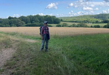
![](/images/other/stat-length.png)
![Trail Mountain bike Rolampont - La Tufière de Rolampont - Faverolles - Photo](https://media.geolcdn.com/t/1900/400/ext.pjpeg?maxdim=2&url=https%3A%2F%2Fservices.sitytrail.com%2FGeolivesWS%2FDownloadMedia.ashx%3FTrailID%3D108725%26Media%3D1820_2.jpg)
La Tufière de Rolampont - Faverolles
tracegps
User
![Length](/images/other/stat-length.png)
![Max alt](https://static1.geolcdn.com/siteimages/upload/files/1508320355ic_sort_altitude_max_24dp.png)
![Uphill gradient](https://static1.geolcdn.com/siteimages/upload/files/1508320355ic_sort_den_pos_24dp.png)
![Km-Effort](/images/other/stat-length.png)
![Min alt](https://static1.geolcdn.com/siteimages/upload/files/1508320355ic_sort_altitude_min_24dp.png)
![Downhill gradient](https://static1.geolcdn.com/siteimages/upload/files/1508320355ic_sort_den_neg_24dp.png)
![Boucle](https://static1.geolcdn.com/siteimages/upload/files/16400158638029165_repeat_loop_refresh_sync_direction_icon.png)
![Mountain bike](https://static1.geolcdn.com/sitytour/trail-icons/202.png)
1h30
Difficulty : Medium
![Scan this QR Code to open this trail in the SityTrail application](https://capi.geolives.com/qq0zvz2zws4bq2lad0pu/sitytour/trails/108725/qr.png?size=200)
FREE GPS app for hiking
About
Trail Mountain bike of 11.5 km to be discovered at Grand Est, Haute-Marne, Rolampont. This trail is proposed by tracegps.
Description
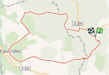
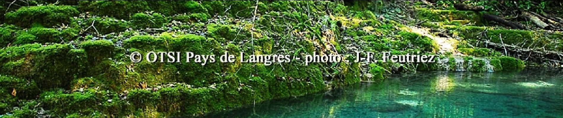
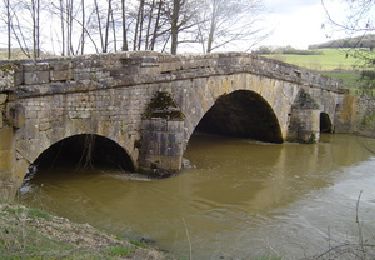
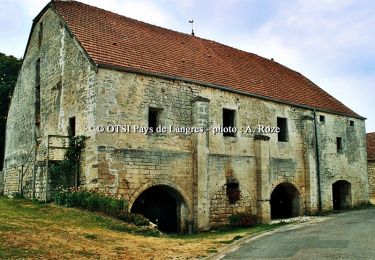
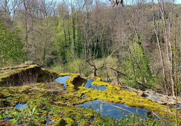
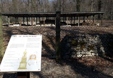
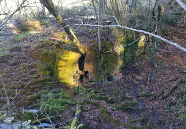
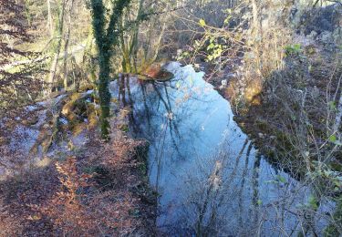
Office de Tourisme du Pays de Langres Circuit balisé. La randonnée est le plus sûr moyen pour découvrir les secrets du Pays de Langres et des 4 lacs, ses villages entre Champagne et Bourgogne, ses légendes, sa nature généreuse, et bien d’autres surprises encore… Ce circuit vous fera découvrir le magnifique site de la cascade pétrifiante de la Tufière (visite guidée sur demande à l'office de tourisme). Au programme : - La cascade et le marais tufeux. - Les bois de Vaubrien et les vestiges de l'ancienne voie romaine. - Faverolles et son atelier archéologique ou sont exposés les vestiges du Mausolée gallo-romain. - Les bois de Mongessey et le site du Mausolée gallo-romain.La fiche est téléchargeable ICI Nota : Les données de l'OT du Pays de Langres sont officielles et restent la référence; toute différence dans le kilométrage provient d'un décalage de calcul entre les différents logiciels.
Positioning
Comments
Trails nearby
![Trail Mountain bike Rolampont - Rolampont Thivet - Photo](https://media.geolcdn.com/t/375/260/ext.jpg?maxdim=2&url=https%3A%2F%2Fservices.sitytrail.com%2FGeolivesWS%2FDownloadMedia.ashx%3FTrailID%3D430827%26Media%3Dbd3938cb-7f66-4dcf-ac4e-c3757f1a14a2.PNG)
![Mountain bike Mountain bike](https://static1.geolcdn.com/sitytour/trail-icons/202.png)
Mountain bike
![](/images/other/stat-length.png)
![](https://static1.geolcdn.com/siteimages/upload/files/16400158638029165_repeat_loop_refresh_sync_direction_icon.png)
![Trail Mountain bike Rolampont - Rolampont - Lac de la Liez - Photo](https://media.geolcdn.com/t/375/260/ext.jpg?maxdim=2&url=https%3A%2F%2Fservices.sitytrail.com%2FGeolivesWS%2FDownloadMedia.ashx%3FTrailID%3D142635%26Media%3Decbb10a6-f619-41a2-a626-4a74595062b5.jpg)
![Mountain bike Mountain bike](https://static1.geolcdn.com/sitytour/trail-icons/202.png)
Mountain bike
![](/images/other/stat-length.png)
![](https://static1.geolcdn.com/siteimages/upload/files/16400158638029165_repeat_loop_refresh_sync_direction_icon.png)
![Trail Cycle Rolampont - De la Suize à l'Aujon - Rolampont - Photo](https://media.geolcdn.com/t/375/260/ext.jpg?maxdim=2&url=https%3A%2F%2Fservices.sitytrail.com%2FGeolivesWS%2FDownloadMedia.ashx%3FTrailID%3D109267%26Media%3D3387_5.jpg)
![Cycle Cycle](https://static1.geolcdn.com/sitytour/trail-icons/200.png)
Cycle
![](/images/other/stat-length.png)
![](https://static1.geolcdn.com/siteimages/upload/files/16400158638029165_repeat_loop_refresh_sync_direction_icon.png)
![Trail sport Villiers-sur-Suize - 52 Villiers sur Suize Rochevilliers réel 17 juillet 2024 - Photo](https://media.geolcdn.com/t/375/260/19bc62a4-6def-4dcc-831e-84e02896c6f7.jpg&format=jpg&maxdim=2)
sport
![](/images/other/stat-length.png)
![](https://static1.geolcdn.com/siteimages/upload/files/16400158638029165_repeat_loop_refresh_sync_direction_icon.png)
![Trail Walking Marac - marac et la suize - Photo](https://media.geolcdn.com/t/375/260/785a4264-61ef-403d-bef6-ccbb5919167a.jpg&format=jpg&maxdim=2)
![Walking Walking](https://static1.geolcdn.com/sitytour/trail-icons/101.png)
Walking
![](/images/other/stat-length.png)
![](https://static1.geolcdn.com/siteimages/upload/files/16400158638029165_repeat_loop_refresh_sync_direction_icon.png)
![Trail Electric bike Rolampont - Vallée des Caivottes, Trimeule et Tufiere - Photo](https://media.geolcdn.com/t/375/260/edf3e753-6302-4789-9fb5-b467cca70c93.jpg&format=jpg&maxdim=2)
![Electric bike Electric bike](https://static1.geolcdn.com/sitytour/trail-icons/205.png)
Electric bike
![](/images/other/stat-length.png)
![](https://static1.geolcdn.com/siteimages/upload/files/16400158638029165_repeat_loop_refresh_sync_direction_icon.png)
![Trail Mountain bike Villiers-sur-Suize - 079 Circuit du Mausolée - Photo](https://media.geolcdn.com/t/375/260/b85f83da-d335-41e5-8f96-dbe154cf821f.jpg&format=jpg&maxdim=2)
![Mountain bike Mountain bike](https://static1.geolcdn.com/sitytour/trail-icons/202.png)
Mountain bike
![](/images/other/stat-length.png)
![](https://static1.geolcdn.com/siteimages/upload/files/16400158638029165_repeat_loop_refresh_sync_direction_icon.png)
![Trail Mountain bike Rolampont - Source de la Tuffiere - Photo](https://media.geolcdn.com/t/375/260/de7a3704-ddd1-4ad9-a445-c7ed348fc8b8.jpg&format=jpg&maxdim=2)
![Mountain bike Mountain bike](https://static1.geolcdn.com/sitytour/trail-icons/202.png)
Mountain bike
![](/images/other/stat-length.png)
![](https://static1.geolcdn.com/siteimages/upload/files/16400158638029165_repeat_loop_refresh_sync_direction_icon.png)
![Trail Mountain bike Rolampont - SityTrail - Autour de la Tuffière - Photo](https://media.geolcdn.com/t/375/260/0a3804a2-f563-4878-95d1-65c4ec4baa98.jpg&format=jpg&maxdim=2)
![Mountain bike Mountain bike](https://static1.geolcdn.com/sitytour/trail-icons/202.png)
Mountain bike
![](/images/other/stat-length.png)
![](https://static1.geolcdn.com/siteimages/upload/files/16400158638029165_repeat_loop_refresh_sync_direction_icon.png)