![](/images/other/stat-length.png)
![Trail Walking Chevregny - La marguerite de la Saint-Michel - Photo](https://media.geolcdn.com/t/1900/400/ext.pjpeg?maxdim=2&url=https%3A%2F%2Fstatic1.geolcdn.com%2Fsiteimages%2Fupload%2Ffiles%2F1553511878bg_sport_marche.png)
La marguerite de la Saint-Michel
tracegps
User
![Length](/images/other/stat-length.png)
Length
7 km
![Max alt](https://static1.geolcdn.com/siteimages/upload/files/1508320355ic_sort_altitude_max_24dp.png)
Max alt
178 m
![Uphill gradient](https://static1.geolcdn.com/siteimages/upload/files/1508320355ic_sort_den_pos_24dp.png)
Uphill gradient
175 m
![Km-Effort](/images/other/stat-length.png)
Km-Effort
9.3 km
![Min alt](https://static1.geolcdn.com/siteimages/upload/files/1508320355ic_sort_altitude_min_24dp.png)
Min alt
79 m
![Downhill gradient](https://static1.geolcdn.com/siteimages/upload/files/1508320355ic_sort_den_neg_24dp.png)
Downhill gradient
172 m
![Boucle](https://static1.geolcdn.com/siteimages/upload/files/16400158638029165_repeat_loop_refresh_sync_direction_icon.png)
Boucle
Yes
Creation date :
2014-12-10 00:00:00.0
Updated on :
2014-12-10 00:00:00.0
![Walking](https://static1.geolcdn.com/sitytour/trail-icons/101.png)
3h00
Difficulty : Very difficult
![Scan this QR Code to open this trail in the SityTrail application](https://capi.geolives.com/qq0zvz2zws4bq2lad0pu/sitytour/trails/108695/qr.png?size=200)
FREE GPS app for hiking
About
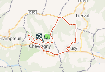
Trail Walking of 7 km to be discovered at Hauts-de-France, Aisne, Chevregny. This trail is proposed by tracegps.
Description
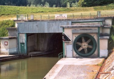
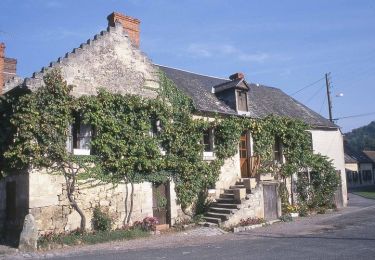
Les coteaux abritent ici une flore et une faune typiques des pelouses calcicoles, dont la belle marguerite de la Saint-Michel. Flânez ainsi entre mont Bossu et mont Ecoué, une balade à tomber sous le charme du pays laonnois ! Toutes les infos sont ICI
Positioning
Country:
France
Region :
Hauts-de-France
Department/Province :
Aisne
Municipality :
Chevregny
Location:
Unknown
Start:(Dec)
Start:(UTM)
542993 ; 5480221 (31U) N.
Comments
Trails nearby
![Trail Walking Monampteuil - Le lac de Monampteuil - Photo](https://media.geolcdn.com/t/375/260/ext.jpg?maxdim=2&url=https%3A%2F%2Fservices.sitytrail.com%2FGeolivesWS%2FDownloadMedia.ashx%3FTrailID%3D202836%26Media%3D03f0deb3-4d67-4348-9461-89fcd419cc3e.jpg)
![Walking Walking](https://static1.geolcdn.com/sitytour/trail-icons/101.png)
Le lac de Monampteuil
Walking
Very easy
(2)
Monampteuil,
Hauts-de-France,
Aisne,
France
![](/images/other/stat-length.png)
10.2 km | 12.3 km-effort
Unknown
![](https://static1.geolcdn.com/siteimages/upload/files/16400158638029165_repeat_loop_refresh_sync_direction_icon.png)
Yes
![Trail Walking Vorges - circuit uit d'équipe vendangeoirs - Photo](https://media.geolcdn.com/t/375/260/62c5390c-9d97-4cd2-8086-a9c64b026908.jpg&format=jpg&maxdim=2)
![Walking Walking](https://static1.geolcdn.com/sitytour/trail-icons/101.png)
circuit uit d'équipe vendangeoirs
Walking
Medium
Vorges,
Hauts-de-France,
Aisne,
France
![](/images/other/stat-length.png)
13.2 km | 16 km-effort
3h 49min
![](https://static1.geolcdn.com/siteimages/upload/files/16400158638029165_repeat_loop_refresh_sync_direction_icon.png)
Yes
![Trail Walking Braye-en-Laonnois - Le tunnel du Chemin des Dames - Photo](https://media.geolcdn.com/t/375/260/ext.jpg?maxdim=2&url=https%3A%2F%2Fservices.sitytrail.com%2FGeolivesWS%2FDownloadMedia.ashx%3FTrailID%3D202846%26Media%3D7780bc81-5677-4cbb-a8a0-95210261846b.jpg)
![Walking Walking](https://static1.geolcdn.com/sitytour/trail-icons/101.png)
Le tunnel du Chemin des Dames
Walking
Very easy
Braye-en-Laonnois,
Hauts-de-France,
Aisne,
France
![](/images/other/stat-length.png)
4.8 km | 6.8 km-effort
Unknown
![](https://static1.geolcdn.com/siteimages/upload/files/16400158638029165_repeat_loop_refresh_sync_direction_icon.png)
Yes
![Trail Walking Monampteuil - FERME DU CHÂTEAU, MONAMPTEUIL - Photo](https://media.geolcdn.com/t/375/260/67ba0da9-5261-497f-929f-2d36798d3e9b.jpg&format=jpg&maxdim=2)
![Walking Walking](https://static1.geolcdn.com/sitytour/trail-icons/101.png)
FERME DU CHÂTEAU, MONAMPTEUIL
Walking
Medium
Monampteuil,
Hauts-de-France,
Aisne,
France
![](/images/other/stat-length.png)
8.6 km | 10.3 km-effort
2h 58min
![](https://static1.geolcdn.com/siteimages/upload/files/16400158638029165_repeat_loop_refresh_sync_direction_icon.png)
Yes
![Trail Walking Braye-en-Laonnois - Le tunnel du Chemin des Dames - variante - Photo](https://media.geolcdn.com/t/375/260/ext.jpg?maxdim=2&url=https%3A%2F%2Fservices.sitytrail.com%2FGeolivesWS%2FDownloadMedia.ashx%3FTrailID%3D108915%26Media%3D2604_1.jpg)
![Walking Walking](https://static1.geolcdn.com/sitytour/trail-icons/101.png)
Le tunnel du Chemin des Dames - variante
Walking
Medium
Braye-en-Laonnois,
Hauts-de-France,
Aisne,
France
![](/images/other/stat-length.png)
9.4 km | 12.1 km-effort
3h 0min
![](https://static1.geolcdn.com/siteimages/upload/files/16400158638029165_repeat_loop_refresh_sync_direction_icon.png)
Yes
![Trail Walking Braye-en-Laonnois - Le tunnel du Chemin des Dames - Photo](https://media.geolcdn.com/t/375/260/ext.jpg?maxdim=2&url=https%3A%2F%2Fservices.sitytrail.com%2FGeolivesWS%2FDownloadMedia.ashx%3FTrailID%3D108914%26Media%3D2603_1.jpg)
![Walking Walking](https://static1.geolcdn.com/sitytour/trail-icons/101.png)
Le tunnel du Chemin des Dames
Walking
Medium
(1)
Braye-en-Laonnois,
Hauts-de-France,
Aisne,
France
![](/images/other/stat-length.png)
4.8 km | 6.8 km-effort
1h 30min
![](https://static1.geolcdn.com/siteimages/upload/files/16400158638029165_repeat_loop_refresh_sync_direction_icon.png)
Yes
![Trail Walking Vorges - Les vendangeoirs du Laonnois - Photo](https://media.geolcdn.com/t/375/260/ext.jpg?maxdim=2&url=https%3A%2F%2Fservices.sitytrail.com%2FGeolivesWS%2FDownloadMedia.ashx%3FTrailID%3D108381%26Media%3D1065_2.jpg)
![Walking Walking](https://static1.geolcdn.com/sitytour/trail-icons/101.png)
Les vendangeoirs du Laonnois
Walking
Very difficult
Vorges,
Hauts-de-France,
Aisne,
France
![](/images/other/stat-length.png)
11.8 km | 13.8 km-effort
3h 30min
![](https://static1.geolcdn.com/siteimages/upload/files/16400158638029165_repeat_loop_refresh_sync_direction_icon.png)
Yes
![Trail Nordic walking Monampteuil - Monampteuil FC - Photo](https://media.geolcdn.com/t/375/260/ext.jpg?maxdim=2&url=https%3A%2F%2Fstatic1.geolcdn.com%2Fsiteimages%2Fupload%2Ffiles%2F1545311037marcheuse_200dpi.jpg)
![Nordic walking Nordic walking](https://static1.geolcdn.com/sitytour/trail-icons/102.png)
Monampteuil FC
Nordic walking
Very easy
Monampteuil,
Hauts-de-France,
Aisne,
France
![](/images/other/stat-length.png)
5.1 km | 6.8 km-effort
1h 11min
![](https://static1.geolcdn.com/siteimages/upload/files/16400158638029165_repeat_loop_refresh_sync_direction_icon.png)
Yes
![Trail Walking Monampteuil - monamptzuil - Photo](https://media.geolcdn.com/t/375/260/ext.jpg?maxdim=2&url=https%3A%2F%2Fstatic1.geolcdn.com%2Fsiteimages%2Fupload%2Ffiles%2F1553511878bg_sport_marche.png)
![Walking Walking](https://static1.geolcdn.com/sitytour/trail-icons/101.png)
monamptzuil
Walking
Medium
Monampteuil,
Hauts-de-France,
Aisne,
France
![](/images/other/stat-length.png)
9.3 km | 11.3 km-effort
2h 5min
![](https://static1.geolcdn.com/siteimages/upload/files/16400158638029165_repeat_loop_refresh_sync_direction_icon.png)
Yes