![](/images/other/stat-length.png)
![Trail Walking Miannay - Les Auteux - Miannay - Photo](https://media.geolcdn.com/t/1900/400/ext.pjpeg?maxdim=2&url=https%3A%2F%2Fservices.sitytrail.com%2FGeolivesWS%2FDownloadMedia.ashx%3FTrailID%3D108619%26Media%3D1529_1.jpg)
Les Auteux - Miannay
tracegps
User
![Length](/images/other/stat-length.png)
Length
7.6 km
![Max alt](https://static1.geolcdn.com/siteimages/upload/files/1508320355ic_sort_altitude_max_24dp.png)
Max alt
76 m
![Uphill gradient](https://static1.geolcdn.com/siteimages/upload/files/1508320355ic_sort_den_pos_24dp.png)
Uphill gradient
128 m
![Km-Effort](/images/other/stat-length.png)
Km-Effort
9.3 km
![Min alt](https://static1.geolcdn.com/siteimages/upload/files/1508320355ic_sort_altitude_min_24dp.png)
Min alt
13 m
![Downhill gradient](https://static1.geolcdn.com/siteimages/upload/files/1508320355ic_sort_den_neg_24dp.png)
Downhill gradient
127 m
![Boucle](https://static1.geolcdn.com/siteimages/upload/files/16400158638029165_repeat_loop_refresh_sync_direction_icon.png)
Boucle
Yes
Creation date :
2014-12-10 00:00:00.0
Updated on :
2014-12-10 00:00:00.0
![Walking](https://static1.geolcdn.com/sitytour/trail-icons/101.png)
2h19
Difficulty : Medium
![Scan this QR Code to open this trail in the SityTrail application](https://capi.geolives.com/qq0zvz2zws4bq2lad0pu/sitytour/trails/108619/qr.png?size=200)
FREE GPS app for hiking
About
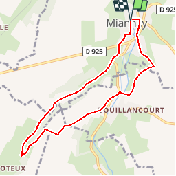
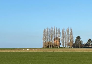
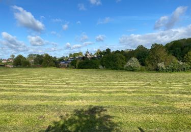
Trail Walking of 7.6 km to be discovered at Hauts-de-France, Somme, Miannay. This trail is proposed by tracegps.
Description
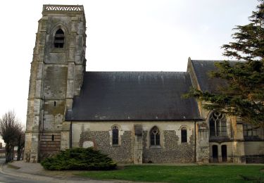
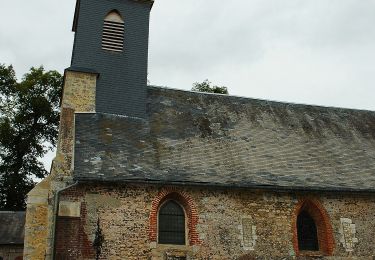
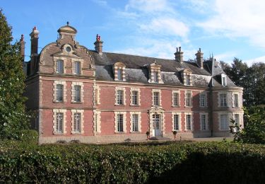
Découvrir des sites aussi plaisants que variés dans cette charmante vallée de la Trie. Pour télécharger la fiche du circuit en format pdf. Partez à la découverte de la Côte Picarde et de la Baie de Somme à travers 38 promenades et randonnées pédestres.
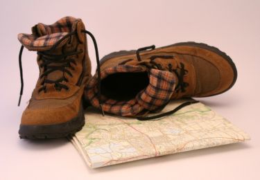
Positioning
Country:
France
Region :
Hauts-de-France
Department/Province :
Somme
Municipality :
Miannay
Location:
Unknown
Start:(Dec)
Start:(UTM)
408357 ; 5550312 (31U) N.
Comments
Trails nearby
![Trail Walking Moyenneville - Le rideau Favery - Moyenneville - Photo](https://media.geolcdn.com/t/375/260/ext.jpg?maxdim=2&url=https%3A%2F%2Fservices.sitytrail.com%2FGeolivesWS%2FDownloadMedia.ashx%3FTrailID%3D108620%26Media%3D1530_1.jpg)
![Walking Walking](https://static1.geolcdn.com/sitytour/trail-icons/101.png)
Le rideau Favery - Moyenneville
Walking
Very difficult
(1)
Moyenneville,
Hauts-de-France,
Somme,
France
![](/images/other/stat-length.png)
13.9 km | 16.4 km-effort
4h 30min
![](https://static1.geolcdn.com/siteimages/upload/files/16400158638029165_repeat_loop_refresh_sync_direction_icon.png)
Yes
![Trail On foot Béhen - Vallée de Bienfay - Photo](https://media.geolcdn.com/t/375/260/2cb287af-8470-401f-a8b5-1e13f328d58d.jpeg&format=jpg&maxdim=2)
![On foot On foot](https://static1.geolcdn.com/sitytour/trail-icons/100.png)
Vallée de Bienfay
On foot
Easy
Béhen,
Hauts-de-France,
Somme,
France
![](/images/other/stat-length.png)
10.5 km | 11.7 km-effort
2h 39min
![](https://static1.geolcdn.com/siteimages/upload/files/16400158638029165_repeat_loop_refresh_sync_direction_icon.png)
Yes
![Trail On foot Tœufles - Circuit de Toeufles - Photo](https://media.geolcdn.com/t/375/260/eec530c3-4343-43c3-8818-6e9ae2d24108.jpeg&format=jpg&maxdim=2)
![On foot On foot](https://static1.geolcdn.com/sitytour/trail-icons/100.png)
Circuit de Toeufles
On foot
Easy
Tœufles,
Hauts-de-France,
Somme,
France
![](/images/other/stat-length.png)
13.7 km | 16 km-effort
3h 37min
![](https://static1.geolcdn.com/siteimages/upload/files/16400158638029165_repeat_loop_refresh_sync_direction_icon.png)
Yes
![Trail Nordic walking Mons-Boubert - Mons Boubert - Photo](https://media.geolcdn.com/t/375/260/53b7182a-3f34-417e-ac4e-bfef251d8c8f.jpg&format=jpg&maxdim=2)
![Nordic walking Nordic walking](https://static1.geolcdn.com/sitytour/trail-icons/102.png)
Mons Boubert
Nordic walking
Very easy
Mons-Boubert,
Hauts-de-France,
Somme,
France
![](/images/other/stat-length.png)
11.2 km | 12.8 km-effort
2h 30min
![](https://static1.geolcdn.com/siteimages/upload/files/16400158638029165_repeat_loop_refresh_sync_direction_icon.png)
Yes
![Trail Nordic walking Acheux-en-Vimeu - Acheux-en-Vimeu - Photo](https://media.geolcdn.com/t/375/260/5cba5944-7338-4101-b9cf-193c4610a920.jpg&format=jpg&maxdim=2)
![Nordic walking Nordic walking](https://static1.geolcdn.com/sitytour/trail-icons/102.png)
Acheux-en-Vimeu
Nordic walking
Acheux-en-Vimeu,
Hauts-de-France,
Somme,
France
![](/images/other/stat-length.png)
11.6 km | 13.6 km-effort
2h 11min
![](https://static1.geolcdn.com/siteimages/upload/files/16400158638029165_repeat_loop_refresh_sync_direction_icon.png)
Yes
![Trail Walking Saigneville - LP80_Petit-Port-Saigneville_7.7km - Photo](https://media.geolcdn.com/t/375/260/bf71f213-7439-4c00-a169-49a7a8c10639.jpg&format=jpg&maxdim=2)
![Walking Walking](https://static1.geolcdn.com/sitytour/trail-icons/101.png)
LP80_Petit-Port-Saigneville_7.7km
Walking
Very easy
Saigneville,
Hauts-de-France,
Somme,
France
![](/images/other/stat-length.png)
7.7 km | 8.3 km-effort
1h 53min
![](https://static1.geolcdn.com/siteimages/upload/files/16400158638029165_repeat_loop_refresh_sync_direction_icon.png)
Yes
![Trail Walking Moyenneville - La Vallée de Bienfay - Photo](https://media.geolcdn.com/t/375/260/ext.jpg?maxdim=2&url=https%3A%2F%2Fservices.sitytrail.com%2FGeolivesWS%2FDownloadMedia.ashx%3FTrailID%3D108621%26Media%3D1531_1.jpg)
![Walking Walking](https://static1.geolcdn.com/sitytour/trail-icons/101.png)
La Vallée de Bienfay
Walking
Difficult
Moyenneville,
Hauts-de-France,
Somme,
France
![](/images/other/stat-length.png)
10.4 km | 11.7 km-effort
3h 10min
![](https://static1.geolcdn.com/siteimages/upload/files/16400158638029165_repeat_loop_refresh_sync_direction_icon.png)
Yes
![Trail Walking Tœufles - Circuit de Toeufles - Photo](https://media.geolcdn.com/t/375/260/ext.jpg?maxdim=2&url=https%3A%2F%2Fservices.sitytrail.com%2FGeolivesWS%2FDownloadMedia.ashx%3FTrailID%3D108618%26Media%3D1528_1.jpg)
![Walking Walking](https://static1.geolcdn.com/sitytour/trail-icons/101.png)
Circuit de Toeufles
Walking
Very difficult
Tœufles,
Hauts-de-France,
Somme,
France
![](/images/other/stat-length.png)
13.6 km | 15.9 km-effort
4h 40min
![](https://static1.geolcdn.com/siteimages/upload/files/16400158638029165_repeat_loop_refresh_sync_direction_icon.png)
Yes
![Trail Nordic walking Quesnoy-le-Montant - Quesnoy le montant 2023 - Photo](https://media.geolcdn.com/t/375/260/00ec3533-857d-430f-93df-c8af78189328.jpg&format=jpg&maxdim=2)
![Nordic walking Nordic walking](https://static1.geolcdn.com/sitytour/trail-icons/102.png)
Quesnoy le montant 2023
Nordic walking
Quesnoy-le-Montant,
Hauts-de-France,
Somme,
France
![](/images/other/stat-length.png)
11.2 km | 12.3 km-effort
2h 10min
![](https://static1.geolcdn.com/siteimages/upload/files/16400158638029165_repeat_loop_refresh_sync_direction_icon.png)
Yes
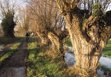
circuit très sympa entre bois et pâtures. faire attention à la signalétique plusieurs circuits