![](/images/other/stat-length.png)
![Trail Walking Maisnières - Le moulin de Visse - Photo](https://media.geolcdn.com/t/1900/400/ext.pjpeg?maxdim=2&url=https%3A%2F%2Fservices.sitytrail.com%2FGeolivesWS%2FDownloadMedia.ashx%3FTrailID%3D108615%26Media%3D1524_1.jpg)
Le moulin de Visse
tracegps
User
![Length](/images/other/stat-length.png)
Length
5.2 km
![Max alt](https://static1.geolcdn.com/siteimages/upload/files/1508320355ic_sort_altitude_max_24dp.png)
Max alt
109 m
![Uphill gradient](https://static1.geolcdn.com/siteimages/upload/files/1508320355ic_sort_den_pos_24dp.png)
Uphill gradient
65 m
![Km-Effort](/images/other/stat-length.png)
Km-Effort
6.1 km
![Min alt](https://static1.geolcdn.com/siteimages/upload/files/1508320355ic_sort_altitude_min_24dp.png)
Min alt
50 m
![Downhill gradient](https://static1.geolcdn.com/siteimages/upload/files/1508320355ic_sort_den_neg_24dp.png)
Downhill gradient
66 m
![Boucle](https://static1.geolcdn.com/siteimages/upload/files/16400158638029165_repeat_loop_refresh_sync_direction_icon.png)
Boucle
Yes
Creation date :
2014-12-10 00:00:00.0
Updated on :
2014-12-10 00:00:00.0
![Walking](https://static1.geolcdn.com/sitytour/trail-icons/101.png)
1h49
Difficulty : Medium
![Scan this QR Code to open this trail in the SityTrail application](https://capi.geolives.com/qq0zvz2zws4bq2lad0pu/sitytour/trails/108615/qr.png?size=200)
FREE GPS app for hiking
About
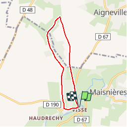
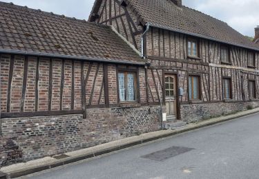
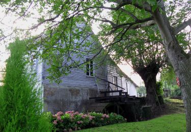
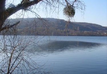
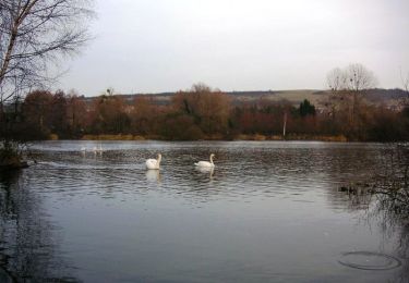
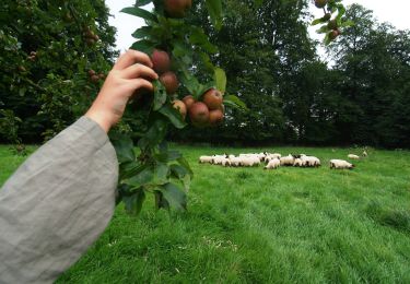
Trail Walking of 5.2 km to be discovered at Hauts-de-France, Somme, Maisnières. This trail is proposed by tracegps.
Description
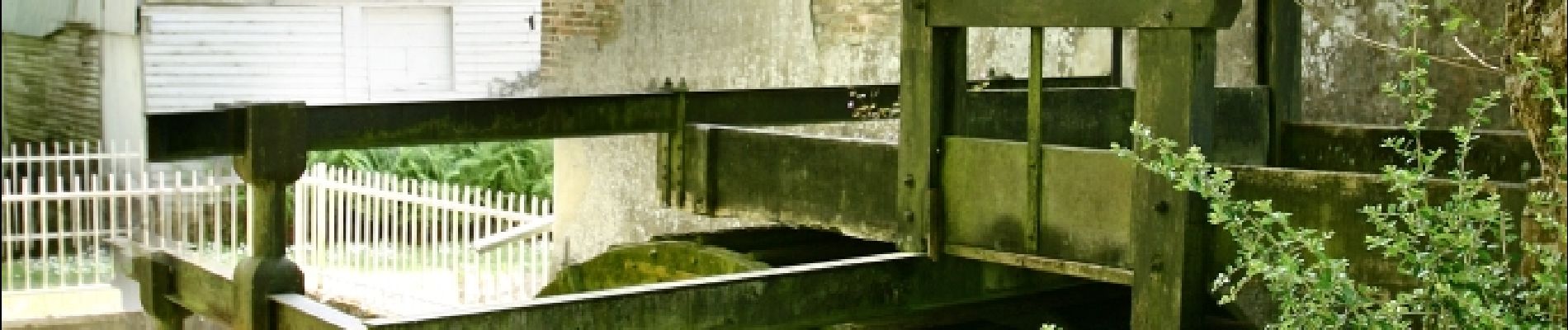
Une balade dans la plaine traversée par la Vimeuse qui, naguère, alimentait un moulin à froment. Pour télécharger la fiche du circuit en format pdf. Partez à la découverte de la Côte Picarde et de la Baie de Somme à travers 38 promenades et randonnées pédestres.
Positioning
Country:
France
Region :
Hauts-de-France
Department/Province :
Somme
Municipality :
Maisnières
Location:
Unknown
Start:(Dec)
Start:(UTM)
400237 ; 5540893 (31U) N.
Comments
Trails nearby
![Trail On foot Gamaches - L'eau vive - Photo](https://media.geolcdn.com/t/375/260/3c4fa46f-9dc2-4d1a-9161-49027c2a541e.jpeg&format=jpg&maxdim=2)
![On foot On foot](https://static1.geolcdn.com/sitytour/trail-icons/100.png)
L'eau vive
On foot
Easy
Gamaches,
Hauts-de-France,
Somme,
France
![](/images/other/stat-length.png)
4.8 km | 5.3 km-effort
1h 11min
![](https://static1.geolcdn.com/siteimages/upload/files/16400158638029165_repeat_loop_refresh_sync_direction_icon.png)
Yes
![Trail On foot Gamaches - Au fil des Étangs - Photo](https://media.geolcdn.com/t/375/260/fbb955a0-b551-4370-8c7b-e1b57583333e.jpeg&format=jpg&maxdim=2)
![On foot On foot](https://static1.geolcdn.com/sitytour/trail-icons/100.png)
Au fil des Étangs
On foot
Easy
Gamaches,
Hauts-de-France,
Somme,
France
![](/images/other/stat-length.png)
3.1 km | 3.3 km-effort
45min
![](https://static1.geolcdn.com/siteimages/upload/files/16400158638029165_repeat_loop_refresh_sync_direction_icon.png)
No
![Trail Walking Longroy - Longroy - Photo](https://media.geolcdn.com/t/375/260/7ec4c826-5a9d-4fa1-ae36-51fe24f1785e.jpg&format=jpg&maxdim=2)
![Walking Walking](https://static1.geolcdn.com/sitytour/trail-icons/101.png)
Longroy
Walking
Easy
Longroy,
Normandy,
Seine-Maritime,
France
![](/images/other/stat-length.png)
10.8 km | 13.5 km-effort
2h 32min
![](https://static1.geolcdn.com/siteimages/upload/files/16400158638029165_repeat_loop_refresh_sync_direction_icon.png)
Yes
![Trail On foot Maisnières - Le Moulin de Visse - Photo](https://media.geolcdn.com/t/375/260/518aeeca-2dd6-428e-8883-2e7cd772f69f.jpeg&format=jpg&maxdim=2)
![On foot On foot](https://static1.geolcdn.com/sitytour/trail-icons/100.png)
Le Moulin de Visse
On foot
Easy
Maisnières,
Hauts-de-France,
Somme,
France
![](/images/other/stat-length.png)
5.3 km | 6.2 km-effort
1h 23min
![](https://static1.geolcdn.com/siteimages/upload/files/16400158638029165_repeat_loop_refresh_sync_direction_icon.png)
Yes
![Trail Walking Gamaches - Circuit de La Tuilerie - Longroy - Photo](https://media.geolcdn.com/t/375/260/ext.jpg?maxdim=2&url=https%3A%2F%2Fservices.sitytrail.com%2FGeolivesWS%2FDownloadMedia.ashx%3FTrailID%3D191424%26Media%3D15006_1.jpg)
![Walking Walking](https://static1.geolcdn.com/sitytour/trail-icons/101.png)
Circuit de La Tuilerie - Longroy
Walking
Medium
Gamaches,
Hauts-de-France,
Somme,
France
![](/images/other/stat-length.png)
10.7 km | 13.4 km-effort
2h 40min
![](https://static1.geolcdn.com/siteimages/upload/files/16400158638029165_repeat_loop_refresh_sync_direction_icon.png)
Yes
![Trail Cycle Gamaches - Les Croisettes - Gamaches dans le Vimeu - Photo](https://media.geolcdn.com/t/375/260/ext.jpg?maxdim=2&url=https%3A%2F%2Fservices.sitytrail.com%2FGeolivesWS%2FDownloadMedia.ashx%3FTrailID%3D109921%26Media%3D4938_1.jpg)
![Cycle Cycle](https://static1.geolcdn.com/sitytour/trail-icons/200.png)
Les Croisettes - Gamaches dans le Vimeu
Cycle
Difficult
Gamaches,
Hauts-de-France,
Somme,
France
![](/images/other/stat-length.png)
40 km | 45 km-effort
3h 0min
![](https://static1.geolcdn.com/siteimages/upload/files/16400158638029165_repeat_loop_refresh_sync_direction_icon.png)
Yes
![Trail Walking Tilloy-Floriville - La Vimeuse - Tilloy Floriville - Photo](https://media.geolcdn.com/t/375/260/ext.jpg?maxdim=2&url=https%3A%2F%2Fservices.sitytrail.com%2FGeolivesWS%2FDownloadMedia.ashx%3FTrailID%3D108617%26Media%3D1527_1.jpg)
![Walking Walking](https://static1.geolcdn.com/sitytour/trail-icons/101.png)
La Vimeuse - Tilloy Floriville
Walking
Medium
Tilloy-Floriville,
Hauts-de-France,
Somme,
France
![](/images/other/stat-length.png)
9 km | 10.5 km-effort
2h 49min
![](https://static1.geolcdn.com/siteimages/upload/files/16400158638029165_repeat_loop_refresh_sync_direction_icon.png)
Yes
![Trail Walking Gamaches - 20230616 Gamaches - Photo](https://media.geolcdn.com/t/375/260/f59e8ab2-5ee1-4984-aaba-50424a5b486b.jpg&format=jpg&maxdim=2)
![Walking Walking](https://static1.geolcdn.com/sitytour/trail-icons/101.png)
20230616 Gamaches
Walking
Medium
Gamaches,
Hauts-de-France,
Somme,
France
![](/images/other/stat-length.png)
18.8 km | 22 km-effort
5h 37min
![](https://static1.geolcdn.com/siteimages/upload/files/16400158638029165_repeat_loop_refresh_sync_direction_icon.png)
Yes
![Trail On foot Tilloy-Floriville - Vimeuse - Photo](https://media.geolcdn.com/t/375/260/ext.jpg?maxdim=2&url=https%3A%2F%2Fstatic1.geolcdn.com%2Fsiteimages%2Fupload%2Ffiles%2F1545311037marcheuse_200dpi.jpg)
![On foot On foot](https://static1.geolcdn.com/sitytour/trail-icons/100.png)
Vimeuse
On foot
Easy
Tilloy-Floriville,
Hauts-de-France,
Somme,
France
![](/images/other/stat-length.png)
8.2 km | 9.6 km-effort
2h 11min
![](https://static1.geolcdn.com/siteimages/upload/files/16400158638029165_repeat_loop_refresh_sync_direction_icon.png)
No