![](/images/other/stat-length.png)
![Trail Walking Mareuil-Caubert - La Vallée de Frosme - Photo](https://media.geolcdn.com/t/1900/400/ext.pjpeg?maxdim=2&url=https%3A%2F%2Fservices.sitytrail.com%2FGeolivesWS%2FDownloadMedia.ashx%3FTrailID%3D108583%26Media%3D1491_1.jpg)
La Vallée de Frosme
tracegps
User
![Length](/images/other/stat-length.png)
Length
9 km
![Max alt](https://static1.geolcdn.com/siteimages/upload/files/1508320355ic_sort_altitude_max_24dp.png)
Max alt
90 m
![Uphill gradient](https://static1.geolcdn.com/siteimages/upload/files/1508320355ic_sort_den_pos_24dp.png)
Uphill gradient
183 m
![Km-Effort](/images/other/stat-length.png)
Km-Effort
11.4 km
![Min alt](https://static1.geolcdn.com/siteimages/upload/files/1508320355ic_sort_altitude_min_24dp.png)
Min alt
5 m
![Downhill gradient](https://static1.geolcdn.com/siteimages/upload/files/1508320355ic_sort_den_neg_24dp.png)
Downhill gradient
187 m
![Boucle](https://static1.geolcdn.com/siteimages/upload/files/16400158638029165_repeat_loop_refresh_sync_direction_icon.png)
Boucle
Yes
Creation date :
2014-12-10 00:00:00.0
Updated on :
2014-12-10 00:00:00.0
![Walking](https://static1.geolcdn.com/sitytour/trail-icons/101.png)
3h00
Difficulty : Medium
![Scan this QR Code to open this trail in the SityTrail application](https://capi.geolives.com/qq0zvz2zws4bq2lad0pu/sitytour/trails/108583/qr.png?size=200)
FREE GPS app for hiking
About
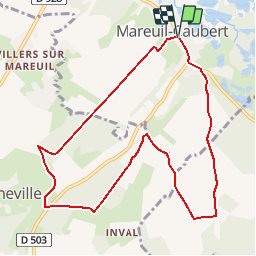
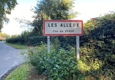
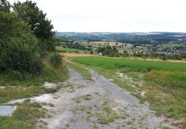
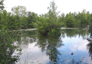
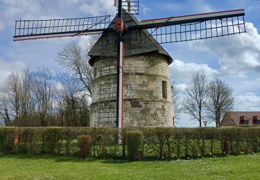
Trail Walking of 9 km to be discovered at Hauts-de-France, Somme, Mareuil-Caubert. This trail is proposed by tracegps.
Description
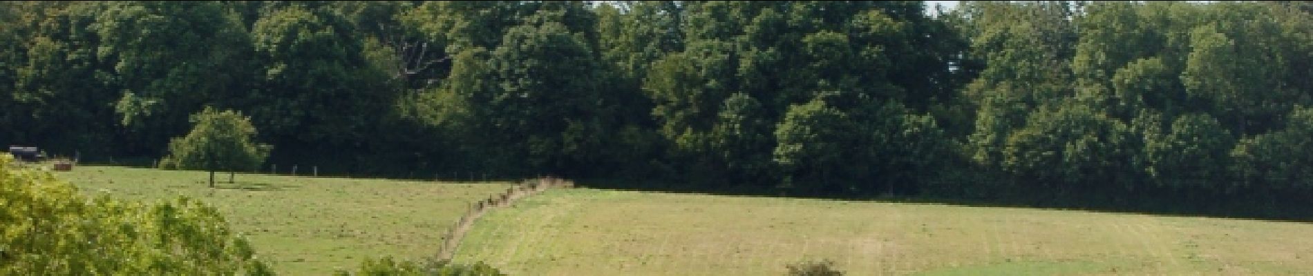
En quittant ce bourg truffé d’étangs et de marais, on découvre un autre charme dans sa campagne verdoyante et boisée. Pour télécharger la fiche du circuit en format pdf. Partez à la découverte de la Côte Picarde et de la Baie de Somme à travers 38 promenades et randonnées pédestres.
Positioning
Country:
France
Region :
Hauts-de-France
Department/Province :
Somme
Municipality :
Mareuil-Caubert
Location:
Unknown
Start:(Dec)
Start:(UTM)
416317 ; 5546826 (31U) N.
Comments
Trails nearby
![Trail Walking Yonval - Les 3 Fétus - Yonval - Photo](https://media.geolcdn.com/t/375/260/ext.jpg?maxdim=2&url=https%3A%2F%2Fservices.sitytrail.com%2FGeolivesWS%2FDownloadMedia.ashx%3FTrailID%3D108581%26Media%3D1489_1.jpg)
![Walking Walking](https://static1.geolcdn.com/sitytour/trail-icons/101.png)
Les 3 Fétus - Yonval
Walking
Difficult
(2)
Yonval,
Hauts-de-France,
Somme,
France
![](/images/other/stat-length.png)
7.5 km | 9.4 km-effort
2h 30min
![](https://static1.geolcdn.com/siteimages/upload/files/16400158638029165_repeat_loop_refresh_sync_direction_icon.png)
Yes
![Trail On foot Eaucourt-sur-Somme - Le Moulin d'Eaucourt - Photo](https://media.geolcdn.com/t/375/260/9b9489ba-5456-4746-a4ec-6f9e1c594e14.jpeg&format=jpg&maxdim=2)
![On foot On foot](https://static1.geolcdn.com/sitytour/trail-icons/100.png)
Le Moulin d'Eaucourt
On foot
Easy
Eaucourt-sur-Somme,
Hauts-de-France,
Somme,
France
![](/images/other/stat-length.png)
5.8 km | 7.3 km-effort
1h 39min
![](https://static1.geolcdn.com/siteimages/upload/files/16400158638029165_repeat_loop_refresh_sync_direction_icon.png)
Yes
![Trail Road bike Béhen - Béhen Huppy Boëncourt - Photo](https://media.geolcdn.com/t/375/260/63d1e102-e234-4f81-9781-7a4437ef0dd2.jpg&format=jpg&maxdim=2)
![Road bike Road bike](https://static1.geolcdn.com/sitytour/trail-icons/201.png)
Béhen Huppy Boëncourt
Road bike
Easy
Béhen,
Hauts-de-France,
Somme,
France
![](/images/other/stat-length.png)
11.9 km | 12.8 km-effort
59min
![](https://static1.geolcdn.com/siteimages/upload/files/16400158638029165_repeat_loop_refresh_sync_direction_icon.png)
Yes
![Trail Running Béhen - Les Alleux - Photo](https://media.geolcdn.com/t/375/260/0b72ba47-eb3e-48ef-8977-db903cf4990c.jpg&format=jpg&maxdim=2)
![Running Running](https://static1.geolcdn.com/sitytour/trail-icons/103.png)
![Trail Walking Eaucourt-sur-Somme - le moulin d'Eaucourt - Photo](https://media.geolcdn.com/t/375/260/4264d59a-a879-4d1d-a4fc-208df5e572be.jpg&format=jpg&maxdim=2)
![Walking Walking](https://static1.geolcdn.com/sitytour/trail-icons/101.png)
le moulin d'Eaucourt
Walking
Easy
Eaucourt-sur-Somme,
Hauts-de-France,
Somme,
France
![](/images/other/stat-length.png)
7.4 km | 9.1 km-effort
2h 23min
![](https://static1.geolcdn.com/siteimages/upload/files/16400158638029165_repeat_loop_refresh_sync_direction_icon.png)
Yes
![Trail Walking Mareuil-Caubert - Au travers des étangs - Photo](https://media.geolcdn.com/t/375/260/3d0ba1a8-2447-466c-a227-2f133fd97408.jpg&format=jpg&maxdim=2)
![Walking Walking](https://static1.geolcdn.com/sitytour/trail-icons/101.png)
Au travers des étangs
Walking
Very easy
Mareuil-Caubert,
Hauts-de-France,
Somme,
France
![](/images/other/stat-length.png)
3.7 km | 3.9 km-effort
1h 16min
![](https://static1.geolcdn.com/siteimages/upload/files/16400158638029165_repeat_loop_refresh_sync_direction_icon.png)
Yes
![Trail Cycle Abbeville - la baie de Somme à vélo - Photo](https://media.geolcdn.com/t/375/260/ext.jpg?maxdim=2&url=https%3A%2F%2Fservices.sitytrail.com%2FGeolivesWS%2FDownloadMedia.ashx%3FTrailID%3D1132041%26Media%3D20190407095358.jpg)
![Cycle Cycle](https://static1.geolcdn.com/sitytour/trail-icons/200.png)
la baie de Somme à vélo
Cycle
Very easy
Abbeville,
Hauts-de-France,
Somme,
France
![](/images/other/stat-length.png)
118 km | 124 km-effort
8h 12min
![](https://static1.geolcdn.com/siteimages/upload/files/16400158638029165_repeat_loop_refresh_sync_direction_icon.png)
No
![Trail Walking Abbeville - Abbeville chemin du Pâtis - Photo](https://media.geolcdn.com/t/375/260/ba947a24-30d5-4d85-9868-f6de26ac7666.jpg&format=jpg&maxdim=2)
![Walking Walking](https://static1.geolcdn.com/sitytour/trail-icons/101.png)
Abbeville chemin du Pâtis
Walking
Easy
Abbeville,
Hauts-de-France,
Somme,
France
![](/images/other/stat-length.png)
14 km | 15 km-effort
4h 6min
![](https://static1.geolcdn.com/siteimages/upload/files/16400158638029165_repeat_loop_refresh_sync_direction_icon.png)
No
![Trail Walking Eaucourt-sur-Somme - lp80_eaucourt - Photo](https://media.geolcdn.com/t/375/260/9ce553b3-b2ee-49ec-b994-ab1db0443503.jpg&format=jpg&maxdim=2)
![Walking Walking](https://static1.geolcdn.com/sitytour/trail-icons/101.png)
lp80_eaucourt
Walking
Medium
Eaucourt-sur-Somme,
Hauts-de-France,
Somme,
France
![](/images/other/stat-length.png)
7.2 km | 8.9 km-effort
2h 1min
![](https://static1.geolcdn.com/siteimages/upload/files/16400158638029165_repeat_loop_refresh_sync_direction_icon.png)
Yes