Trail Mountain bike Saint-Zacharie - Le pas de Peyruis - Saint Zacharie - Photo

Le pas de Peyruis - Saint Zacharie

 tracegps
tracegps

User

© OpenStreetMap contributors
Length
Length
16.2 km
Max alt
Max alt
455 m
Uphill gradient
Uphill gradient
243 m
Km-Effort
Km-Effort  
19.5 km
Min alt
Min alt
268 m
Downhill gradient
Downhill gradient
245 m
Boucle
Boucle
Yes
Creation date :
2014-12-10 00:00:00.0
Updated on :
2014-12-10 00:00:00.0

(0 Reviews)

Mountain bike
Mountain bike
1h45
Difficulty : Easy

Scan this QR Code to open this trail in the SityTrail application

FREE GPS app for hiking

Logo SityTrail SityTrail

IGN / Geographical institutes

Download SityTrail from the App Store Download SityTrail from Google Play

Logo SityTrail SityTrail World

The world is yours!

Download SityTrail from the App Store Download SityTrail from Google Play Download SityTrail on Huawei AppGallery

About

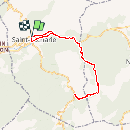
Trail Mountain bike of 16.2 km to be discovered at Provence-Alpes-Côte d'Azur, Var, Saint-Zacharie. This trail is proposed by tracegps.

Description

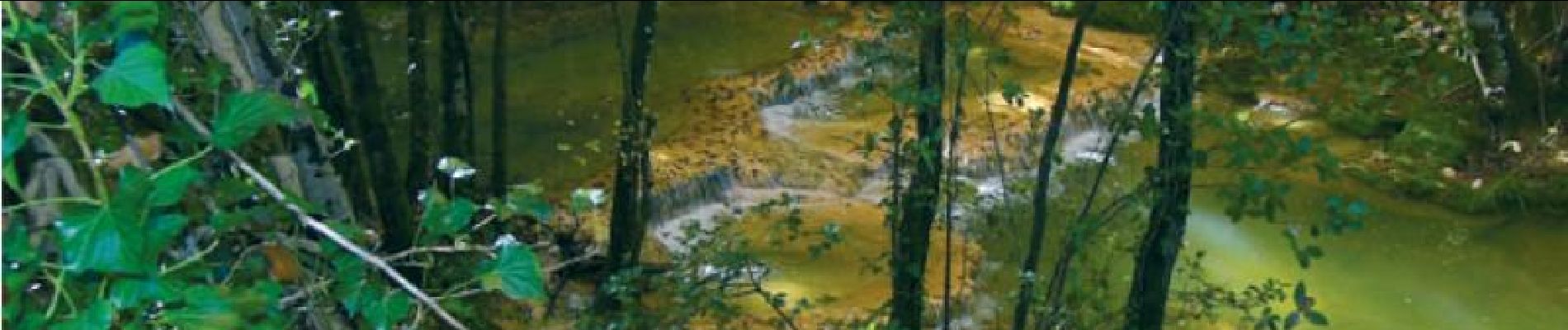
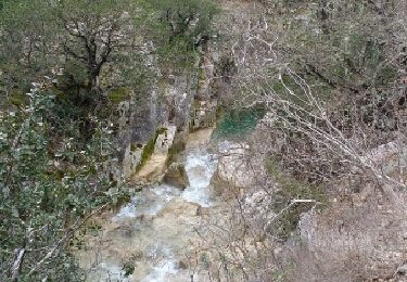
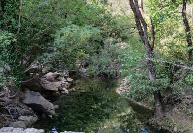
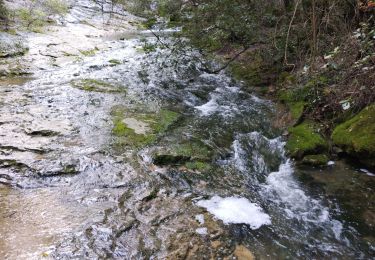
Joli parcours sans difficulté technique ou physique particulière. Adaptée pour les enfants, cette randonnée accompagne l’Huveaune sur plusieurs kilomètres donnant l’occasion de découvrir la faune et la flore aquatique. Pour éviter de rouler sur la nationale, il est possible de se garer au pont de Coulomb. Retrouvez plus de précisions sur le site de VTOPO.com

Elevation profile

Photos

Positioning

Country:
France
Region :
Provence-Alpes-Côte d'Azur
Department/Province :
Var
Municipality :
Saint-Zacharie
Location:
Unknown
Start:(UTM)
719243 ; 4807132 (31T) N.

Trails nearby

Trail Mountain bike Trets - les contreforts du mont Olympe - Photo
Mountain bike
GUIDE
amiral13

Mountain bike

Easy
(1)
Trets, Provence-Alpes-Côte d'Azur, Bouches-du-Rhône, France
11.8 km | 15.5 km-effort
2h 52min
Yes
Trail Walking Auriol - la crete des infernets - Photo
Walking
Coryphene

Walking

Difficult
(1)
Auriol, Provence-Alpes-Côte d'Azur, Bouches-du-Rhône, France
8.6 km | 14 km-effort
3h 22min
Yes
Trail Walking Auriol - le ravin des Encanaux - Photo
Walking
GUIDE
amiral13

Walking

Difficult
Auriol, Provence-Alpes-Côte d'Azur, Bouches-du-Rhône, France
7.3 km | 12.2 km-effort
3h 10min
Yes
Trail Walking Saint-Zacharie - Source de l'Huveaune  - Photo
Walking
GUIDE
lhomme.ph

Walking

Easy
Saint-Zacharie, Provence-Alpes-Côte d'Azur, Var, France
15.2 km | 19.7 km-effort
4h 24min
Yes
Trail Walking Auriol - Les Encanaux, Auriol-05-06-24 - Photo
Walking
Christiancordin

Walking

Medium
Auriol, Provence-Alpes-Côte d'Azur, Bouches-du-Rhône, France
15.4 km | 24 km-effort
4h 9min
Yes
Trail Walking Auriol - les Encanaux  - Photo
Walking
cousam

Walking

Difficult
Auriol, Provence-Alpes-Côte d'Azur, Bouches-du-Rhône, France
7.1 km | 11 km-effort
2h 14min
Yes
Trail Walking Saint-Zacharie - Sources des Nayes  - Photo
Walking
dudu42

Walking

Medium
Saint-Zacharie, Provence-Alpes-Côte d'Azur, Var, France
7.6 km | 9.6 km-effort
1h 47min
Yes
Trail Walking Auriol - Ravin des Infernets -Tête de chien - Photo
Walking
cousam

Walking

Very difficult
Auriol, Provence-Alpes-Côte d'Azur, Bouches-du-Rhône, France
13.7 km | 22 km-effort
9h 33min
Yes
Trail Walking Plan-d'Aups-Sainte-Baume - l'huveaune - Photo
Walking
cousam

Walking

Very difficult
Plan-d'Aups-Sainte-Baume, Provence-Alpes-Côte d'Azur, Var, France
15.4 km | 25 km-effort
7h 52min
Yes


Close
My subscriptions