


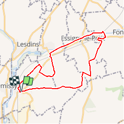

17.4 km | 19.6 km-effort


User


FREE GPS app for hiking
 SityTrail
IGN / Geographical institutes
SityTrail World
The world is yours!
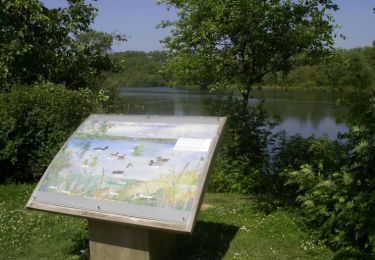
Trail Walking of 14.7 km to be discovered at Hauts-de-France, Aisne, Morcourt. This trail is proposed by tracegps.
En aval des sources de la Somme, cette grande boucle démarre à Morcourt pour se diriger vers le fleuve sinueux après un crochet par la ferme du Tilloy. Passé Essigny-le-Petit, on suit un temps la rigole de l'Oise et du Noirrieu au tracé rectiligne pour revenir par les champs Clochers et le champ à Cailloux. Toutes les infos sont ICI
Walking
Walking

Walking

Walking
Walking

Walking

Walking

Walking
Walking