Trail Walking Fère-en-Tardenois - Le grès qui va boire - variante - Photo

Le grès qui va boire - variante

 tracegps
tracegps

User

© OpenStreetMap contributors
Length
Length
11 km
Max alt
Max alt
179 m
Uphill gradient
Uphill gradient
116 m
Km-Effort
Km-Effort  
12.5 km
Min alt
Min alt
119 m
Downhill gradient
Downhill gradient
117 m
Boucle
Boucle
Yes
Creation date :
2014-12-10 00:00:00.0
Updated on :
2014-12-10 00:00:00.0

(0 Reviews)

Walking
Walking
3h00
Difficulty : Very difficult

Scan this QR Code to open this trail in the SityTrail application

FREE GPS app for hiking

Logo SityTrail SityTrail

IGN / Geographical institutes

Download SityTrail from the App Store Download SityTrail from Google Play

Logo SityTrail SityTrail World

The world is yours!

Download SityTrail from the App Store Download SityTrail from Google Play Download SityTrail on Huawei AppGallery

About

Trail Walking of 11 km to be discovered at Hauts-de-France, Aisne, Fère-en-Tardenois. This trail is proposed by tracegps.

Description

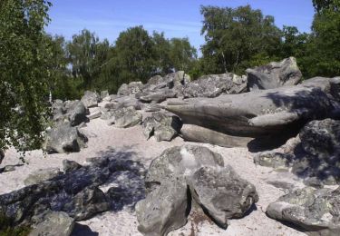
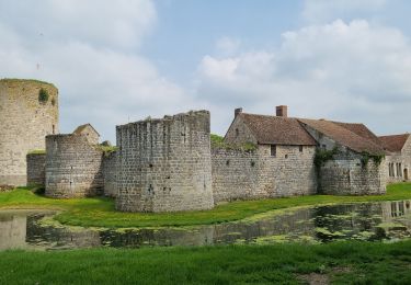
Le "Grès qui va boire" surveille la route de Paris, que les rois empruntaient pour se rendre à Reims. L'itinéraire mène à la forteresse de Nesles et à l'élégant et romantique château de Fère, qui aurait servi de modèle à l'édification de Chenonceaux. Toutes les infos sont ICI

Elevation profile

Positioning

Country:
France
Region :
Hauts-de-France
Department/Province :
Aisne
Municipality :
Fère-en-Tardenois
Location:
Unknown
Start:(UTM)
537384 ; 5449922 (31U) N.

Trails nearby

Trail Walking Villeneuve-sur-Fère - Au pays des Claudel - Photo
Walking
tracegps

Walking

Very difficult
(1)
Villeneuve-sur-Fère, Hauts-de-France, Aisne, France
10.1 km | 12.6 km-effort
3h 0min
Yes
Trail Walking Seringes-et-Nesles - En terre Tardenoise - Photo
Walking
José800

Walking

Medium
Seringes-et-Nesles, Hauts-de-France, Aisne, France
15.1 km | 17.6 km-effort
4h 1min
Yes
Trail Walking Fère-en-Tardenois - FERE VIA BOIS DE SAPONAY DERNIERE VERSION - Photo
Walking
explorateur

Walking

Medium
(1)
Fère-en-Tardenois, Hauts-de-France, Aisne, France
10.5 km | 12.2 km-effort
2h 28min
Yes
Trail Walking Fère-en-Tardenois - Fère en Tardenois par le bois de Saponay - Photo
Walking
GUIDE
VANDERPUTTENMi

Walking

Very easy
Fère-en-Tardenois, Hauts-de-France, Aisne, France
11.5 km | 12.9 km-effort
2h 58min
Yes
Trail Mountain bike Fère-en-Tardenois - Bois de Saponay du 08/09/2020 - Photo
Mountain bike
GUIDE
VANDERPUTTENMi

Mountain bike

Very easy
Fère-en-Tardenois, Hauts-de-France, Aisne, France
10.8 km | 12.1 km-effort
51min
Yes
Trail Walking Villeneuve-sur-Fère - Au Pays de Claudel - Photo
Walking
PatRando

Walking

Easy
Villeneuve-sur-Fère, Hauts-de-France, Aisne, France
23 km | 29 km-effort
6h 17min
Yes
Trail Walking Villeneuve-sur-Fère - Villeneuve Sur Fère - Photo
Walking
PatRando

Walking

Easy
Villeneuve-sur-Fère, Hauts-de-France, Aisne, France
10.8 km | 13.1 km-effort
2h 59min
Yes
Trail Walking Villeneuve-sur-Fère - Au pays des Claudel - Photo
Walking

Walking

Very easy
Villeneuve-sur-Fère, Hauts-de-France, Aisne, France
10.1 km | 12.6 km-effort
Unknown
Yes
Trail Walking Fère-en-Tardenois - ballade dimanche le 7 avril 2013 - Photo
Walking
olivier77580

Walking

Very easy
Fère-en-Tardenois, Hauts-de-France, Aisne, France
95 km | 108 km-effort
3h 43min
No


Close
My subscriptions