


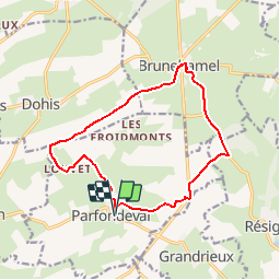

12.5 km | 14.2 km-effort

User


FREE GPS app for hiking
 SityTrail
IGN / Geographical institutes
SityTrail World
The world is yours!
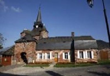
Trail Walking of 13 km to be discovered at Hauts-de-France, Aisne, Parfondeval. This trail is proposed by tracegps.
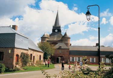
Classé parmi les "plus beaux villages de France", Parfondeval, avec son église fortifiée dominant la Brune et ses maisons de brique ou à colombages, est le point de départ de ce parcours entre vergers de pommiers et petits bois de feuillus. Toutes les infos sont ICI


On foot
Walking
Walking

Walking
Walking