![](/images/other/stat-length.png)
![Trail Walking Rozoy-Bellevalle - Le gué de la Bochat - Photo](https://media.geolcdn.com/t/1900/400/ext.pjpeg?maxdim=2&url=https%3A%2F%2Fservices.sitytrail.com%2FGeolivesWS%2FDownloadMedia.ashx%3FTrailID%3D108365%26Media%3D1041_2.jpg)
Le gué de la Bochat
tracegps
User
![Length](/images/other/stat-length.png)
Length
7.5 km
![Max alt](https://static1.geolcdn.com/siteimages/upload/files/1508320355ic_sort_altitude_max_24dp.png)
Max alt
213 m
![Uphill gradient](https://static1.geolcdn.com/siteimages/upload/files/1508320355ic_sort_den_pos_24dp.png)
Uphill gradient
78 m
![Km-Effort](/images/other/stat-length.png)
Km-Effort
8.5 km
![Min alt](https://static1.geolcdn.com/siteimages/upload/files/1508320355ic_sort_altitude_min_24dp.png)
Min alt
186 m
![Downhill gradient](https://static1.geolcdn.com/siteimages/upload/files/1508320355ic_sort_den_neg_24dp.png)
Downhill gradient
77 m
![Boucle](https://static1.geolcdn.com/siteimages/upload/files/16400158638029165_repeat_loop_refresh_sync_direction_icon.png)
Boucle
Yes
Creation date :
2014-12-10 00:00:00.0
Updated on :
2014-12-10 00:00:00.0
![Walking](https://static1.geolcdn.com/sitytour/trail-icons/101.png)
1h45
Difficulty : Medium
![Scan this QR Code to open this trail in the SityTrail application](https://capi.geolives.com/qq0zvz2zws4bq2lad0pu/sitytour/trails/108365/qr.png?size=200)
FREE GPS app for hiking
About
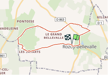
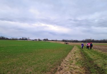
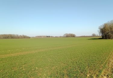
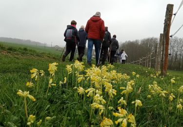
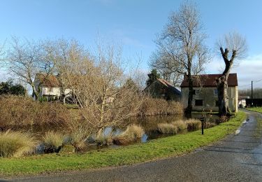
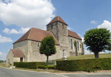
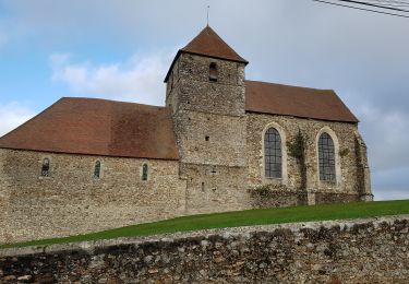
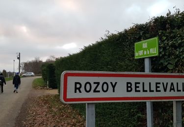
Trail Walking of 7.5 km to be discovered at Hauts-de-France, Aisne, Rozoy-Bellevalle. This trail is proposed by tracegps.
Description
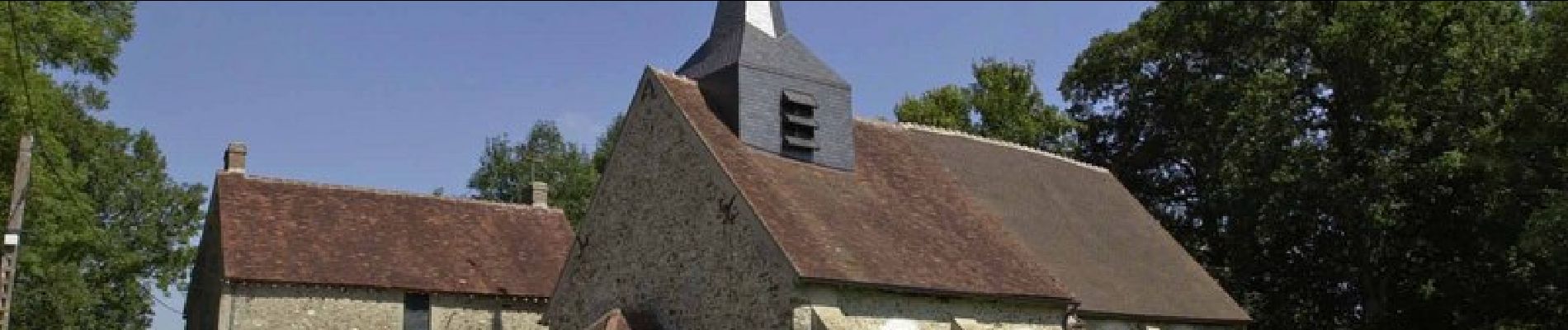
Au départ de Rozoy-Bellevalle, village de Brie à l'habitat dispersé, cet itinéraire champêtre enjambe un petit gué. Il est équipé de panneaux pédagogiques sur l'environnement. Toutes les infos sont ICI
Positioning
Country:
France
Region :
Hauts-de-France
Department/Province :
Aisne
Municipality :
Rozoy-Bellevalle
Location:
Unknown
Start:(Dec)
Start:(UTM)
533101 ; 5419205 (31U) N.
Comments
Trails nearby
![Trail Walking Montfaucon - La croix de Montfaucon - Photo](https://media.geolcdn.com/t/375/260/ext.jpg?maxdim=2&url=https%3A%2F%2Fservices.sitytrail.com%2FGeolivesWS%2FDownloadMedia.ashx%3FTrailID%3D108364%26Media%3D1040_2.jpg)
![Walking Walking](https://static1.geolcdn.com/sitytour/trail-icons/101.png)
La croix de Montfaucon
Walking
Very difficult
(1)
Montfaucon,
Hauts-de-France,
Aisne,
France
![](/images/other/stat-length.png)
14.7 km | 17.8 km-effort
3h 45min
![](https://static1.geolcdn.com/siteimages/upload/files/16400158638029165_repeat_loop_refresh_sync_direction_icon.png)
Yes
![Trail Walking Dhuys et Morin-en-Brie - Fontenelle-en-Brie du 12-01-2022 - Photo](https://media.geolcdn.com/t/375/260/64e24db2-5b70-4c81-a4d4-125398f586f3.jpg&format=jpg&maxdim=2)
![Walking Walking](https://static1.geolcdn.com/sitytour/trail-icons/101.png)
Fontenelle-en-Brie du 12-01-2022
Walking
Medium
Dhuys et Morin-en-Brie,
Hauts-de-France,
Aisne,
France
![](/images/other/stat-length.png)
11.1 km | 12.5 km-effort
2h 35min
![](https://static1.geolcdn.com/siteimages/upload/files/16400158638029165_repeat_loop_refresh_sync_direction_icon.png)
Yes
![Trail Walking Dhuys et Morin-en-Brie - Fontenelle en Brie du 25-01-2024 - Photo](https://media.geolcdn.com/t/375/260/88209a05-4218-4d0c-ad09-4d63cf620c86.jpg&format=jpg&maxdim=2)
![Walking Walking](https://static1.geolcdn.com/sitytour/trail-icons/101.png)
Fontenelle en Brie du 25-01-2024
Walking
Medium
Dhuys et Morin-en-Brie,
Hauts-de-France,
Aisne,
France
![](/images/other/stat-length.png)
10.2 km | 11.3 km-effort
2h 33min
![](https://static1.geolcdn.com/siteimages/upload/files/16400158638029165_repeat_loop_refresh_sync_direction_icon.png)
Yes
![Trail Walking L'Épine-aux-Bois - L'Epine-aux-Bois du 07-02-2023 - Photo](https://media.geolcdn.com/t/375/260/cf70cf2a-089e-4f4f-a2c3-a1924549264f.jpg&format=jpg&maxdim=2)
![Walking Walking](https://static1.geolcdn.com/sitytour/trail-icons/101.png)
L'Epine-aux-Bois du 07-02-2023
Walking
Medium
L'Épine-aux-Bois,
Hauts-de-France,
Aisne,
France
![](/images/other/stat-length.png)
8.8 km | 9.9 km-effort
2h 0min
![](https://static1.geolcdn.com/siteimages/upload/files/16400158638029165_repeat_loop_refresh_sync_direction_icon.png)
Yes
![Trail Walking Viffort - Viffort du 05-04-2022 - Photo](https://media.geolcdn.com/t/375/260/6a38da00-6e8c-4851-ae5a-5c03310e8c57.jpg&format=jpg&maxdim=2)
![Walking Walking](https://static1.geolcdn.com/sitytour/trail-icons/101.png)
Viffort du 05-04-2022
Walking
Medium
Viffort,
Hauts-de-France,
Aisne,
France
![](/images/other/stat-length.png)
10.1 km | 11.6 km-effort
2h 11min
![](https://static1.geolcdn.com/siteimages/upload/files/16400158638029165_repeat_loop_refresh_sync_direction_icon.png)
Yes
![Trail Walking Dhuys et Morin-en-Brie - Fontenelle-en-Brie - Photo](https://media.geolcdn.com/t/375/260/f1e3f59e-3420-434e-b70c-f93bd1b6fe17.jpg&format=jpg&maxdim=2)
![Walking Walking](https://static1.geolcdn.com/sitytour/trail-icons/101.png)
Fontenelle-en-Brie
Walking
Difficult
Dhuys et Morin-en-Brie,
Hauts-de-France,
Aisne,
France
![](/images/other/stat-length.png)
11.7 km | 13 km-effort
2h 27min
![](https://static1.geolcdn.com/siteimages/upload/files/16400158638029165_repeat_loop_refresh_sync_direction_icon.png)
Yes
![Trail Walking Viffort - Viffort](https://media.geolcdn.com/t/375/260/0e5af384-11cd-44c6-81b2-637be3b7e457.jpg&format=jpg&maxdim=2)
![Walking Walking](https://static1.geolcdn.com/sitytour/trail-icons/101.png)
Viffort " la Vicufontaine"
Walking
Difficult
Viffort,
Hauts-de-France,
Aisne,
France
![](/images/other/stat-length.png)
11.2 km | 13 km-effort
2h 29min
![](https://static1.geolcdn.com/siteimages/upload/files/16400158638029165_repeat_loop_refresh_sync_direction_icon.png)
Yes
![Trail Walking Viffort - Viffort ADR du 20-12-2020 - Photo](https://media.geolcdn.com/t/375/260/fbf0f983-968c-4c35-ae90-8d7dfbec8f6c.jpg&format=jpg&maxdim=2)
![Walking Walking](https://static1.geolcdn.com/sitytour/trail-icons/101.png)
Viffort ADR du 20-12-2020
Walking
Very easy
Viffort,
Hauts-de-France,
Aisne,
France
![](/images/other/stat-length.png)
8.3 km | 9.8 km-effort
2h 4min
![](https://static1.geolcdn.com/siteimages/upload/files/16400158638029165_repeat_loop_refresh_sync_direction_icon.png)
Yes
![Trail Walking Rozoy-Bellevalle - Rozoy-Bellevalle du 8-12-2020 - Photo](https://media.geolcdn.com/t/375/260/86b38434-801b-487c-afd7-44f6b9ebd4a6.jpg&format=jpg&maxdim=2)
![Walking Walking](https://static1.geolcdn.com/sitytour/trail-icons/101.png)
Rozoy-Bellevalle du 8-12-2020
Walking
Very easy
Rozoy-Bellevalle,
Hauts-de-France,
Aisne,
France
![](/images/other/stat-length.png)
10.7 km | 12.7 km-effort
2h 32min
![](https://static1.geolcdn.com/siteimages/upload/files/16400158638029165_repeat_loop_refresh_sync_direction_icon.png)
Yes