![](/images/other/stat-length.png)
![Trail Walking Montfaucon - La croix de Montfaucon - Photo](https://media.geolcdn.com/t/1900/400/ext.pjpeg?maxdim=2&url=https%3A%2F%2Fservices.sitytrail.com%2FGeolivesWS%2FDownloadMedia.ashx%3FTrailID%3D108364%26Media%3D1040_2.jpg)
La croix de Montfaucon
tracegps
User
![Length](/images/other/stat-length.png)
Length
14.7 km
![Max alt](https://static1.geolcdn.com/siteimages/upload/files/1508320355ic_sort_altitude_max_24dp.png)
Max alt
216 m
![Uphill gradient](https://static1.geolcdn.com/siteimages/upload/files/1508320355ic_sort_den_pos_24dp.png)
Uphill gradient
228 m
![Km-Effort](/images/other/stat-length.png)
Km-Effort
17.8 km
![Min alt](https://static1.geolcdn.com/siteimages/upload/files/1508320355ic_sort_altitude_min_24dp.png)
Min alt
132 m
![Downhill gradient](https://static1.geolcdn.com/siteimages/upload/files/1508320355ic_sort_den_neg_24dp.png)
Downhill gradient
226 m
![Boucle](https://static1.geolcdn.com/siteimages/upload/files/16400158638029165_repeat_loop_refresh_sync_direction_icon.png)
Boucle
Yes
Creation date :
2014-12-10 00:00:00.0
Updated on :
2014-12-10 00:00:00.0
![Walking](https://static1.geolcdn.com/sitytour/trail-icons/101.png)
3h45
Difficulty : Very difficult
![Scan this QR Code to open this trail in the SityTrail application](https://capi.geolives.com/qq0zvz2zws4bq2lad0pu/sitytour/trails/108364/qr.png?size=200)
FREE GPS app for hiking
About
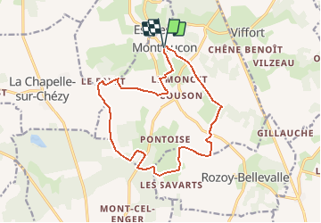
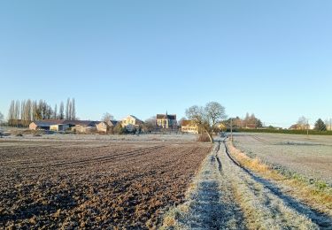
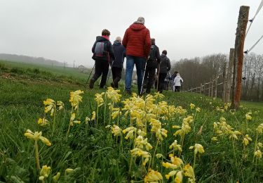
Trail Walking of 14.7 km to be discovered at Hauts-de-France, Aisne, Montfaucon. This trail is proposed by tracegps.
Description
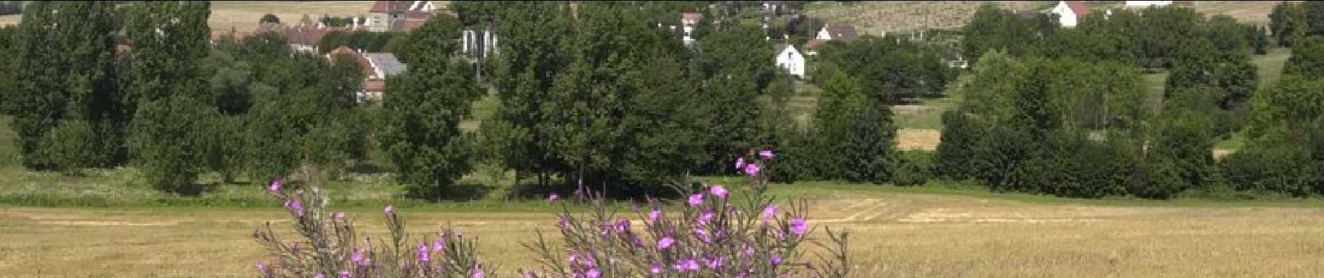
La géographie éclatée de Montfaucon, dans la vallée du Dolloir, confère à ce parcours une ambiance champêtre, avec une sensation d'isolement propice à la rêverie. Toutes les infos sont ICI
Positioning
Country:
France
Region :
Hauts-de-France
Department/Province :
Aisne
Municipality :
Montfaucon
Location:
Unknown
Start:(Dec)
Start:(UTM)
531097 ; 5422748 (31U) N.
Comments
Trails nearby
![Trail Walking Chézy-sur-Marne - CHEZY 090125 - Photo](https://media.geolcdn.com/t/375/260/098b0d85-ebf4-4a2f-b279-cb16b4216acf.jpg&format=jpg&maxdim=2)
![Walking Walking](https://static1.geolcdn.com/sitytour/trail-icons/101.png)
CHEZY 090125
Walking
Difficult
(1)
Chézy-sur-Marne,
Hauts-de-France,
Aisne,
France
![](/images/other/stat-length.png)
11.1 km | 13.3 km-effort
3h 1min
![](https://static1.geolcdn.com/siteimages/upload/files/16400158638029165_repeat_loop_refresh_sync_direction_icon.png)
Yes
![Trail Walking Chézy-sur-Marne - Les grenadiers de la Garde - Photo](https://media.geolcdn.com/t/375/260/ext.jpg?maxdim=2&url=https%3A%2F%2Fservices.sitytrail.com%2FGeolivesWS%2FDownloadMedia.ashx%3FTrailID%3D108363%26Media%3D1039_2.jpg)
![Walking Walking](https://static1.geolcdn.com/sitytour/trail-icons/101.png)
Les grenadiers de la Garde
Walking
Very difficult
(1)
Chézy-sur-Marne,
Hauts-de-France,
Aisne,
France
![](/images/other/stat-length.png)
14.8 km | 18.8 km-effort
4h 30min
![](https://static1.geolcdn.com/siteimages/upload/files/16400158638029165_repeat_loop_refresh_sync_direction_icon.png)
Yes
![Trail On foot Chézy-sur-Marne - CHEZY / MARNE VERSION 21 KM FINAL - Photo](https://media.geolcdn.com/t/375/260/ext.jpg?maxdim=2&url=https%3A%2F%2Fstatic1.geolcdn.com%2Fsiteimages%2Fupload%2Ffiles%2F1545311037marcheuse_200dpi.jpg)
![On foot On foot](https://static1.geolcdn.com/sitytour/trail-icons/100.png)
CHEZY / MARNE VERSION 21 KM FINAL
On foot
Medium
(1)
Chézy-sur-Marne,
Hauts-de-France,
Aisne,
France
![](/images/other/stat-length.png)
21 km | 27 km-effort
6h 2min
![](https://static1.geolcdn.com/siteimages/upload/files/16400158638029165_repeat_loop_refresh_sync_direction_icon.png)
Yes
![Trail Walking Dhuys et Morin-en-Brie - Fontenelle-en-Brie du 12-01-2022 - Photo](https://media.geolcdn.com/t/375/260/64e24db2-5b70-4c81-a4d4-125398f586f3.jpg&format=jpg&maxdim=2)
![Walking Walking](https://static1.geolcdn.com/sitytour/trail-icons/101.png)
Fontenelle-en-Brie du 12-01-2022
Walking
Medium
Dhuys et Morin-en-Brie,
Hauts-de-France,
Aisne,
France
![](/images/other/stat-length.png)
11.1 km | 12.5 km-effort
2h 35min
![](https://static1.geolcdn.com/siteimages/upload/files/16400158638029165_repeat_loop_refresh_sync_direction_icon.png)
Yes
![Trail Walking Azy-sur-Marne - BONNEIL - Photo](https://media.geolcdn.com/t/375/260/ext.jpg?maxdim=2&url=https%3A%2F%2Fstatic1.geolcdn.com%2Fsiteimages%2Fupload%2Ffiles%2F1553511878bg_sport_marche.png)
![Walking Walking](https://static1.geolcdn.com/sitytour/trail-icons/101.png)
BONNEIL
Walking
Medium
(1)
Azy-sur-Marne,
Hauts-de-France,
Aisne,
France
![](/images/other/stat-length.png)
8.7 km | 10.8 km-effort
2h 21min
![](https://static1.geolcdn.com/siteimages/upload/files/16400158638029165_repeat_loop_refresh_sync_direction_icon.png)
Yes
![Trail Walking Azy-sur-Marne - La corniche d'Azy - Photo](https://media.geolcdn.com/t/375/260/ext.jpg?maxdim=2&url=https%3A%2F%2Fservices.sitytrail.com%2FGeolivesWS%2FDownloadMedia.ashx%3FTrailID%3D202820%26Media%3Dba605bfc-351c-41c6-aa51-b89ab3123535.jpg)
![Walking Walking](https://static1.geolcdn.com/sitytour/trail-icons/101.png)
La corniche d'Azy
Walking
Very easy
Azy-sur-Marne,
Hauts-de-France,
Aisne,
France
![](/images/other/stat-length.png)
10.6 km | 14.2 km-effort
Unknown
![](https://static1.geolcdn.com/siteimages/upload/files/16400158638029165_repeat_loop_refresh_sync_direction_icon.png)
Yes
![Trail Walking Dhuys et Morin-en-Brie - Fontenelle en Brie du 25-01-2024 - Photo](https://media.geolcdn.com/t/375/260/88209a05-4218-4d0c-ad09-4d63cf620c86.jpg&format=jpg&maxdim=2)
![Walking Walking](https://static1.geolcdn.com/sitytour/trail-icons/101.png)
Fontenelle en Brie du 25-01-2024
Walking
Medium
Dhuys et Morin-en-Brie,
Hauts-de-France,
Aisne,
France
![](/images/other/stat-length.png)
10.2 km | 11.3 km-effort
2h 33min
![](https://static1.geolcdn.com/siteimages/upload/files/16400158638029165_repeat_loop_refresh_sync_direction_icon.png)
Yes
![Trail Walking Chézy-sur-Marne - Chézy-sur-Marne du 19/04/2023 - Photo](https://media.geolcdn.com/t/375/260/00e260b2-1ffe-438f-8665-828b73e38bd9.jpg&format=jpg&maxdim=2)
![Walking Walking](https://static1.geolcdn.com/sitytour/trail-icons/101.png)
Chézy-sur-Marne du 19/04/2023
Walking
Difficult
Chézy-sur-Marne,
Hauts-de-France,
Aisne,
France
![](/images/other/stat-length.png)
12.5 km | 15.1 km-effort
3h 25min
![](https://static1.geolcdn.com/siteimages/upload/files/16400158638029165_repeat_loop_refresh_sync_direction_icon.png)
Yes
![Trail Walking Viffort - Viffort du 05-04-2022 - Photo](https://media.geolcdn.com/t/375/260/6a38da00-6e8c-4851-ae5a-5c03310e8c57.jpg&format=jpg&maxdim=2)
![Walking Walking](https://static1.geolcdn.com/sitytour/trail-icons/101.png)
Viffort du 05-04-2022
Walking
Medium
Viffort,
Hauts-de-France,
Aisne,
France
![](/images/other/stat-length.png)
10.1 km | 11.6 km-effort
2h 11min
![](https://static1.geolcdn.com/siteimages/upload/files/16400158638029165_repeat_loop_refresh_sync_direction_icon.png)
Yes
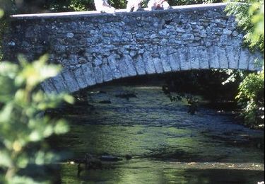
Cette jolie randonnée n'a rien de très difficile je la classerai difficile tout au plus, les seules difficultés résident dans le franchissement du ru de champ de faye et de celui de la Madeleine. Les franchissements se font par des gués donc inaccessibles en périodes humides.