Trail Walking Pierrepont - Le marais - Photo
 tracegps
tracegps

User

© OpenStreetMap contributors
Length
Length
5 km
Max alt
Max alt
76 m
Uphill gradient
Uphill gradient
32 m
Km-Effort
Km-Effort  
5.4 km
Min alt
Min alt
67 m
Downhill gradient
Downhill gradient
30 m
Boucle
Boucle
Yes
Creation date :
2014-12-10 00:00:00.0
Updated on :
2014-12-10 00:00:00.0

(0 Reviews)

Walking
Walking
1h15
Difficulty : Easy

Scan this QR Code to open this trail in the SityTrail application

FREE GPS app for hiking

Logo SityTrail SityTrail

IGN / Geographical institutes

Download SityTrail from the App Store Download SityTrail from Google Play

Logo SityTrail SityTrail World

The world is yours!

Download SityTrail from the App Store Download SityTrail from Google Play Download SityTrail on Huawei AppGallery

About

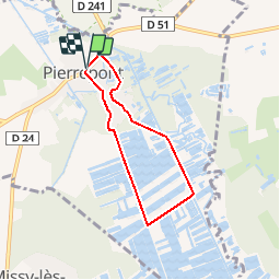
Trail Walking of 5 km to be discovered at Hauts-de-France, Aisne, Pierrepont. This trail is proposed by tracegps.

Description

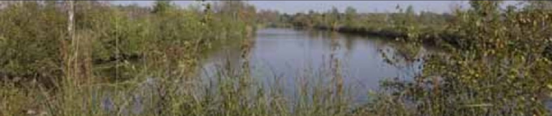
Au cœur de la région palustre de la Souche, Pierrepont se souvient de l'exploitation de tourbières qui a fait sa richesse. Cette excursion, idéale pour toute la famille, pénètre dans le milieu méconnu des marais, paradis ornithologique et floristique. Patience, silence et observation sont les meilleurs atouts pour découvrir les trésors du marais Saint-Boétien. Toutes les infos sont ICI

Elevation profile

Photos

Positioning

Country:
France
Region :
Hauts-de-France
Department/Province :
Aisne
Municipality :
Pierrepont
Location:
Unknown
Start:(UTM)
557245 ; 5500510 (31U) N.

Trails nearby

Trail Walking Chivres-en-Laonnois - Saint-Boétien - Photo
Walking
tracegps

Walking

Difficult
(1)
Chivres-en-Laonnois, Hauts-de-France, Aisne, France
16.2 km | 17.4 km-effort
4h 0min
Yes
Trail Walking Pierrepont - Au pays des demoiselles - Photo
Walking
tracegps

Walking

Medium
Pierrepont, Hauts-de-France, Aisne, France
10.2 km | 10.9 km-effort
3h 15min
Yes


Close
My subscriptions