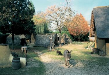
Trail Walking Voyenne - Du côté du terroir - Photo

Du côté du terroir

 tracegps
tracegps

User

© OpenStreetMap contributors
Length
Length
5.6 km
Max alt
Max alt
81 m
Uphill gradient
Uphill gradient
29 m
Km-Effort
Km-Effort  
6 km
Min alt
Min alt
68 m
Downhill gradient
Downhill gradient
31 m
Boucle
Boucle
Yes
Creation date :
2014-12-10 00:00:00.0
Updated on :
2014-12-10 00:00:00.0

(0 Reviews)

Walking
Walking
1h30
Difficulty : Easy

Scan this QR Code to open this trail in the SityTrail application

FREE GPS app for hiking

Logo SityTrail SityTrail

IGN / Geographical institutes

Download SityTrail from the App Store Download SityTrail from Google Play

Logo SityTrail SityTrail World

The world is yours!

Download SityTrail from the App Store Download SityTrail from Google Play Download SityTrail on Huawei AppGallery

About

Trail Walking of 5.6 km to be discovered at Hauts-de-France, Aisne, Voyenne. This trail is proposed by tracegps.

Description

A proximité de Marle, ce court itinéraire relie deux producteurs de saveurs paysannes, à Marcy et à Voyenne. Au discret village de Marcy, possédant de beaux exemples d'architecture paysanne avec l'église Saint-Médard et un pigeonnier carré, s'oppose Voyenne, plus aristocratique, paré de l'église Saint-Rémi (XIIe-XIIIe siècles), de cadrans solaires et de pigeonniers du XVIIIe siècle. Toutes les infos sont ICI

Elevation profile

Photos

Positioning

Country:
France
Region :
Hauts-de-France
Department/Province :
Aisne
Municipality :
Voyenne
Location:
Unknown
Start:(UTM)
552678 ; 5508229 (31U) N.

Trails nearby

Trail Mountain bike Marcy-sous-Marle - Vallées et vallons entre Serre et Vilpion - Photo
Mountain bike
tracegps

Mountain bike

Medium
Marcy-sous-Marle, Hauts-de-France, Aisne, France
24 km | 27 km-effort
3h 0min
Yes


Close
My subscriptions