Trail Walking Plomion - La Nigaudière - Photo
 tracegps
tracegps

User

© OpenStreetMap contributors
Length
Length
9.7 km
Max alt
Max alt
227 m
Uphill gradient
Uphill gradient
135 m
Km-Effort
Km-Effort  
11.5 km
Min alt
Min alt
146 m
Downhill gradient
Downhill gradient
133 m
Boucle
Boucle
Yes
Creation date :
2014-12-10 00:00:00.0
Updated on :
2014-12-10 00:00:00.0

(0 Reviews)

Walking
Walking
3h00
Difficulty : Medium

Scan this QR Code to open this trail in the SityTrail application

FREE GPS app for hiking

Logo SityTrail SityTrail

IGN / Geographical institutes

Download SityTrail from the App Store Download SityTrail from Google Play

Logo SityTrail SityTrail World

The world is yours!

Download SityTrail from the App Store Download SityTrail from Google Play Download SityTrail on Huawei AppGallery

About

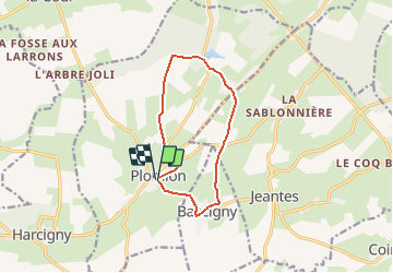
Trail Walking of 9.7 km to be discovered at Hauts-de-France, Aisne, Plomion. This trail is proposed by tracegps.

Description

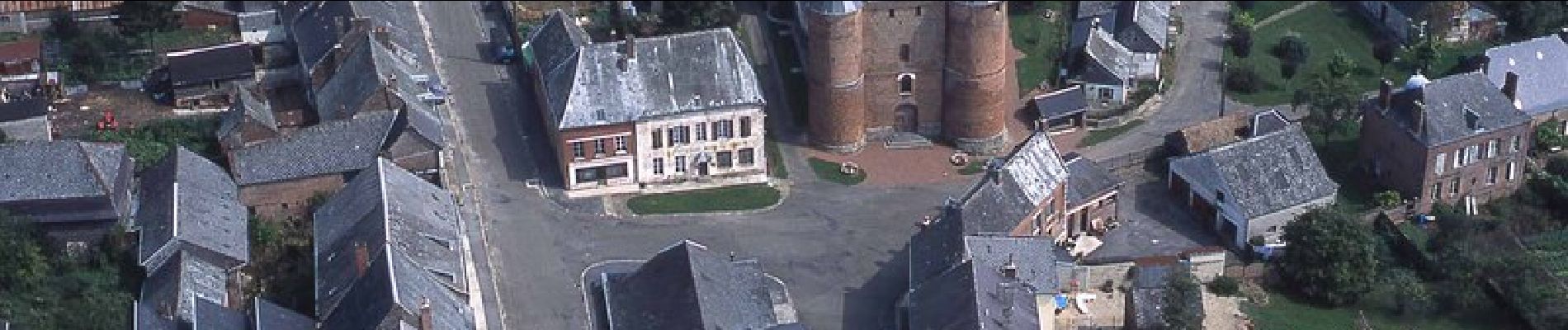
Cette boucle permet de découvrir Plomion, qui regroupe ses toits d'ardoise autour d'une puissante église ; un hameau autrefois siège d'un comté important, Bancigny, et le plan d'eau de La Nigaudière. Toutes les infos sont ICI

Elevation profile

Photos

Positioning

Country:
France
Region :
Hauts-de-France
Department/Province :
Aisne
Municipality :
Plomion
Location:
Unknown
Start:(UTM)
573306 ; 5517751 (31U) N.

Trails nearby

Trail Mountain bike Nampcelles-la-Cour - FD E4 - Photo
Mountain bike
khemriskhara

Mountain bike

Very difficult
Nampcelles-la-Cour, Hauts-de-France, Aisne, France
93 km | 0 m-effort
11h 39min
No


Close
My subscriptions