![](/images/other/stat-length.png)
![Trail Walking Guise - La Salette - Photo](https://media.geolcdn.com/t/1900/400/ext.pjpeg?maxdim=2&url=https%3A%2F%2Fservices.sitytrail.com%2FGeolivesWS%2FDownloadMedia.ashx%3FTrailID%3D108296%26Media%3D967_2.jpg)
La Salette
tracegps
User
![Length](/images/other/stat-length.png)
Length
15.5 km
![Max alt](https://static1.geolcdn.com/siteimages/upload/files/1508320355ic_sort_altitude_max_24dp.png)
Max alt
149 m
![Uphill gradient](https://static1.geolcdn.com/siteimages/upload/files/1508320355ic_sort_den_pos_24dp.png)
Uphill gradient
205 m
![Km-Effort](/images/other/stat-length.png)
Km-Effort
18.3 km
![Min alt](https://static1.geolcdn.com/siteimages/upload/files/1508320355ic_sort_altitude_min_24dp.png)
Min alt
80 m
![Downhill gradient](https://static1.geolcdn.com/siteimages/upload/files/1508320355ic_sort_den_neg_24dp.png)
Downhill gradient
205 m
![Boucle](https://static1.geolcdn.com/siteimages/upload/files/16400158638029165_repeat_loop_refresh_sync_direction_icon.png)
Boucle
Yes
Creation date :
2014-12-10 00:00:00.0
Updated on :
2014-12-10 00:00:00.0
![Walking](https://static1.geolcdn.com/sitytour/trail-icons/101.png)
4h15
Difficulty : Very difficult
![Scan this QR Code to open this trail in the SityTrail application](https://capi.geolives.com/qq0zvz2zws4bq2lad0pu/sitytour/trails/108296/qr.png?size=200)
FREE GPS app for hiking
About
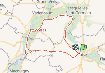
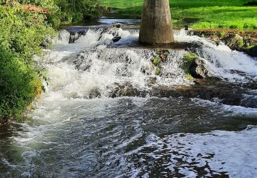
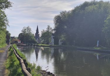
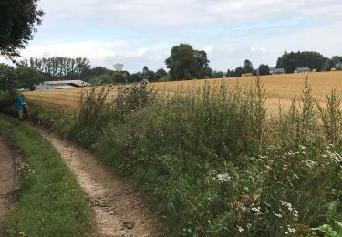
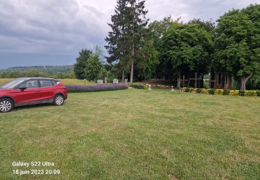
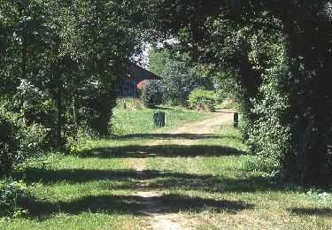
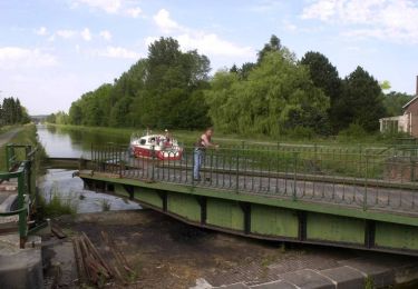
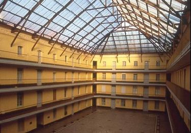
Trail Walking of 15.5 km to be discovered at Hauts-de-France, Aisne, Guise. This trail is proposed by tracegps.
Description
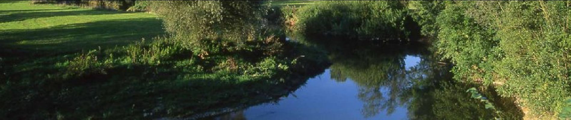
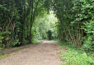
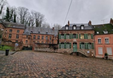
Guise, "porte de la Thiérache", patrie de Desmoulins et de Godin : de cette petite ville située au creux de la vallée de l'Oise, le circuit rejoint l'ancienne abbaye de Bohéries puis, d'écluse en chemin de halage, s'approche de la chapelle de la Salette. Toutes les infos sont ICI
Positioning
Country:
France
Region :
Hauts-de-France
Department/Province :
Aisne
Municipality :
Guise
Location:
Unknown
Start:(Dec)
Start:(UTM)
544815 ; 5527565 (31U) N.
Comments
Trails nearby
![Trail Walking Vadencourt - Vadencourt- Tupigny - Photo](https://media.geolcdn.com/t/375/260/02e97167-ffc1-4783-8083-2391bf5afee8.jpg&format=jpg&maxdim=2)
![Walking Walking](https://static1.geolcdn.com/sitytour/trail-icons/101.png)
Vadencourt- Tupigny
Walking
Easy
Vadencourt,
Hauts-de-France,
Aisne,
France
![](/images/other/stat-length.png)
13.5 km | 15.3 km-effort
3h 52min
![](https://static1.geolcdn.com/siteimages/upload/files/16400158638029165_repeat_loop_refresh_sync_direction_icon.png)
Yes
![Trail Walking Proix - la valette par le nouveau circuit - Photo](https://media.geolcdn.com/t/375/260/c2df988d-8b0e-4da7-a7ba-2e7bc8a9bf21.jpg&format=jpg&maxdim=2)
![Walking Walking](https://static1.geolcdn.com/sitytour/trail-icons/101.png)
la valette par le nouveau circuit
Walking
Easy
Proix,
Hauts-de-France,
Aisne,
France
![](/images/other/stat-length.png)
15.8 km | 18.5 km-effort
3h 49min
![](https://static1.geolcdn.com/siteimages/upload/files/16400158638029165_repeat_loop_refresh_sync_direction_icon.png)
Yes
![Trail Walking Guise - Guise - Photo](https://media.geolcdn.com/t/375/260/5b712963-22f6-47bc-8eb9-f7928c2138c6.jpg&format=jpg&maxdim=2)
![Walking Walking](https://static1.geolcdn.com/sitytour/trail-icons/101.png)
![Trail Walking Vadencourt - circuit vadencourt-Vénerolle - Photo](https://media.geolcdn.com/t/375/260/b99e537c-d3c8-4b21-80c7-0cfd1589a5db.jpg&format=jpg&maxdim=2)
![Walking Walking](https://static1.geolcdn.com/sitytour/trail-icons/101.png)
circuit vadencourt-Vénerolle
Walking
Easy
Vadencourt,
Hauts-de-France,
Aisne,
France
![](/images/other/stat-length.png)
18.1 km | 20 km-effort
3h 33min
![](https://static1.geolcdn.com/siteimages/upload/files/16400158638029165_repeat_loop_refresh_sync_direction_icon.png)
Yes
![Trail Walking Flavigny-le-Grand-et-Beaurain - Béaurain Puisieux - Photo](https://media.geolcdn.com/t/375/260/ee1740f7-cddf-4488-98b6-33bec463e912.jpg&format=jpg&maxdim=2)
![Walking Walking](https://static1.geolcdn.com/sitytour/trail-icons/101.png)
Béaurain Puisieux
Walking
Easy
Flavigny-le-Grand-et-Beaurain,
Hauts-de-France,
Aisne,
France
![](/images/other/stat-length.png)
16.6 km | 18.7 km-effort
3h 57min
![](https://static1.geolcdn.com/siteimages/upload/files/16400158638029165_repeat_loop_refresh_sync_direction_icon.png)
Yes
![Trail Walking Proix - tour 2 la valette - Photo](https://media.geolcdn.com/t/375/260/86333c6b-e5a1-4fa6-9db7-c424c120711e.jpg&format=jpg&maxdim=2)
![Walking Walking](https://static1.geolcdn.com/sitytour/trail-icons/101.png)
tour 2 la valette
Walking
Easy
Proix,
Hauts-de-France,
Aisne,
France
![](/images/other/stat-length.png)
15.3 km | 18.1 km-effort
4h 42min
![](https://static1.geolcdn.com/siteimages/upload/files/16400158638029165_repeat_loop_refresh_sync_direction_icon.png)
Yes
![Trail Walking Guise - Axe vert de Thiérache 1 - Photo](https://media.geolcdn.com/t/375/260/ext.jpg?maxdim=2&url=https%3A%2F%2Fservices.sitytrail.com%2FGeolivesWS%2FDownloadMedia.ashx%3FTrailID%3D108763%26Media%3D1880_1.jpg)
![Walking Walking](https://static1.geolcdn.com/sitytour/trail-icons/101.png)
Axe vert de Thiérache 1
Walking
Difficult
Guise,
Hauts-de-France,
Aisne,
France
![](/images/other/stat-length.png)
13.3 km | 15.2 km-effort
5h 0min
![](https://static1.geolcdn.com/siteimages/upload/files/16400158638029165_repeat_loop_refresh_sync_direction_icon.png)
No
![Trail Walking Vadencourt - La rigole - Photo](https://media.geolcdn.com/t/375/260/ext.jpg?maxdim=2&url=https%3A%2F%2Fservices.sitytrail.com%2FGeolivesWS%2FDownloadMedia.ashx%3FTrailID%3D108297%26Media%3D968_2.jpg)
![Walking Walking](https://static1.geolcdn.com/sitytour/trail-icons/101.png)
La rigole
Walking
Medium
Vadencourt,
Hauts-de-France,
Aisne,
France
![](/images/other/stat-length.png)
8.3 km | 9.8 km-effort
2h 15min
![](https://static1.geolcdn.com/siteimages/upload/files/16400158638029165_repeat_loop_refresh_sync_direction_icon.png)
Yes
![Trail Walking Guise - La Ferme-de-l'étang - Photo](https://media.geolcdn.com/t/375/260/ext.jpg?maxdim=2&url=https%3A%2F%2Fservices.sitytrail.com%2FGeolivesWS%2FDownloadMedia.ashx%3FTrailID%3D108295%26Media%3D966_1.jpg)
![Walking Walking](https://static1.geolcdn.com/sitytour/trail-icons/101.png)
La Ferme-de-l'étang
Walking
Very difficult
Guise,
Hauts-de-France,
Aisne,
France
![](/images/other/stat-length.png)
18.1 km | 21 km-effort
5h 30min
![](https://static1.geolcdn.com/siteimages/upload/files/16400158638029165_repeat_loop_refresh_sync_direction_icon.png)
Yes