![](/images/other/stat-length.png)
![Trail Walking Guise - La Ferme-de-l'étang - Photo](https://media.geolcdn.com/t/1900/400/ext.pjpeg?maxdim=2&url=https%3A%2F%2Fservices.sitytrail.com%2FGeolivesWS%2FDownloadMedia.ashx%3FTrailID%3D108295%26Media%3D966_1.jpg)
La Ferme-de-l'étang
tracegps
User
![Length](/images/other/stat-length.png)
Length
18.1 km
![Max alt](https://static1.geolcdn.com/siteimages/upload/files/1508320355ic_sort_altitude_max_24dp.png)
Max alt
160 m
![Uphill gradient](https://static1.geolcdn.com/siteimages/upload/files/1508320355ic_sort_den_pos_24dp.png)
Uphill gradient
252 m
![Km-Effort](/images/other/stat-length.png)
Km-Effort
21 km
![Min alt](https://static1.geolcdn.com/siteimages/upload/files/1508320355ic_sort_altitude_min_24dp.png)
Min alt
94 m
![Downhill gradient](https://static1.geolcdn.com/siteimages/upload/files/1508320355ic_sort_den_neg_24dp.png)
Downhill gradient
249 m
![Boucle](https://static1.geolcdn.com/siteimages/upload/files/16400158638029165_repeat_loop_refresh_sync_direction_icon.png)
Boucle
Yes
Creation date :
2014-12-10 00:00:00.0
Updated on :
2014-12-10 00:00:00.0
![Walking](https://static1.geolcdn.com/sitytour/trail-icons/101.png)
5h30
Difficulty : Very difficult
![Scan this QR Code to open this trail in the SityTrail application](https://capi.geolives.com/qq0zvz2zws4bq2lad0pu/sitytour/trails/108295/qr.png?size=200)
FREE GPS app for hiking
About
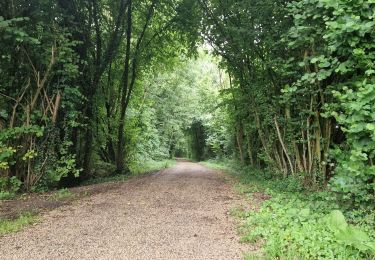
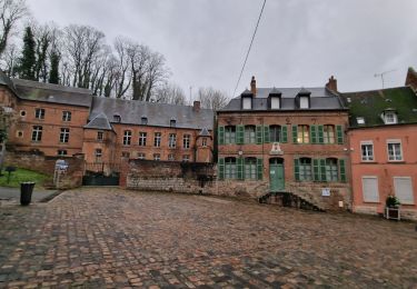
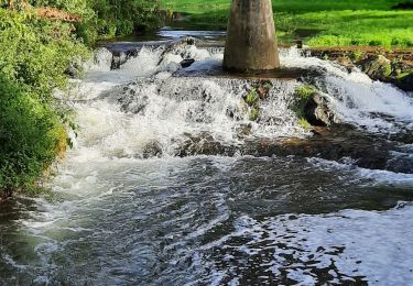
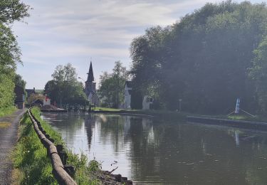
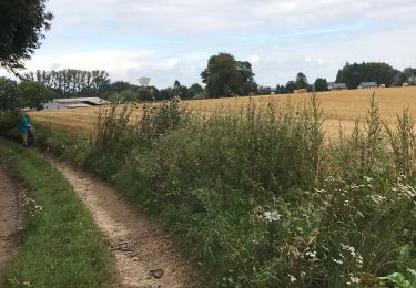
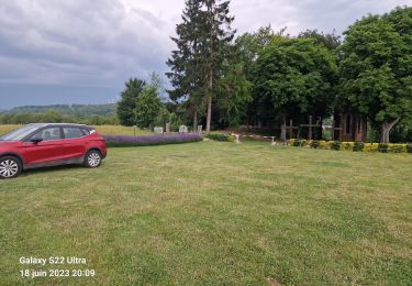
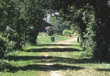
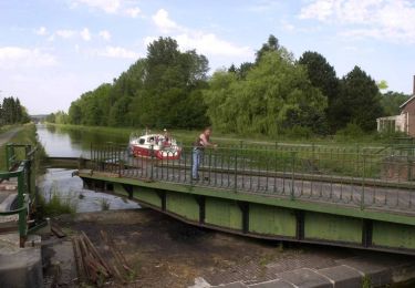
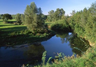
Trail Walking of 18.1 km to be discovered at Hauts-de-France, Aisne, Guise. This trail is proposed by tracegps.
Description
Au départ du familistère Godin, cette longue balade vallonnée emprunte l'Axe Vert avant de rejoindre l'ancien château de La Ferme-de-l'Etang et le village fleuri de Beaurain. Toutes les infos sont ICI
Positioning
Country:
France
Region :
Hauts-de-France
Department/Province :
Aisne
Municipality :
Guise
Location:
Unknown
Start:(Dec)
Start:(UTM)
544957 ; 5528198 (31U) N.
Comments
Trails nearby
![Trail Walking Vadencourt - Vadencourt- Tupigny - Photo](https://media.geolcdn.com/t/375/260/02e97167-ffc1-4783-8083-2391bf5afee8.jpg&format=jpg&maxdim=2)
![Walking Walking](https://static1.geolcdn.com/sitytour/trail-icons/101.png)
Vadencourt- Tupigny
Walking
Easy
Vadencourt,
Hauts-de-France,
Aisne,
France
![](/images/other/stat-length.png)
13.5 km | 15.3 km-effort
3h 52min
![](https://static1.geolcdn.com/siteimages/upload/files/16400158638029165_repeat_loop_refresh_sync_direction_icon.png)
Yes
![Trail Walking Proix - la valette par le nouveau circuit - Photo](https://media.geolcdn.com/t/375/260/c2df988d-8b0e-4da7-a7ba-2e7bc8a9bf21.jpg&format=jpg&maxdim=2)
![Walking Walking](https://static1.geolcdn.com/sitytour/trail-icons/101.png)
la valette par le nouveau circuit
Walking
Easy
Proix,
Hauts-de-France,
Aisne,
France
![](/images/other/stat-length.png)
15.8 km | 18.5 km-effort
3h 49min
![](https://static1.geolcdn.com/siteimages/upload/files/16400158638029165_repeat_loop_refresh_sync_direction_icon.png)
Yes
![Trail Walking Guise - Guise - Photo](https://media.geolcdn.com/t/375/260/5b712963-22f6-47bc-8eb9-f7928c2138c6.jpg&format=jpg&maxdim=2)
![Walking Walking](https://static1.geolcdn.com/sitytour/trail-icons/101.png)
![Trail Walking Vadencourt - circuit vadencourt-Vénerolle - Photo](https://media.geolcdn.com/t/375/260/b99e537c-d3c8-4b21-80c7-0cfd1589a5db.jpg&format=jpg&maxdim=2)
![Walking Walking](https://static1.geolcdn.com/sitytour/trail-icons/101.png)
circuit vadencourt-Vénerolle
Walking
Easy
Vadencourt,
Hauts-de-France,
Aisne,
France
![](/images/other/stat-length.png)
18.1 km | 20 km-effort
3h 33min
![](https://static1.geolcdn.com/siteimages/upload/files/16400158638029165_repeat_loop_refresh_sync_direction_icon.png)
Yes
![Trail Walking Flavigny-le-Grand-et-Beaurain - Béaurain Puisieux - Photo](https://media.geolcdn.com/t/375/260/ee1740f7-cddf-4488-98b6-33bec463e912.jpg&format=jpg&maxdim=2)
![Walking Walking](https://static1.geolcdn.com/sitytour/trail-icons/101.png)
Béaurain Puisieux
Walking
Easy
Flavigny-le-Grand-et-Beaurain,
Hauts-de-France,
Aisne,
France
![](/images/other/stat-length.png)
16.6 km | 18.7 km-effort
3h 57min
![](https://static1.geolcdn.com/siteimages/upload/files/16400158638029165_repeat_loop_refresh_sync_direction_icon.png)
Yes
![Trail Walking Proix - tour 2 la valette - Photo](https://media.geolcdn.com/t/375/260/86333c6b-e5a1-4fa6-9db7-c424c120711e.jpg&format=jpg&maxdim=2)
![Walking Walking](https://static1.geolcdn.com/sitytour/trail-icons/101.png)
tour 2 la valette
Walking
Easy
Proix,
Hauts-de-France,
Aisne,
France
![](/images/other/stat-length.png)
15.3 km | 18.1 km-effort
4h 42min
![](https://static1.geolcdn.com/siteimages/upload/files/16400158638029165_repeat_loop_refresh_sync_direction_icon.png)
Yes
![Trail Walking Guise - Axe vert de Thiérache 1 - Photo](https://media.geolcdn.com/t/375/260/ext.jpg?maxdim=2&url=https%3A%2F%2Fservices.sitytrail.com%2FGeolivesWS%2FDownloadMedia.ashx%3FTrailID%3D108763%26Media%3D1880_1.jpg)
![Walking Walking](https://static1.geolcdn.com/sitytour/trail-icons/101.png)
Axe vert de Thiérache 1
Walking
Difficult
Guise,
Hauts-de-France,
Aisne,
France
![](/images/other/stat-length.png)
13.3 km | 15.2 km-effort
5h 0min
![](https://static1.geolcdn.com/siteimages/upload/files/16400158638029165_repeat_loop_refresh_sync_direction_icon.png)
No
![Trail Walking Vadencourt - La rigole - Photo](https://media.geolcdn.com/t/375/260/ext.jpg?maxdim=2&url=https%3A%2F%2Fservices.sitytrail.com%2FGeolivesWS%2FDownloadMedia.ashx%3FTrailID%3D108297%26Media%3D968_2.jpg)
![Walking Walking](https://static1.geolcdn.com/sitytour/trail-icons/101.png)
La rigole
Walking
Medium
Vadencourt,
Hauts-de-France,
Aisne,
France
![](/images/other/stat-length.png)
8.3 km | 9.8 km-effort
2h 15min
![](https://static1.geolcdn.com/siteimages/upload/files/16400158638029165_repeat_loop_refresh_sync_direction_icon.png)
Yes
![Trail Walking Guise - La Salette - Photo](https://media.geolcdn.com/t/375/260/ext.jpg?maxdim=2&url=https%3A%2F%2Fservices.sitytrail.com%2FGeolivesWS%2FDownloadMedia.ashx%3FTrailID%3D108296%26Media%3D967_2.jpg)
![Walking Walking](https://static1.geolcdn.com/sitytour/trail-icons/101.png)
La Salette
Walking
Very difficult
Guise,
Hauts-de-France,
Aisne,
France
![](/images/other/stat-length.png)
15.5 km | 18.3 km-effort
4h 15min
![](https://static1.geolcdn.com/siteimages/upload/files/16400158638029165_repeat_loop_refresh_sync_direction_icon.png)
Yes