![](/images/other/stat-length.png)
![Trail Walking Moÿ-de-l'Aisne - Les garennes - Photo](https://media.geolcdn.com/t/1900/400/ext.pjpeg?maxdim=2&url=https%3A%2F%2Fservices.sitytrail.com%2FGeolivesWS%2FDownloadMedia.ashx%3FTrailID%3D108290%26Media%3D961_2.jpg)
Les garennes
tracegps
User
![Length](/images/other/stat-length.png)
Length
12.2 km
![Max alt](https://static1.geolcdn.com/siteimages/upload/files/1508320355ic_sort_altitude_max_24dp.png)
Max alt
85 m
![Uphill gradient](https://static1.geolcdn.com/siteimages/upload/files/1508320355ic_sort_den_pos_24dp.png)
Uphill gradient
102 m
![Km-Effort](/images/other/stat-length.png)
Km-Effort
13.5 km
![Min alt](https://static1.geolcdn.com/siteimages/upload/files/1508320355ic_sort_altitude_min_24dp.png)
Min alt
50 m
![Downhill gradient](https://static1.geolcdn.com/siteimages/upload/files/1508320355ic_sort_den_neg_24dp.png)
Downhill gradient
102 m
![Boucle](https://static1.geolcdn.com/siteimages/upload/files/16400158638029165_repeat_loop_refresh_sync_direction_icon.png)
Boucle
Yes
Creation date :
2014-12-10 00:00:00.0
Updated on :
2014-12-10 00:00:00.0
![Walking](https://static1.geolcdn.com/sitytour/trail-icons/101.png)
3h15
Difficulty : Medium
![Scan this QR Code to open this trail in the SityTrail application](https://capi.geolives.com/qq0zvz2zws4bq2lad0pu/sitytour/trails/108290/qr.png?size=200)
FREE GPS app for hiking
About
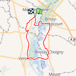
Trail Walking of 12.2 km to be discovered at Hauts-de-France, Aisne, Moÿ-de-l'Aisne. This trail is proposed by tracegps.
Description
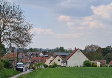
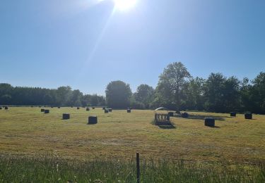
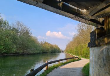
Au départ de Moÿ-de-l'Aisne, cette belle balade permet de contempler la vallée de l'Oise avec son chapelet d'étangs et le canal de la Sambre à l'Oise. A Brissy-Hamégicourt, un blockhaus rappelle la présence de la ligne Hindenburg. Toutes les infos sont ICI
Positioning
Country:
France
Region :
Hauts-de-France
Department/Province :
Aisne
Municipality :
Moÿ-de-l'Aisne
Location:
Unknown
Start:(Dec)
Start:(UTM)
526162 ; 5510574 (31U) N.
Comments
Trails nearby
![Trail Mountain bike Châtillon-sur-Oise - chatillon Mayot travecy vendeuil - Photo](https://media.geolcdn.com/t/375/260/895cbf97-8699-4887-b91c-f419bf6f08e4.jpg&format=jpg&maxdim=2)
![Mountain bike Mountain bike](https://static1.geolcdn.com/sitytour/trail-icons/202.png)
chatillon Mayot travecy vendeuil
Mountain bike
Easy
Châtillon-sur-Oise,
Hauts-de-France,
Aisne,
France
![](/images/other/stat-length.png)
51 km | 56 km-effort
3h 22min
![](https://static1.geolcdn.com/siteimages/upload/files/16400158638029165_repeat_loop_refresh_sync_direction_icon.png)
Yes
![Trail Walking Moÿ-de-l'Aisne - parcours Moy de l'Aisne - Vendeuil - Photo](https://media.geolcdn.com/t/375/260/27cb0fd4-ff51-402e-8003-75f2a4b1d313.jpg&format=jpg&maxdim=2)
![Walking Walking](https://static1.geolcdn.com/sitytour/trail-icons/101.png)
parcours Moy de l'Aisne - Vendeuil
Walking
Very easy
Moÿ-de-l'Aisne,
Hauts-de-France,
Aisne,
France
![](/images/other/stat-length.png)
12.1 km | 13.3 km-effort
2h 23min
![](https://static1.geolcdn.com/siteimages/upload/files/16400158638029165_repeat_loop_refresh_sync_direction_icon.png)
Yes
![Trail Walking Châtillon-sur-Oise - parcours Châtillon-sur-oise Ribemont Senercy - Photo](https://media.geolcdn.com/t/375/260/d3829fe4-38c1-49ee-b298-d567a36ef890.jpg&format=jpg&maxdim=2)
![Walking Walking](https://static1.geolcdn.com/sitytour/trail-icons/101.png)
parcours Châtillon-sur-oise Ribemont Senercy
Walking
Very easy
Châtillon-sur-Oise,
Hauts-de-France,
Aisne,
France
![](/images/other/stat-length.png)
24 km | 27 km-effort
4h 34min
![](https://static1.geolcdn.com/siteimages/upload/files/16400158638029165_repeat_loop_refresh_sync_direction_icon.png)
Yes
![Trail Walking Urvillers - parcours urvillers moy de l'aisne - Photo](https://media.geolcdn.com/t/375/260/0bbe3d9e-4132-4c60-83ab-c911e53c6ac9.jpg&format=jpg&maxdim=2)
![Walking Walking](https://static1.geolcdn.com/sitytour/trail-icons/101.png)
parcours urvillers moy de l'aisne
Walking
Easy
Urvillers,
Hauts-de-France,
Aisne,
France
![](/images/other/stat-length.png)
21 km | 23 km-effort
3h 55min
![](https://static1.geolcdn.com/siteimages/upload/files/16400158638029165_repeat_loop_refresh_sync_direction_icon.png)
Yes
![Trail Mountain bike Mézières-sur-Oise - activity_13131051734 - Photo](https://media.geolcdn.com/t/375/260/ext.jpg?maxdim=2&url=https%3A%2F%2Fstatic1.geolcdn.com%2Fsiteimages%2Fupload%2Ffiles%2F1524743154velo.jpg)
![Mountain bike Mountain bike](https://static1.geolcdn.com/sitytour/trail-icons/202.png)
activity_13131051734
Mountain bike
Very difficult
Mézières-sur-Oise,
Hauts-de-France,
Aisne,
France
![](/images/other/stat-length.png)
46 km | 51 km-effort
3h 33min
![](https://static1.geolcdn.com/siteimages/upload/files/16400158638029165_repeat_loop_refresh_sync_direction_icon.png)
Yes
![Trail Walking Vendeuil - Ve.deil Septvaux VF - Photo](https://media.geolcdn.com/t/375/260/ext.jpg?maxdim=2&url=https%3A%2F%2Fstatic1.geolcdn.com%2Fsiteimages%2Fupload%2Ffiles%2F1553511878bg_sport_marche.png)
![Walking Walking](https://static1.geolcdn.com/sitytour/trail-icons/101.png)
Ve.deil Septvaux VF
Walking
Medium
Vendeuil,
Hauts-de-France,
Aisne,
France
![](/images/other/stat-length.png)
24 km | 28 km-effort
6h 49min
![](https://static1.geolcdn.com/siteimages/upload/files/16400158638029165_repeat_loop_refresh_sync_direction_icon.png)
No
![Trail On foot Mayot - Randonnée autour du fort Mayot 02 - Photo](https://media.geolcdn.com/t/375/260/ext.jpg?maxdim=2&url=https%3A%2F%2Fstatic1.geolcdn.com%2Fsiteimages%2Fupload%2Ffiles%2F1545311037marcheuse_200dpi.jpg)
![On foot On foot](https://static1.geolcdn.com/sitytour/trail-icons/100.png)
Randonnée autour du fort Mayot 02
On foot
Easy
Mayot,
Hauts-de-France,
Aisne,
France
![](/images/other/stat-length.png)
11.2 km | 12.5 km-effort
2h 50min
![](https://static1.geolcdn.com/siteimages/upload/files/16400158638029165_repeat_loop_refresh_sync_direction_icon.png)
Yes
![Trail Mountain bike Moÿ-de-l'Aisne - Moy Aisne Justine - Photo](https://media.geolcdn.com/t/375/260/ext.jpg?maxdim=2&url=https%3A%2F%2Fstatic1.geolcdn.com%2Fsiteimages%2Fupload%2Ffiles%2F1524743154velo.jpg)
![Mountain bike Mountain bike](https://static1.geolcdn.com/sitytour/trail-icons/202.png)
Moy Aisne Justine
Mountain bike
Medium
Moÿ-de-l'Aisne,
Hauts-de-France,
Aisne,
France
![](/images/other/stat-length.png)
26 km | 28 km-effort
1h 25min
![](https://static1.geolcdn.com/siteimages/upload/files/16400158638029165_repeat_loop_refresh_sync_direction_icon.png)
No
![Trail Walking Moÿ-de-l'Aisne - Moy de l’Aisne - Photo](https://media.geolcdn.com/t/375/260/ext.jpg?maxdim=2&url=https%3A%2F%2Fstatic1.geolcdn.com%2Fsiteimages%2Fupload%2Ffiles%2F1553511878bg_sport_marche.png)
![Walking Walking](https://static1.geolcdn.com/sitytour/trail-icons/101.png)
Moy de l’Aisne
Walking
Medium
Moÿ-de-l'Aisne,
Hauts-de-France,
Aisne,
France
![](/images/other/stat-length.png)
20 km | 22 km-effort
4h 39min
![](https://static1.geolcdn.com/siteimages/upload/files/16400158638029165_repeat_loop_refresh_sync_direction_icon.png)
Yes