Trail Walking Ferrals-les-Montagnes - Cantignergues FERRALS LES MONTAGNES - Photo

Cantignergues FERRALS LES MONTAGNES

© OpenStreetMap contributors
Length
Length
14.1 km
Max alt
Max alt
631 m
Uphill gradient
Uphill gradient
452 m
Km-Effort
Km-Effort  
20 km
Min alt
Min alt
352 m
Downhill gradient
Downhill gradient
451 m
Boucle
Boucle
Yes
Creation date :
2019-04-30 11:08:01.217
Updated on :
2019-10-11 06:06:31.943

(0 Reviews)

Walking
Walking
4h45
Difficulty : Medium

Scan this QR Code to open this trail in the SityTrail application

FREE GPS app for hiking

Logo SityTrail SityTrail

IGN / Geographical institutes

Download SityTrail from the App Store Download SityTrail from Google Play

Logo SityTrail SityTrail World

The world is yours!

Download SityTrail from the App Store Download SityTrail from Google Play Download SityTrail on Huawei AppGallery

About

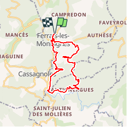
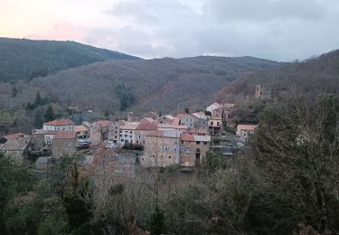
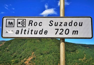
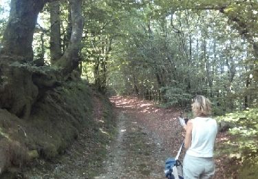
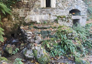
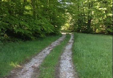
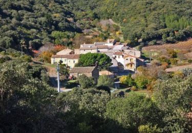
Trail Walking of 14.1 km to be discovered at Occitania, Hérault, Ferrals-les-Montagnes. This trail is proposed by blackfeet.

Description

Tracé conforme à la fiche 53 des 73 sentiers de randonnée en Pays Haut Languedoc

Elevation profile

Points of interest

Point of interest Ferrals-les-Montagnes - Prendre sentier à gauche - Photo
blackfeet
FERRALS-LES-MONTAGNES 
Point of interest Ferrals-les-Montagnes - Obliquer à gauche - Photo
blackfeet
FERRALS-LES-MONTAGNES 
Point of interest Ferrals-les-Montagnes - Prendre à gauche - Photo
blackfeet
FERRALS-LES-MONTAGNES 
Point of interest La Livinière - Rester sur la piste de gauche jusqu'au carrefour  - Photo
blackfeet
Point of interest La Livinière - rester à gauche - Photo
blackfeet
LA LIVINIÈRE 

Positioning

Country:
France
Region :
Occitania
Department/Province :
Hérault
Municipality :
Ferrals-les-Montagnes
Location:
Unknown
Start:(UTM)
470306 ; 4805937 (31T) N.

Trails nearby

Trail Walking Lacabarède - Fontaine des 3 Eveques - Photo
Walking
tracegps

Walking

Medium
(1)
Lacabarède, Occitania, Tarn, France
12.9 km | 17.9 km-effort
4h 0min
Yes
Trail Walking Ferrals-les-Montagnes - ferrals-les-Montagnes- Mont Cayroux  - Photo
Walking
jacques delaporte

Walking

Very difficult
Ferrals-les-Montagnes, Occitania, Hérault, France
33 km | 49 km-effort
7h 11min
Yes
Trail On foot Ferrals-les-Montagnes - Les Hauts de Ferrals - Photo
On foot
GUIDE+

On foot

Medium
Ferrals-les-Montagnes, Occitania, Hérault, France
15.4 km | 23 km-effort
5h 18min
Yes
Trail Walking Cassagnoles - To Saladou - Photo
Walking
mootman

Walking

Easy
Cassagnoles, Occitania, Hérault, France
4.7 km | 6.6 km-effort
1h 46min
Yes
Trail Walking Lespinassière - Salette -Chiffre - Photo
Walking
jsaun

Walking

Medium
(1)
Lespinassière, Occitania, Aude, France
9.6 km | 13.9 km-effort
2h 32min
No
Trail Walking La Livinière - Source de la Cesse Guilaine  - Photo
Walking
GUIDE
Ada11

Walking

Easy
La Livinière, Occitania, Hérault, France
14.9 km | 21 km-effort
5h 2min
Yes
Trail Running Lacabarède - la fontaine des 3 Évêques  - Photo
Running
cedric3175

Running

Medium
Lacabarède, Occitania, Tarn, France
8.4 km | 10.8 km-effort
59min
Yes
Trail Mountain bike La Livinière - Grande Traversée de l'Hérault à VTT - itinéraire Sud - de St Julien des Molières à Notre Dame du Cros  - Photo
Mountain bike
tracegps

Mountain bike

Difficult
La Livinière, Occitania, Hérault, France
23 km | 35 km-effort
3h 30min
No
Trail Walking La Livinière - Grande Traversée de l'Hérault à VTT - itinéraire Sud - de St Julien des Molières à Notre Dame du Cros  - Photo
Walking
tracegps

Walking

Difficult
La Livinière, Occitania, Hérault, France
23 km | 35 km-effort
7h 0min
No


Close
My subscriptions