![](/images/other/stat-length.png)
![Trail Walking Sainte-Foy-Tarentaise - Le Monal et le Lac du Clou - Ste Foy Tarentaise - Photo](https://media.geolcdn.com/t/1900/400/ext.pjpeg?maxdim=2&url=https%3A%2F%2Fservices.sitytrail.com%2FGeolivesWS%2FDownloadMedia.ashx%3FTrailID%3D107643%26Media%3D12632_3.jpg)
Le Monal et le Lac du Clou - Ste Foy Tarentaise
tracegps
User
![Length](/images/other/stat-length.png)
![Max alt](https://static1.geolcdn.com/siteimages/upload/files/1508320355ic_sort_altitude_max_24dp.png)
![Uphill gradient](https://static1.geolcdn.com/siteimages/upload/files/1508320355ic_sort_den_pos_24dp.png)
![Km-Effort](/images/other/stat-length.png)
![Min alt](https://static1.geolcdn.com/siteimages/upload/files/1508320355ic_sort_altitude_min_24dp.png)
![Downhill gradient](https://static1.geolcdn.com/siteimages/upload/files/1508320355ic_sort_den_neg_24dp.png)
![Boucle](https://static1.geolcdn.com/siteimages/upload/files/16400158638029165_repeat_loop_refresh_sync_direction_icon.png)
![Walking](https://static1.geolcdn.com/sitytour/trail-icons/101.png)
3h00
Difficulty : Difficult
![Scan this QR Code to open this trail in the SityTrail application](https://capi.geolives.com/qq0zvz2zws4bq2lad0pu/sitytour/trails/107643/qr.png?size=200)
FREE GPS app for hiking
About
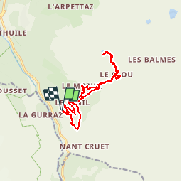
Trail Walking of 13.2 km to be discovered at Auvergne-Rhône-Alpes, Savoy, Sainte-Foy-Tarentaise. This trail is proposed by tracegps.
Description
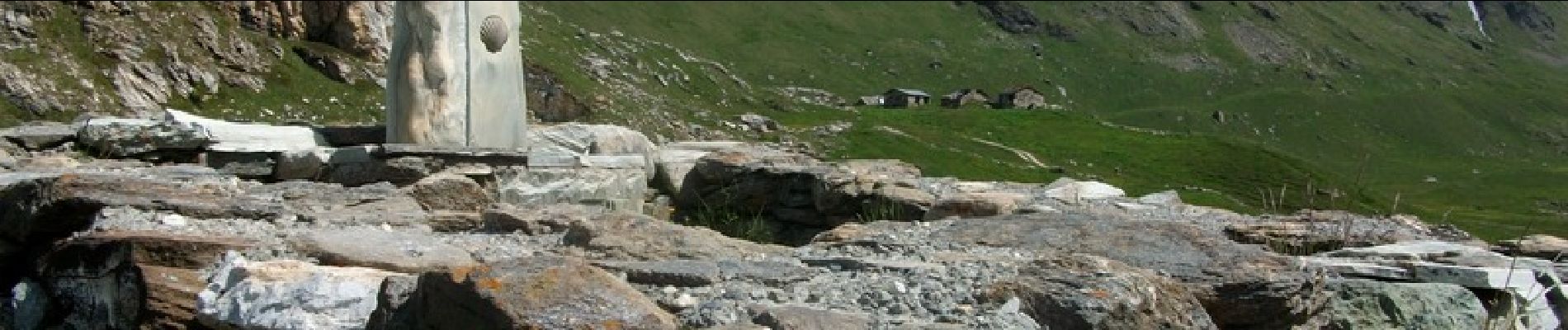
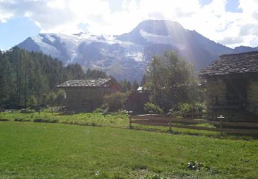
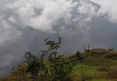
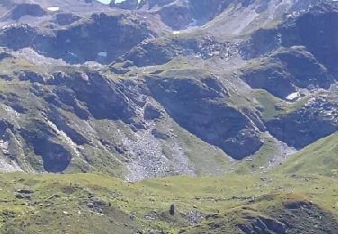
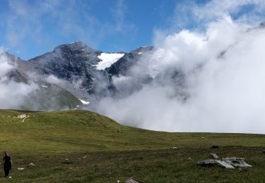
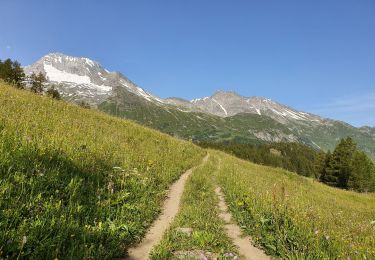
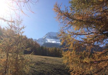
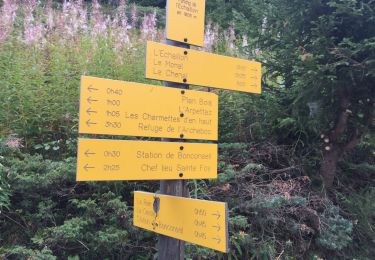
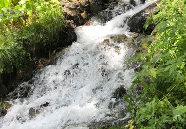
Départ au parking du Chenal puis montée au hameau du Monal niché à 1874 mètres d’altitude. Ce site classé est superbe (vue sur le Mont pourri en face). De là remonter jusqu'au lac du Clou 2373 mètres. Passage devant les vestiges de l'ancienne chapelle de Saint Jacques, puis retour au point de départ. 13 kilomètres avec un bon dénivelé mais en prenant son temps, ça vaut le coup.
Positioning
Comments
Trails nearby
![Trail Walking Sainte-Foy-Tarentaise - le lac du Clou par le Monal - Photo](https://media.geolcdn.com/t/375/260/ext.jpg?maxdim=2&url=https%3A%2F%2Fservices.sitytrail.com%2FGeolivesWS%2FDownloadMedia.ashx%3FTrailID%3D462593%26Media%3Dfix__20150822160630.jpg)
![Walking Walking](https://static1.geolcdn.com/sitytour/trail-icons/101.png)
Walking
![](/images/other/stat-length.png)
![](https://static1.geolcdn.com/siteimages/upload/files/16400158638029165_repeat_loop_refresh_sync_direction_icon.png)
![Trail Walking Villaroger - le refuge de Turia et l'approche du glacier de la Gurraz - Photo](https://media.geolcdn.com/t/375/260/ext.jpg?maxdim=2&url=https%3A%2F%2Fservices.sitytrail.com%2FGeolivesWS%2FDownloadMedia.ashx%3FTrailID%3D1031304%26Media%3Dfix__20180830104725.jpg)
![Walking Walking](https://static1.geolcdn.com/sitytour/trail-icons/101.png)
Walking
![](/images/other/stat-length.png)
![](https://static1.geolcdn.com/siteimages/upload/files/16400158638029165_repeat_loop_refresh_sync_direction_icon.png)
![Trail Walking Tignes - Le refuge de la martin - Photo](https://media.geolcdn.com/t/375/260/ext.jpg?maxdim=2&url=https%3A%2F%2Fservices.sitytrail.com%2FGeolivesWS%2FDownloadMedia.ashx%3FTrailID%3D619103%26Media%3Dfix__20160822151310.jpg)
![Walking Walking](https://static1.geolcdn.com/sitytour/trail-icons/101.png)
Walking
![](/images/other/stat-length.png)
![](https://static1.geolcdn.com/siteimages/upload/files/16400158638029165_repeat_loop_refresh_sync_direction_icon.png)
![Trail Walking Villaroger - 73 Tarentaise Villaroger Planey - Photo](https://media.geolcdn.com/t/375/260/ext.jpg?maxdim=2&url=https%3A%2F%2Fstatic1.geolcdn.com%2Fsiteimages%2Fupload%2Ffiles%2F1553511878bg_sport_marche.png)
![Walking Walking](https://static1.geolcdn.com/sitytour/trail-icons/101.png)
Walking
![](/images/other/stat-length.png)
![](https://static1.geolcdn.com/siteimages/upload/files/16400158638029165_repeat_loop_refresh_sync_direction_icon.png)
![Trail Walking Sainte-Foy-Tarentaise - Col de l'aiguille par le lac du clou - Photo](https://media.geolcdn.com/t/375/260/3cdfc5c6-f6c6-4fe9-a47f-d04cd82fdb34.jpg&format=jpg&maxdim=2)
![Walking Walking](https://static1.geolcdn.com/sitytour/trail-icons/101.png)
Walking
![](/images/other/stat-length.png)
![](https://static1.geolcdn.com/siteimages/upload/files/16400158638029165_repeat_loop_refresh_sync_direction_icon.png)
![Trail Walking Sainte-Foy-Tarentaise - Chenal Monal Clou Fenil (boucle) - Photo](https://media.geolcdn.com/t/375/260/7c8dfcdb-f2ec-45bb-b6ab-d2fab85d008b.jpg&format=jpg&maxdim=2)
![Walking Walking](https://static1.geolcdn.com/sitytour/trail-icons/101.png)
Walking
![](/images/other/stat-length.png)
![](https://static1.geolcdn.com/siteimages/upload/files/16400158638029165_repeat_loop_refresh_sync_direction_icon.png)
![Trail Walking Sainte-Foy-Tarentaise - Bon conseil lac du Clou - Photo](https://media.geolcdn.com/t/375/260/e35dae35-19b9-4b63-908a-208274fb6e76.jpg&format=jpg&maxdim=2)
![Walking Walking](https://static1.geolcdn.com/sitytour/trail-icons/101.png)
Walking
![](/images/other/stat-length.png)
![](https://static1.geolcdn.com/siteimages/upload/files/16400158638029165_repeat_loop_refresh_sync_direction_icon.png)
![Trail Walking Sainte-Foy-Tarentaise - Le Monial lac du clos en boucle randonnée très facile - Photo](https://media.geolcdn.com/t/375/260/693c7cdb-79a2-4cdc-af86-543514d84fda.jpg&format=jpg&maxdim=2)
![Walking Walking](https://static1.geolcdn.com/sitytour/trail-icons/101.png)
Walking
![](/images/other/stat-length.png)
![](https://static1.geolcdn.com/siteimages/upload/files/16400158638029165_repeat_loop_refresh_sync_direction_icon.png)
![Trail Walking Sainte-Foy-Tarentaise - Des bataillettes à plan dessous - Photo](https://media.geolcdn.com/t/375/260/0f9717a3-974f-4d61-9ce7-acd65fddf569.jpg&format=jpg&maxdim=2)
![Walking Walking](https://static1.geolcdn.com/sitytour/trail-icons/101.png)
Walking
![](/images/other/stat-length.png)
![](https://static1.geolcdn.com/siteimages/upload/files/16400158638029165_repeat_loop_refresh_sync_direction_icon.png)