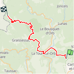
![](/images/other/stat-length.png)
![Trail Mountain bike La Tour-sur-Orb - Grande Traversée de l'Hérault à VTT - itinéraire Nord - de Montbarri à Servies - Photo](https://media.geolcdn.com/t/1900/400/ext.pjpeg?maxdim=2&url=https%3A%2F%2Fservices.sitytrail.com%2FGeolivesWS%2FDownloadMedia.ashx%3FTrailID%3D107561%26Media%3D12519_1.jpg)
Grande Traversée de l'Hérault à VTT - itinéraire Nord - de Montbarri à Servies
tracegps
User
![Length](/images/other/stat-length.png)
![Max alt](https://static1.geolcdn.com/siteimages/upload/files/1508320355ic_sort_altitude_max_24dp.png)
![Uphill gradient](https://static1.geolcdn.com/siteimages/upload/files/1508320355ic_sort_den_pos_24dp.png)
![Km-Effort](/images/other/stat-length.png)
![Min alt](https://static1.geolcdn.com/siteimages/upload/files/1508320355ic_sort_altitude_min_24dp.png)
![Downhill gradient](https://static1.geolcdn.com/siteimages/upload/files/1508320355ic_sort_den_neg_24dp.png)
![Boucle](https://static1.geolcdn.com/siteimages/upload/files/16400158638029165_repeat_loop_refresh_sync_direction_icon.png)
![Mountain bike](https://static1.geolcdn.com/sitytour/trail-icons/202.png)
4h00
Difficulty : Difficult
![Scan this QR Code to open this trail in the SityTrail application](https://capi.geolives.com/qq0zvz2zws4bq2lad0pu/sitytour/trails/107561/qr.png?size=200)
FREE GPS app for hiking
About
Trail Mountain bike of 29 km to be discovered at Occitania, Hérault, La Tour-sur-Orb. This trail is proposed by tracegps.
Description
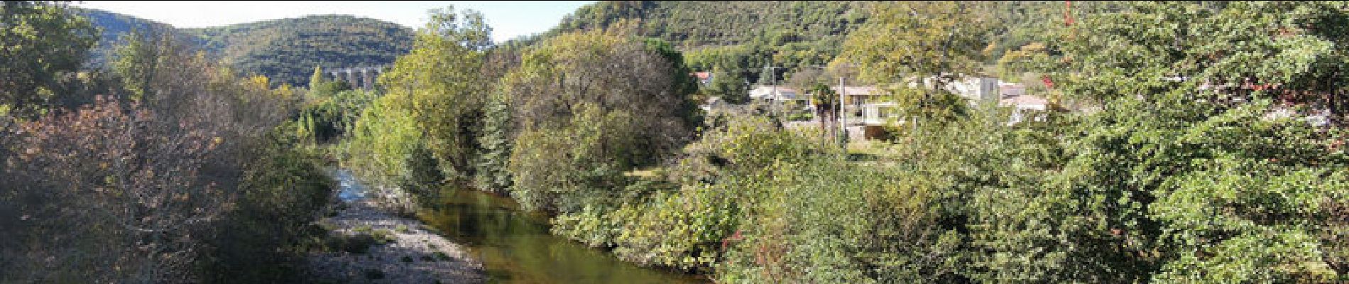
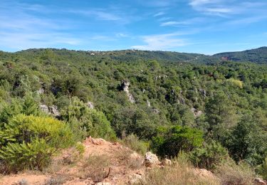
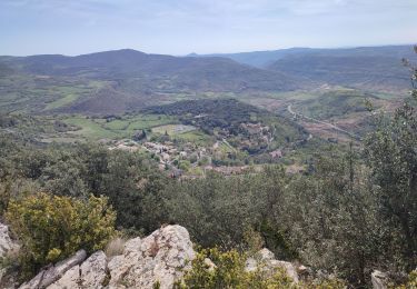
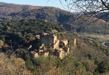
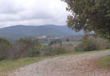
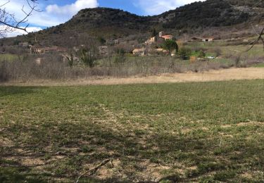
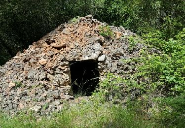
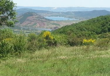
Grande Traversée de l'Hérault à VTT - itinéraire Nord - de Montbarri à Servies. Itinéraire officiel s'appuyant sur le Réseau Vert® et labellisé par la Fédération Française de Cyclisme. A l’entrée du vallon d’Espaze, à proximité des panneaux d’information de l’Arboretum, vous découvrirez les vestiges du "chevalement" du Puits Durand qui resta en activité jusqu’en 1993, à l’emplacement même de la Sainte Marguerite, première mine ouverte à Camplong en 1769. D’abord extrait des profondeurs (1769-1960), le charbon fut ensuite exploité à "ciel ouvert" (1960-1993) laissant l’empreinte de gradins d’amphithéâtre sur près de 1000 hectares de collines dégradées. Actuellement la compagnie minière réhabilite le site. Sur Camplong, 130 000 arbres ont été replantés ces dernières années, en liaison avec la commune. Les Anglais auraient occupé Servies plusieurs années, à l’époque de la guerre de cent ans (Xlle siècle). Ils en seraient repartis avec un seul regret : ne pas avoir exploité tout l’or de la montagne ! A déguster absolument sur place les spécialités de Servies la "croustade" aux noix, le boudin aux herbes sauvages, et "’âne farci" qui, contrairement à ce que l’on pourrait croire, est de l’estomac de porc farci. Téléchargez la fiche de ce tronçon. Cet itinéraire est accessible aux randonneurs à pied et aux cavaliers en suivant les bornes vertes. Le balisage de la Grande Traversée est à double sens alors que le Réseau Vert est balisé dans le sens Est-Ouest.
Positioning
Comments
Trails nearby
![Trail Walking Carlencas-et-Levas - Carlencas - Photo](https://media.geolcdn.com/t/375/260/0339a666-2d2a-4cee-8c31-0571be47d361.jpg&format=jpg&maxdim=2)
![Walking Walking](https://static1.geolcdn.com/sitytour/trail-icons/101.png)
Walking
![](/images/other/stat-length.png)
![](https://static1.geolcdn.com/siteimages/upload/files/16400158638029165_repeat_loop_refresh_sync_direction_icon.png)
![Trail Walking Dio-et-Valquières - rando gourmande - Photo](https://media.geolcdn.com/t/375/260/aad3ee6f-3e75-4d4e-8792-5c2b1fc59800.jpg&format=jpg&maxdim=2)
![Walking Walking](https://static1.geolcdn.com/sitytour/trail-icons/101.png)
Walking
![](/images/other/stat-length.png)
![](https://static1.geolcdn.com/siteimages/upload/files/16400158638029165_repeat_loop_refresh_sync_direction_icon.png)
![Trail On foot Pézènes-les-Mines - Le Dolmen de Pézènes - Photo](https://media.geolcdn.com/t/375/260/c555ea4a-5e40-4fbc-b83f-822db13b9bf6.jpeg&format=jpg&maxdim=2)
![On foot On foot](https://static1.geolcdn.com/sitytour/trail-icons/100.png)
On foot
![](/images/other/stat-length.png)
![](https://static1.geolcdn.com/siteimages/upload/files/16400158638029165_repeat_loop_refresh_sync_direction_icon.png)
![Trail Walking Dio-et-Valquières - Valquières - Plo du Laurier - Photo](https://media.geolcdn.com/t/375/260/6a9b546c-011f-40ca-aac8-545905aab989.jpg&format=jpg&maxdim=2)
![Walking Walking](https://static1.geolcdn.com/sitytour/trail-icons/101.png)
Walking
![](/images/other/stat-length.png)
![](https://static1.geolcdn.com/siteimages/upload/files/16400158638029165_repeat_loop_refresh_sync_direction_icon.png)
![Trail Walking Bédarieux - Moulins de faugeres - Photo](https://media.geolcdn.com/t/375/260/b3764dc8-fe17-44a1-b048-1c1d073310cb.jpg&format=jpg&maxdim=2)
![Walking Walking](https://static1.geolcdn.com/sitytour/trail-icons/101.png)
Walking
![](/images/other/stat-length.png)
![](https://static1.geolcdn.com/siteimages/upload/files/16400158638029165_repeat_loop_refresh_sync_direction_icon.png)
![Trail Walking Dio-et-Valquières - Dio - Photo](https://media.geolcdn.com/t/375/260/ext.jpg?maxdim=2&url=https%3A%2F%2Fservices.sitytrail.com%2FGeolivesWS%2FDownloadMedia.ashx%3FTrailID%3D926093%26Media%3D20180318142746.jpg)
![Walking Walking](https://static1.geolcdn.com/sitytour/trail-icons/101.png)
Walking
![](/images/other/stat-length.png)
![](https://static1.geolcdn.com/siteimages/upload/files/16400158638029165_repeat_loop_refresh_sync_direction_icon.png)
![Trail Walking Bédarieux - roc rouge - Photo](https://media.geolcdn.com/t/375/260/ext.jpg?maxdim=2&url=https%3A%2F%2Fservices.sitytrail.com%2FGeolivesWS%2FDownloadMedia.ashx%3FTrailID%3D583165%26Media%3Dfix__20160612153746.jpg)
![Walking Walking](https://static1.geolcdn.com/sitytour/trail-icons/101.png)
Walking
![](/images/other/stat-length.png)
![](https://static1.geolcdn.com/siteimages/upload/files/16400158638029165_repeat_loop_refresh_sync_direction_icon.png)
![Trail Walking Brenas - brenas - Photo](https://media.geolcdn.com/t/375/260/ext.jpg?maxdim=2&url=https%3A%2F%2Fservices.sitytrail.com%2FGeolivesWS%2FDownloadMedia.ashx%3FTrailID%3D418970%26Media%3Dfix__20150510151424.jpg)
![Walking Walking](https://static1.geolcdn.com/sitytour/trail-icons/101.png)
![Trail Walking Bédarieux - Moulins de faugeres - Photo](https://media.geolcdn.com/t/375/260/ext.jpg?maxdim=2&url=https%3A%2F%2Fservices.sitytrail.com%2FGeolivesWS%2FDownloadMedia.ashx%3FTrailID%3D321737%26Media%3Dfix__20140706114647.jpg)
![Walking Walking](https://static1.geolcdn.com/sitytour/trail-icons/101.png)
Walking
![](/images/other/stat-length.png)
![](https://static1.geolcdn.com/siteimages/upload/files/16400158638029165_repeat_loop_refresh_sync_direction_icon.png)