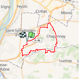
![](/images/other/stat-length.png)
![Trail Mountain bike Simandres - Simandres - Communay la Châtaigneraie - Chaponnay - Photo](https://media.geolcdn.com/t/1900/400/ext.pjpeg?maxdim=2&url=https%3A%2F%2Fservices.sitytrail.com%2FGeolivesWS%2FDownloadMedia.ashx%3FTrailID%3D107518%26Media%3D12474_2.jpg)
Simandres - Communay la Châtaigneraie - Chaponnay
tracegps
User
![Length](/images/other/stat-length.png)
![Max alt](https://static1.geolcdn.com/siteimages/upload/files/1508320355ic_sort_altitude_max_24dp.png)
![Uphill gradient](https://static1.geolcdn.com/siteimages/upload/files/1508320355ic_sort_den_pos_24dp.png)
![Km-Effort](/images/other/stat-length.png)
![Min alt](https://static1.geolcdn.com/siteimages/upload/files/1508320355ic_sort_altitude_min_24dp.png)
![Downhill gradient](https://static1.geolcdn.com/siteimages/upload/files/1508320355ic_sort_den_neg_24dp.png)
![Boucle](https://static1.geolcdn.com/siteimages/upload/files/16400158638029165_repeat_loop_refresh_sync_direction_icon.png)
![Mountain bike](https://static1.geolcdn.com/sitytour/trail-icons/202.png)
2h30
Difficulty : Difficult
![Scan this QR Code to open this trail in the SityTrail application](https://capi.geolives.com/qq0zvz2zws4bq2lad0pu/sitytour/trails/107518/qr.png?size=200)
FREE GPS app for hiking
About
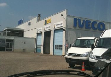
Trail Mountain bike of 25 km to be discovered at Auvergne-Rhône-Alpes, Rhône, Simandres. This trail is proposed by tracegps.
Description
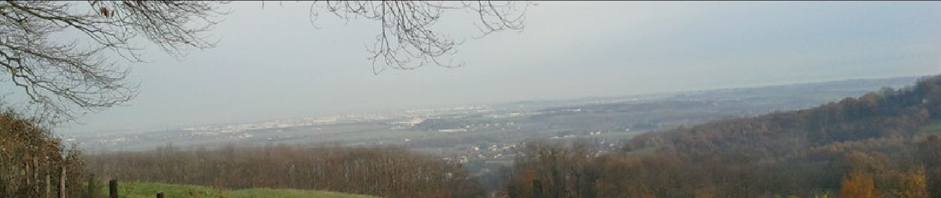
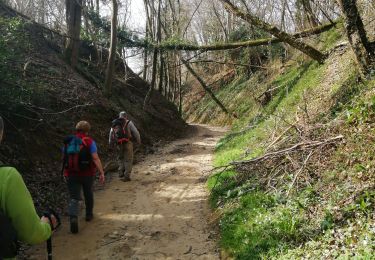
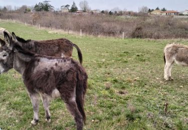
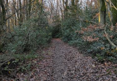
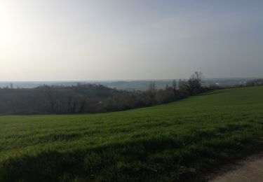
Trace trouvée sur le net, effectuée le 3 dec2011, avec une météo assez clémente (mais lendemain de pluie). Départ Simandres, quelques km relativement plats (2-3km) puis ensuite une grosse et relativement longue montée ( de 1km avec un peu plus de 100m de déniv ), que nous avons fait en poussant sur la fin (caillou glissant feuilles mortes). Une fois arrivé la haut vous avez passé la principale difficulté du circuit. Ps : Le bois de la châtaigneraie est quasiment impossible à traverser et d'ailleurs le chemin est fermé tellement le bois est impraticable (beaucoup d'arbres couchés etc). Par contre beaucoup de passages glissants suite à la pluie de la veille et très grosse flaques d'eau. Selon moi: Sortie en famille : Non. Débutant : oui avec un mininum de condition physique mais faisable. Temps : A éviter le lendemain d'un jour de pluie.
Positioning
Comments
Trails nearby
![Trail Walking Marennes - 69 marennes-villette-V2-17km-420m - Photo](https://media.geolcdn.com/t/375/260/25f97240-4655-4bff-897e-e00f442ce49e.jpg&format=jpg&maxdim=2)
![Walking Walking](https://static1.geolcdn.com/sitytour/trail-icons/101.png)
Walking
![](/images/other/stat-length.png)
![](https://static1.geolcdn.com/siteimages/upload/files/16400158638029165_repeat_loop_refresh_sync_direction_icon.png)
![Trail Walking Vernaison - 69_Vernaison Rhône_12km_150m - Photo](https://media.geolcdn.com/t/375/260/a98e33a3-1aa3-45f3-bb3d-3d1de1405e03.jpg&format=jpg&maxdim=2)
![Walking Walking](https://static1.geolcdn.com/sitytour/trail-icons/101.png)
Walking
![](/images/other/stat-length.png)
![](https://static1.geolcdn.com/siteimages/upload/files/16400158638029165_repeat_loop_refresh_sync_direction_icon.png)
![Trail Mountain bike Chaponnay - Chaponnay marennes villette - Photo](https://media.geolcdn.com/t/375/260/ext.jpg?maxdim=2&url=https%3A%2F%2Fstatic1.geolcdn.com%2Fsiteimages%2Fupload%2Ffiles%2F1524743154velo.jpg)
![Mountain bike Mountain bike](https://static1.geolcdn.com/sitytour/trail-icons/202.png)
Mountain bike
![](/images/other/stat-length.png)
![](https://static1.geolcdn.com/siteimages/upload/files/16400158638029165_repeat_loop_refresh_sync_direction_icon.png)
![Trail Other activity Marennes - iveco - Photo](https://media.geolcdn.com/t/375/260/ext.jpg?maxdim=2&url=https%3A%2F%2Fservices.sitytrail.com%2FGeolivesWS%2FDownloadMedia.ashx%3FTrailID%3D40090%26Media%3Dimage3.jpg)
![Other activity Other activity](https://static1.geolcdn.com/sitytour/trail-icons/900.png)
Other activity
![](/images/other/stat-length.png)
![](https://static1.geolcdn.com/siteimages/upload/files/16400158638029165_repeat_loop_refresh_sync_direction_icon.png)
![Trail Walking Vernaison - 69-Vernaisonlesforts12km170m - Photo](https://media.geolcdn.com/t/375/260/863e3a8f-4d5e-4fc9-a77e-4e2862df8e3d.jpg&format=jpg&maxdim=2)
![Walking Walking](https://static1.geolcdn.com/sitytour/trail-icons/101.png)
Walking
![](/images/other/stat-length.png)
![](https://static1.geolcdn.com/siteimages/upload/files/16400158638029165_repeat_loop_refresh_sync_direction_icon.png)
![Trail Walking Communay - balade notre dame de linon - Photo](https://media.geolcdn.com/t/375/260/40fdd5d2-5497-40a2-be42-86d136965eda.jpg&format=jpg&maxdim=2)
![Walking Walking](https://static1.geolcdn.com/sitytour/trail-icons/101.png)
Walking
![](/images/other/stat-length.png)
![](https://static1.geolcdn.com/siteimages/upload/files/16400158638029165_repeat_loop_refresh_sync_direction_icon.png)
![Trail Walking Marennes - 69 marenne villette 10km 200m - Photo](https://media.geolcdn.com/t/375/260/1eac13ca-fc98-403a-afaa-fbf6aa33bb9b.jpg&format=jpg&maxdim=2)
![Walking Walking](https://static1.geolcdn.com/sitytour/trail-icons/101.png)
Walking
![](/images/other/stat-length.png)
![](https://static1.geolcdn.com/siteimages/upload/files/16400158638029165_repeat_loop_refresh_sync_direction_icon.png)
![Trail Mountain bike Villette-de-Vienne - 1er mai Chaponnay chuzelles Luzinay - Photo](https://media.geolcdn.com/t/375/260/ext.jpg?maxdim=2&url=https%3A%2F%2Fservices.sitytrail.com%2FGeolivesWS%2FDownloadMedia.ashx%3FTrailID%3D1146385%26Media%3Dfix__20180623113357.jpg)
![Mountain bike Mountain bike](https://static1.geolcdn.com/sitytour/trail-icons/202.png)
Mountain bike
![](/images/other/stat-length.png)
![](https://static1.geolcdn.com/siteimages/upload/files/16400158638029165_repeat_loop_refresh_sync_direction_icon.png)
![Trail Mountain bike Chaponnay - Chaponnay chuzelles Luzinay_backup - Photo](https://media.geolcdn.com/t/375/260/ext.jpg?maxdim=2&url=https%3A%2F%2Fservices.sitytrail.com%2FGeolivesWS%2FDownloadMedia.ashx%3FTrailID%3D1146377%26Media%3Dfix__20180623113357.jpg)
![Mountain bike Mountain bike](https://static1.geolcdn.com/sitytour/trail-icons/202.png)
Mountain bike
![](/images/other/stat-length.png)
![](https://static1.geolcdn.com/siteimages/upload/files/16400158638029165_repeat_loop_refresh_sync_direction_icon.png)