


9.2 km | 11.6 km-effort

User


FREE GPS app for hiking
 SityTrail
IGN / Geographical institutes
SityTrail World
The world is yours!
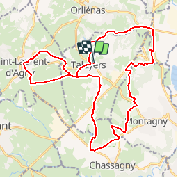
Trail Mountain bike of 23 km to be discovered at Auvergne-Rhône-Alpes, Rhône, Taluyers. This trail is proposed by tracegps.
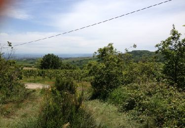
Belle boucle effectuée le 13/11/11. Départ Taluyers, parking facile au niveau du prieuré. Direction St Laurent d'Agny dans un premier temps par un chemin large et roulant, parfait pour se chauffer. Une fois à St Laurent, la trace nous ramène sur Taluyers, qui ensuite nous amène dans les landes de Montagny (des petits singles sympa),puis direction Montagny, puis les 7 chemins (ATTENTION GROSSE DESCENTE en ROCHER). Quelques portages sont à prévoir mais rien d'impossible. Une fois arrivés aux 7 Chemins, un chemin nous ramène jusqu'à Taluyers. Avis perso : TRES belle boucle, attention toutefois à la descente vers les S (surtout quand c'est humide), débutant ok (quelques portage/poussage et 2-3 belles grimpettes mais rien d'impossible !). Par contre, à mes yeux impossible de la faire dans le sens contraire (à moins de monter les S par la route, bref sans grand intérêt). Points fort : Très très peu de goudron !


Walking
Other activity
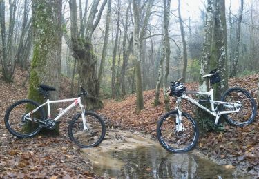
Mountain bike
Walking

Walking
On foot
Walking
Other activity
Walking