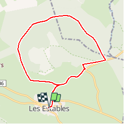
![](/images/other/stat-length.png)
![Trail Mountain bike Les Estables - Site VTT FFC du Mézenc et de la Loire sauvage - Circuit n° 04 - Tour du Mont Alambre - Photo](https://media.geolcdn.com/t/1900/400/ext.pjpeg?maxdim=2&url=https%3A%2F%2Fservices.sitytrail.com%2FGeolivesWS%2FDownloadMedia.ashx%3FTrailID%3D107489%26Media%3D12434_3.jpg)
Site VTT FFC du Mézenc et de la Loire sauvage - Circuit n° 04 - Tour du Mont Alambre
tracegps
User
![Length](/images/other/stat-length.png)
![Max alt](https://static1.geolcdn.com/siteimages/upload/files/1508320355ic_sort_altitude_max_24dp.png)
![Uphill gradient](https://static1.geolcdn.com/siteimages/upload/files/1508320355ic_sort_den_pos_24dp.png)
![Km-Effort](/images/other/stat-length.png)
![Min alt](https://static1.geolcdn.com/siteimages/upload/files/1508320355ic_sort_altitude_min_24dp.png)
![Downhill gradient](https://static1.geolcdn.com/siteimages/upload/files/1508320355ic_sort_den_neg_24dp.png)
![Boucle](https://static1.geolcdn.com/siteimages/upload/files/16400158638029165_repeat_loop_refresh_sync_direction_icon.png)
![Mountain bike](https://static1.geolcdn.com/sitytour/trail-icons/202.png)
1h00
Difficulty : Medium
![Scan this QR Code to open this trail in the SityTrail application](https://capi.geolives.com/qq0zvz2zws4bq2lad0pu/sitytour/trails/107489/qr.png?size=200)
FREE GPS app for hiking
About
Trail Mountain bike of 8.6 km to be discovered at Auvergne-Rhône-Alpes, Haute-Loire, Les Estables. This trail is proposed by tracegps.
Description
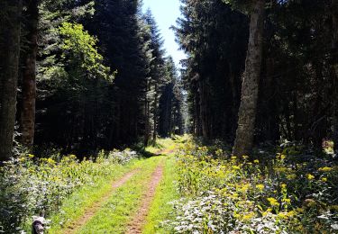
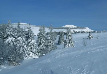
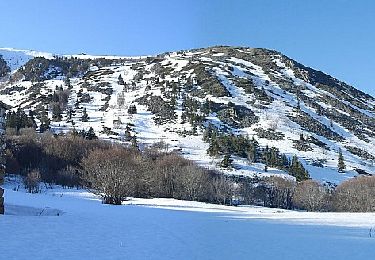
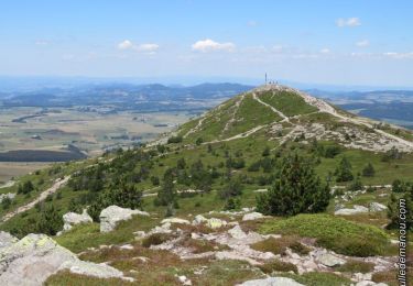
Site VTT FFC du Mézenc et de la Loire sauvage - Circuit n° 04 - Tour du Mont Alambre. Circuit officiel labellisé par la Fédération Française de Cyclisme. Départ et arrivée : Place de l’office de Tourisme. Avides d’odeurs et de couleurs vives, de 1350 m à 1582 m d’altitudes, vous serez charmés à la belle saison par les nombreuses espèces protégées du massif du Mézenc. Dans un cadre préservé offrant des panoramas variés et grandioses, s’ouvrant notamment sur la chaîne des Alpes.
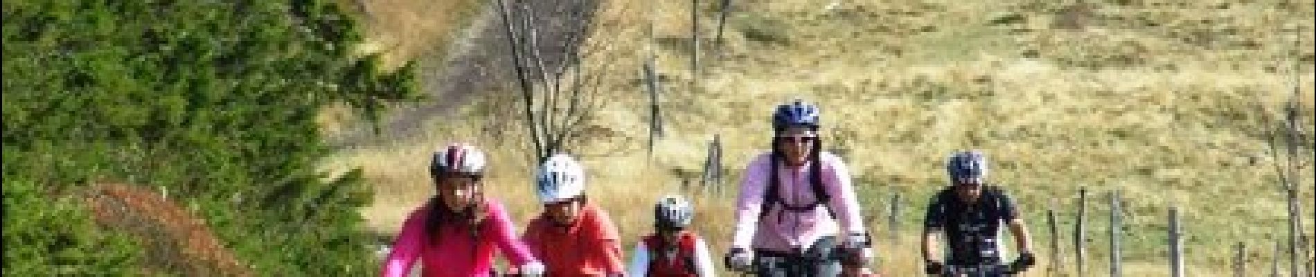
Positioning
Comments
Trails nearby
![Trail Mountain bike Les Estables - Site VTT FFC du Mézenc et de la Loire sauvage - Circuit n° 07 - Boucle en foret domaniale - Photo](https://media.geolcdn.com/t/375/260/ext.jpg?maxdim=2&url=https%3A%2F%2Fservices.sitytrail.com%2FGeolivesWS%2FDownloadMedia.ashx%3FTrailID%3D107492%26Media%3D12437_2.jpg)
![Mountain bike Mountain bike](https://static1.geolcdn.com/sitytour/trail-icons/202.png)
Mountain bike
![](/images/other/stat-length.png)
![](https://static1.geolcdn.com/siteimages/upload/files/16400158638029165_repeat_loop_refresh_sync_direction_icon.png)
![Trail Walking Les Estables - Mont Mezenc - Photo](https://media.geolcdn.com/t/375/260/ce0fbf1f-346a-43be-bffd-dfd03dc61c12.jpg&format=jpg&maxdim=2)
![Walking Walking](https://static1.geolcdn.com/sitytour/trail-icons/101.png)
Walking
![](/images/other/stat-length.png)
![](https://static1.geolcdn.com/siteimages/upload/files/16400158638029165_repeat_loop_refresh_sync_direction_icon.png)
![Trail Walking Borée - Le tour du Mont Mézenc en Ardèche - Photo](https://media.geolcdn.com/t/375/260/970aece0-8ccf-44ea-bc9f-1d6489c7e0aa.jpg&format=jpg&maxdim=2)
![Walking Walking](https://static1.geolcdn.com/sitytour/trail-icons/101.png)
Walking
![](/images/other/stat-length.png)
![](https://static1.geolcdn.com/siteimages/upload/files/16400158638029165_repeat_loop_refresh_sync_direction_icon.png)
![Trail Walking La Rochette - Le tour du Mont Signon au départ de la chambre d'hôtes La retrouvade - Photo](https://media.geolcdn.com/t/375/260/a743c4a1-06ad-43d0-8b82-bee213f09387.jpg&format=jpg&maxdim=2)
![Walking Walking](https://static1.geolcdn.com/sitytour/trail-icons/101.png)
Walking
![](/images/other/stat-length.png)
![](https://static1.geolcdn.com/siteimages/upload/files/16400158638029165_repeat_loop_refresh_sync_direction_icon.png)
![Trail Walking Les Estables - Mont Mezenc Tour et sommet - Photo](https://media.geolcdn.com/t/375/260/fadc45c1-ba83-4e9a-a452-756f5fd46c63.jpg&format=jpg&maxdim=2)
![Walking Walking](https://static1.geolcdn.com/sitytour/trail-icons/101.png)
Walking
![](/images/other/stat-length.png)
![](https://static1.geolcdn.com/siteimages/upload/files/16400158638029165_repeat_loop_refresh_sync_direction_icon.png)
![Trail Walking Sainte-Eulalie - 2023-01-26_11h39m37_Sucs Montfol et La Lauzière 11km.gpx.xml - Photo](https://media.geolcdn.com/t/375/260/23607b52-b0d6-4888-813e-934a0c1347d5.jpg&format=jpg&maxdim=2)
![Walking Walking](https://static1.geolcdn.com/sitytour/trail-icons/101.png)
Walking
![](/images/other/stat-length.png)
![](https://static1.geolcdn.com/siteimages/upload/files/16400158638029165_repeat_loop_refresh_sync_direction_icon.png)
![Trail Walking Borée - 2023-01-26_07h29m20_Tour Mézenc 17km.gpx.xml - Photo](https://media.geolcdn.com/t/375/260/92d24228-4d9c-4ba3-b5e5-3f7d7227fc7d.jpg&format=jpg&maxdim=2)
![Walking Walking](https://static1.geolcdn.com/sitytour/trail-icons/101.png)
Walking
![](/images/other/stat-length.png)
![](https://static1.geolcdn.com/siteimages/upload/files/16400158638029165_repeat_loop_refresh_sync_direction_icon.png)
![Trail Walking Les Estables - Circuit incluant le sommet du Mezenc - Photo](https://media.geolcdn.com/t/375/260/f9b8e22d-f239-491b-8f20-19a91b900080.jpg&format=jpg&maxdim=2)
![Walking Walking](https://static1.geolcdn.com/sitytour/trail-icons/101.png)
Walking
![](/images/other/stat-length.png)
![](https://static1.geolcdn.com/siteimages/upload/files/16400158638029165_repeat_loop_refresh_sync_direction_icon.png)
![Trail Walking Borée - 2022-06-27_19h04m40_Tour du Mont Mézenc 15km.gpx.xml - Photo](https://media.geolcdn.com/t/375/260/af414573-165d-4bf9-981e-cdfb4343adbb.jpg&format=jpg&maxdim=2)
![Walking Walking](https://static1.geolcdn.com/sitytour/trail-icons/101.png)
Walking
![](/images/other/stat-length.png)
![](https://static1.geolcdn.com/siteimages/upload/files/16400158638029165_repeat_loop_refresh_sync_direction_icon.png)