Trail Mountain bike Istres - St Blaise - Istres - Photo
 tracegps
tracegps

User

© OpenStreetMap contributors
Length
Length
18.2 km
Max alt
Max alt
67 m
Uphill gradient
Uphill gradient
224 m
Km-Effort
Km-Effort  
21 km
Min alt
Min alt
14 m
Downhill gradient
Downhill gradient
223 m
Boucle
Boucle
Yes
Creation date :
2014-12-10 00:00:00.0
Updated on :
2014-12-10 00:00:00.0

(0 Reviews)

Mountain bike
Mountain bike
1h19
Difficulty : Medium

Scan this QR Code to open this trail in the SityTrail application

FREE GPS app for hiking

Logo SityTrail SityTrail

IGN / Geographical institutes

Download SityTrail from the App Store Download SityTrail from Google Play

Logo SityTrail SityTrail World

The world is yours!

Download SityTrail from the App Store Download SityTrail from Google Play Download SityTrail on Huawei AppGallery

About

Trail Mountain bike of 18.2 km to be discovered at Provence-Alpes-Côte d'Azur, Bouches-du-Rhône, Istres. This trail is proposed by tracegps.

Description

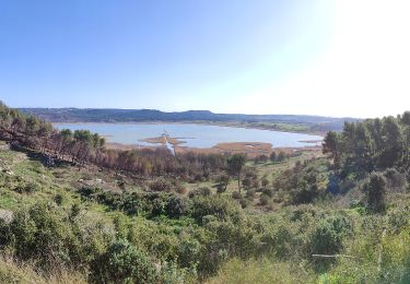
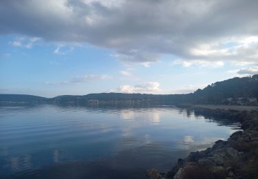
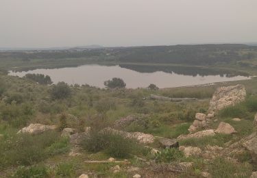
Départ du stade à l'entrée de Istres sur la voie entre Istres et Martigues. Ensuite on a un peu de route pour rejoindre St Blaise, un circuit pour la promenade pédestre ou VTT dans un cadre vraiment magnifique entouré par plusieurs petits lacs. Une fois sur place, on peut faire plusieurs parcours au grès des envies, un large choix de chemins se présente. Sur cette trace, nous avons fait le tour de St Blaise.

Elevation profile

Positioning

Country:
France
Region :
Provence-Alpes-Côte d'Azur
Department/Province :
Bouches-du-Rhône
Municipality :
Istres
Location:
Unknown
Start:(UTM)
661224 ; 4816898 (31T) N.

Trails nearby

Trail Walking Istres - Entre ville et nature - Istres - Photo
Walking
tracegps

Walking

Difficult
(2)
Istres, Provence-Alpes-Côte d'Azur, Bouches-du-Rhône, France
12.3 km | 14.7 km-effort
4h 0min
Yes
Trail On foot Saint-Mitre-les-Remparts - Forêt de Castillon Etang de Saint-Blaise - Photo
On foot
GUIDE+

On foot

Easy
Saint-Mitre-les-Remparts, Provence-Alpes-Côte d'Azur, Bouches-du-Rhône, France
6.1 km | 7.1 km-effort
1h 36min
No
Trail On foot Saint-Mitre-les-Remparts - Entre mer et étangs - Photo
On foot
GUIDE+

On foot

Very difficult
Saint-Mitre-les-Remparts, Provence-Alpes-Côte d'Azur, Bouches-du-Rhône, France
39 km | 46 km-effort
10h 22min
Yes
Trail On foot Saint-Mitre-les-Remparts - Du Crépon aux Rocalèdes - Photo
On foot
GUIDE+

On foot

Easy
Saint-Mitre-les-Remparts, Provence-Alpes-Côte d'Azur, Bouches-du-Rhône, France
6.1 km | 8 km-effort
1h 49min
Yes
Trail On foot Saint-Mitre-les-Remparts - Les Tours Gros - Photo
On foot
GUIDE+

On foot

Easy
Saint-Mitre-les-Remparts, Provence-Alpes-Côte d'Azur, Bouches-du-Rhône, France
6.2 km | 7.9 km-effort
1h 48min
Yes
Trail On foot Istres - Entre ville et nature (Istres) - Photo
On foot
GUIDE+

On foot

Easy
Istres, Provence-Alpes-Côte d'Azur, Bouches-du-Rhône, France
13.3 km | 15.7 km-effort
3h 34min
Yes
Trail Walking Istres - Miramas Istres GR 2013 ALLER - Photo
Walking
hervef13300

Walking

Easy
(2)
Istres, Provence-Alpes-Côte d'Azur, Bouches-du-Rhône, France
7.6 km | 10 km-effort
2h 6min
No
Trail Walking Istres - Le Ranquet-Istres 30.11.24 - Photo
Walking
GUIDE
fredetpascale

Walking

Easy
Istres, Provence-Alpes-Côte d'Azur, Bouches-du-Rhône, France
11.7 km | 14.2 km-effort
3h 30min
Yes
Trail Walking Saint-Mitre-les-Remparts - Étangs de St Mitre les remparts  - Photo
Walking
nana1643

Walking

Easy
Saint-Mitre-les-Remparts, Provence-Alpes-Côte d'Azur, Bouches-du-Rhône, France
8 km | 9.6 km-effort
3h 36min
No


Close
My subscriptions