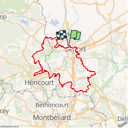
![](/images/other/stat-length.png)
![Trail Mountain bike Belfort - Transterritoire de Belfort 2011 - Photo](https://media.geolcdn.com/t/1900/400/ext.pjpeg?maxdim=2&url=https%3A%2F%2Fservices.sitytrail.com%2FGeolivesWS%2FDownloadMedia.ashx%3FTrailID%3D107302%26Media%3D12189_3.jpg)
Transterritoire de Belfort 2011
tracegps
User
![Length](/images/other/stat-length.png)
![Max alt](https://static1.geolcdn.com/siteimages/upload/files/1508320355ic_sort_altitude_max_24dp.png)
![Uphill gradient](https://static1.geolcdn.com/siteimages/upload/files/1508320355ic_sort_den_pos_24dp.png)
![Km-Effort](/images/other/stat-length.png)
![Min alt](https://static1.geolcdn.com/siteimages/upload/files/1508320355ic_sort_altitude_min_24dp.png)
![Downhill gradient](https://static1.geolcdn.com/siteimages/upload/files/1508320355ic_sort_den_neg_24dp.png)
![Boucle](https://static1.geolcdn.com/siteimages/upload/files/16400158638029165_repeat_loop_refresh_sync_direction_icon.png)
![Mountain bike](https://static1.geolcdn.com/sitytour/trail-icons/202.png)
5h00
Difficulty : Difficult
![Scan this QR Code to open this trail in the SityTrail application](https://capi.geolives.com/qq0zvz2zws4bq2lad0pu/sitytour/trails/107302/qr.png?size=200)
FREE GPS app for hiking
About
Trail Mountain bike of 71 km to be discovered at Bourgogne-Franche-Comté, Territoire-de-Belfort, Belfort. This trail is proposed by tracegps.
Description
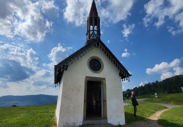
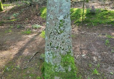
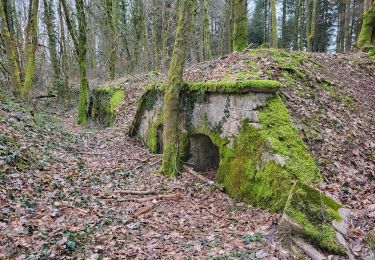
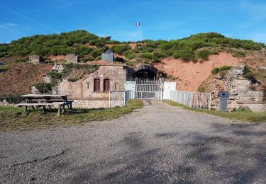
Départ depuis l'UTBM de Belfort. Après 2km de route, première montée et premier sentier pour partir à l'assaut du Salbert qui se fera par palier. Sur la fin de la montée il faudra faire un peu de portage pour passer un escalier. Puis descente rapide et ludique. Ensuite on contourne Châlonvillar par la forêt avec un bon coup de cul mais rien d'insurmontable. Passage à Echenans-Sous-Mont-Vaudois, puis le Mont-Vaudois avec une montée bien sympathique avec un bon single très ludique, une fois arrivée au sommet. Descente assez rapide, puis passage de ruisseau pour remonter directement. Il ne faut vraiment pas avoir peur de passer le ruisseau sur le vélo, ça sera plus simple pour monter. On arrive à Banvillar par des chemins très roulant. De même on rejoindra Châtenois-Lès-Forêt. Bien qu'on soit en VTT, il se profile une longue portion de route pour rejoindre des chemins qui nous conduiront jusqu'à la gare TGV de Méroux. On longe la voie ferrée, on passera également sous la voie. On rejoint tranquillement Belfort à travers champs et forêt. Et quel final dans Belfort avec la montée vers la Tour des Bourgeois et la citadelle avec passage dans des tunnels, passage sous le Lion. Puis retour vers l'UTBM.
Positioning
Comments
Trails nearby
![Trail Mountain bike Andelnans - Tour d'Essert - Photo](https://media.geolcdn.com/t/375/260/ext.jpg?maxdim=2&url=https%3A%2F%2Fstatic1.geolcdn.com%2Fsiteimages%2Fupload%2Ffiles%2F1524743154velo.jpg)
![Mountain bike Mountain bike](https://static1.geolcdn.com/sitytour/trail-icons/202.png)
Mountain bike
![](/images/other/stat-length.png)
![](https://static1.geolcdn.com/siteimages/upload/files/16400158638029165_repeat_loop_refresh_sync_direction_icon.png)
![Trail Walking Belfort - Offemont - La ballade des Champs Cerisiers - Photo](https://media.geolcdn.com/t/375/260/ext.jpg?maxdim=2&url=https%3A%2F%2Fstatic1.geolcdn.com%2Fsiteimages%2Fupload%2Ffiles%2F1553511878bg_sport_marche.png)
![Walking Walking](https://static1.geolcdn.com/sitytour/trail-icons/101.png)
Walking
![](/images/other/stat-length.png)
![](https://static1.geolcdn.com/siteimages/upload/files/16400158638029165_repeat_loop_refresh_sync_direction_icon.png)
![Trail Walking Sermamagny - Veronne PC - Photo](https://media.geolcdn.com/t/375/260/ext.jpg?maxdim=2&url=https%3A%2F%2Fstatic1.geolcdn.com%2Fsiteimages%2Fupload%2Ffiles%2F1553511878bg_sport_marche.png)
![Walking Walking](https://static1.geolcdn.com/sitytour/trail-icons/101.png)
Walking
![](/images/other/stat-length.png)
![](https://static1.geolcdn.com/siteimages/upload/files/16400158638029165_repeat_loop_refresh_sync_direction_icon.png)
![Trail Walking Offemont - Etang des Forges - Forts de la Miotte et de la Justice - Citadèle et Vieille ville de Belfort - Photo](https://media.geolcdn.com/t/375/260/c26a3ad7-a095-475f-934e-c91591fd50e4.jpg&format=jpg&maxdim=2)
![Walking Walking](https://static1.geolcdn.com/sitytour/trail-icons/101.png)
Walking
![](/images/other/stat-length.png)
![](https://static1.geolcdn.com/siteimages/upload/files/16400158638029165_repeat_loop_refresh_sync_direction_icon.png)
![Trail Electric bike Essert - VTT - Essert - Salbert - Vétrigne - Miotte - Citadelle Belfort - Essert - Photo](https://media.geolcdn.com/t/375/260/9ea3754c-f673-4e19-890f-f64e417a9f4d.jpg&format=jpg&maxdim=2)
![Electric bike Electric bike](https://static1.geolcdn.com/sitytour/trail-icons/205.png)
Electric bike
![](/images/other/stat-length.png)
![](https://static1.geolcdn.com/siteimages/upload/files/16400158638029165_repeat_loop_refresh_sync_direction_icon.png)
![Trail Motorbike Évette-Salbert - Moto - Evette - Grand Ballon - Honneck - Lacs de Longemer puis de Gérardmer - chapelle des Vés - Ballon d'Alsace - Photo](https://media.geolcdn.com/t/375/260/7fdb8878-2da7-4fc1-b838-8926082e0304.jpg&format=jpg&maxdim=2)
![Motorbike Motorbike](https://static1.geolcdn.com/sitytour/trail-icons/402.png)
Motorbike
![](/images/other/stat-length.png)
![](https://static1.geolcdn.com/siteimages/upload/files/16400158638029165_repeat_loop_refresh_sync_direction_icon.png)
![Trail Electric bike Châlonvillars - VTT - Châlonvillars - Etobon - Ronchamp - Plancher-Bas - Malsaucy - Photo](https://media.geolcdn.com/t/375/260/0af5e710-b661-426e-a32c-4cb272df7c44.jpg&format=jpg&maxdim=2)
![Electric bike Electric bike](https://static1.geolcdn.com/sitytour/trail-icons/205.png)
Electric bike
![](/images/other/stat-length.png)
![](https://static1.geolcdn.com/siteimages/upload/files/16400158638029165_repeat_loop_refresh_sync_direction_icon.png)
![Trail Walking Châlonvillars - Châlonvillars - Fort du Salbert - Evette-Salbert - Photo](https://media.geolcdn.com/t/375/260/30a56d40-1ac0-4227-a497-f489c67ce1fe.jpg&format=jpg&maxdim=2)
![Walking Walking](https://static1.geolcdn.com/sitytour/trail-icons/101.png)
Walking
![](/images/other/stat-length.png)
![](https://static1.geolcdn.com/siteimages/upload/files/16400158638029165_repeat_loop_refresh_sync_direction_icon.png)
![Trail Mountain bike Châlonvillars - Châlonvillars - Fort Giromagny en passant au milieu des étangs - Photo](https://media.geolcdn.com/t/375/260/4cf742f1-48e3-4bef-b8af-82a52a583623.jpg&format=jpg&maxdim=2)
![Mountain bike Mountain bike](https://static1.geolcdn.com/sitytour/trail-icons/202.png)
Mountain bike
![](/images/other/stat-length.png)
![](https://static1.geolcdn.com/siteimages/upload/files/16400158638029165_repeat_loop_refresh_sync_direction_icon.png)