![](/images/other/stat-length.png)
![Trail Walking Conques-en-Rouergue - La Vinzelle - Grand Vabre - Photo](https://media.geolcdn.com/t/1900/400/ext.pjpeg?maxdim=2&url=https%3A%2F%2Fservices.sitytrail.com%2FGeolivesWS%2FDownloadMedia.ashx%3FTrailID%3D107259%26Media%3D12139_6.jpg)
La Vinzelle - Grand Vabre
tracegps
User
![Length](/images/other/stat-length.png)
Length
6.7 km
![Max alt](https://static1.geolcdn.com/siteimages/upload/files/1508320355ic_sort_altitude_max_24dp.png)
Max alt
489 m
![Uphill gradient](https://static1.geolcdn.com/siteimages/upload/files/1508320355ic_sort_den_pos_24dp.png)
Uphill gradient
325 m
![Km-Effort](/images/other/stat-length.png)
Km-Effort
11.1 km
![Min alt](https://static1.geolcdn.com/siteimages/upload/files/1508320355ic_sort_altitude_min_24dp.png)
Min alt
194 m
![Downhill gradient](https://static1.geolcdn.com/siteimages/upload/files/1508320355ic_sort_den_neg_24dp.png)
Downhill gradient
326 m
![Boucle](https://static1.geolcdn.com/siteimages/upload/files/16400158638029165_repeat_loop_refresh_sync_direction_icon.png)
Boucle
Yes
Creation date :
2014-12-10 00:00:00.0
Updated on :
2014-12-10 00:00:00.0
![Walking](https://static1.geolcdn.com/sitytour/trail-icons/101.png)
3h30
Difficulty : Medium
![Scan this QR Code to open this trail in the SityTrail application](https://capi.geolives.com/qq0zvz2zws4bq2lad0pu/sitytour/trails/107259/qr.png?size=200)
FREE GPS app for hiking
About
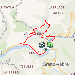
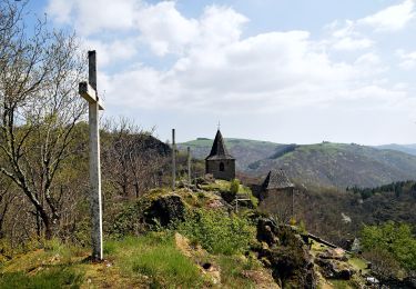
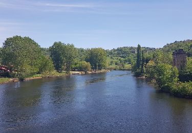
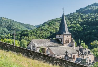
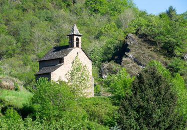
Trail Walking of 6.7 km to be discovered at Occitania, Aveyron, Conques-en-Rouergue. This trail is proposed by tracegps.
Description
Jolie randonnée, très beaux sentiers escarpés, village classé de la Vinzelle avec possibilité de rallonger la randonnée. Au départ du village, une boucle 45 minutes et un balisage jaune plus panneaux.
Positioning
Country:
France
Region :
Occitania
Department/Province :
Aveyron
Municipality :
Conques-en-Rouergue
Location:
Grand-Vabre
Start:(Dec)
Start:(UTM)
448591 ; 4942660 (31T) N.
Comments
Trails nearby
![Trail Walking Conques-en-Rouergue - Les Pelies La Vinzelle : boucle rapide - Photo](https://media.geolcdn.com/t/375/260/ext.jpg?maxdim=2&url=https%3A%2F%2Fservices.sitytrail.com%2FGeolivesWS%2FDownloadMedia.ashx%3FTrailID%3D815525%26Media%3D20170822112933.jpg)
![Walking Walking](https://static1.geolcdn.com/sitytour/trail-icons/101.png)
Les Pelies La Vinzelle : boucle rapide
Walking
Easy
(1)
Conques-en-Rouergue,
Occitania,
Aveyron,
France
![](/images/other/stat-length.png)
5.4 km | 8.8 km-effort
3h 19min
![](https://static1.geolcdn.com/siteimages/upload/files/16400158638029165_repeat_loop_refresh_sync_direction_icon.png)
Yes
![Trail On foot Conques-en-Rouergue - TerraTrail 7 - Photo](https://media.geolcdn.com/t/375/260/a3c72d09-9e84-4bb5-99d1-f393f2772e29.jpeg&format=jpg&maxdim=2)
![On foot On foot](https://static1.geolcdn.com/sitytour/trail-icons/100.png)
TerraTrail 7
On foot
Easy
Conques-en-Rouergue,
Occitania,
Aveyron,
France
![](/images/other/stat-length.png)
9.4 km | 15.8 km-effort
3h 36min
![](https://static1.geolcdn.com/siteimages/upload/files/16400158638029165_repeat_loop_refresh_sync_direction_icon.png)
Yes
![Trail On foot Conques-en-Rouergue - Terra trail 10 - Photo](https://media.geolcdn.com/t/375/260/c1627d11-6231-43ca-9a1f-6c8b11a3fcd5.jpeg&format=jpg&maxdim=2)
![On foot On foot](https://static1.geolcdn.com/sitytour/trail-icons/100.png)
Terra trail 10
On foot
Difficult
Conques-en-Rouergue,
Occitania,
Aveyron,
France
![](/images/other/stat-length.png)
22 km | 34 km-effort
7h 41min
![](https://static1.geolcdn.com/siteimages/upload/files/16400158638029165_repeat_loop_refresh_sync_direction_icon.png)
Yes
![Trail Walking Conques-en-Rouergue - Conques Levinhac le Haut Avril 2018 - Photo](https://media.geolcdn.com/t/375/260/ext.jpg?maxdim=2&url=https%3A%2F%2Fservices.sitytrail.com%2FGeolivesWS%2FDownloadMedia.ashx%3FTrailID%3D954999%26Media%3Dfix__20180426142306.jpg)
![Walking Walking](https://static1.geolcdn.com/sitytour/trail-icons/101.png)
Conques Levinhac le Haut Avril 2018
Walking
Difficult
Conques-en-Rouergue,
Occitania,
Aveyron,
France
![](/images/other/stat-length.png)
25 km | 36 km-effort
7h 4min
![](https://static1.geolcdn.com/siteimages/upload/files/16400158638029165_repeat_loop_refresh_sync_direction_icon.png)
No
![Trail Walking Conques-en-Rouergue - Conques - Photo](https://media.geolcdn.com/t/375/260/b1ba52c1-bc17-4a66-9751-be2d2d70e0b7.jpg&format=jpg&maxdim=2)
![Walking Walking](https://static1.geolcdn.com/sitytour/trail-icons/101.png)
Conques
Walking
Very easy
Conques-en-Rouergue,
Occitania,
Aveyron,
France
![](/images/other/stat-length.png)
10.9 km | 16.3 km-effort
3h 2min
![](https://static1.geolcdn.com/siteimages/upload/files/16400158638029165_repeat_loop_refresh_sync_direction_icon.png)
Yes
![Trail On foot Conques-en-Rouergue - Sentier Conques - Grand-Vabre - Photo](https://media.geolcdn.com/t/375/260/54393b8a-3c65-496a-ad24-69e3b20f1258.jpeg&format=jpg&maxdim=2)
![On foot On foot](https://static1.geolcdn.com/sitytour/trail-icons/100.png)
Sentier Conques - Grand-Vabre
On foot
Easy
Conques-en-Rouergue,
Occitania,
Aveyron,
France
![](/images/other/stat-length.png)
4.9 km | 6.4 km-effort
1h 27min
![](https://static1.geolcdn.com/siteimages/upload/files/16400158638029165_repeat_loop_refresh_sync_direction_icon.png)
No
![Trail On foot Conques-en-Rouergue - Tieulet - Photo](https://media.geolcdn.com/t/375/260/81ea3ff4-8db3-4406-ab2f-734b1935602f.jpeg&format=jpg&maxdim=2)
![On foot On foot](https://static1.geolcdn.com/sitytour/trail-icons/100.png)
Tieulet
On foot
Easy
(1)
Conques-en-Rouergue,
Occitania,
Aveyron,
France
![](/images/other/stat-length.png)
6.6 km | 10.5 km-effort
2h 22min
![](https://static1.geolcdn.com/siteimages/upload/files/16400158638029165_repeat_loop_refresh_sync_direction_icon.png)
No
![Trail On foot Conques-en-Rouergue - Chapelle Sainte-Foy - Photo](https://media.geolcdn.com/t/375/260/434a867d-228b-48bc-b18b-156cab88645d.jpeg&format=jpg&maxdim=2)
![On foot On foot](https://static1.geolcdn.com/sitytour/trail-icons/100.png)
Chapelle Sainte-Foy
On foot
Easy
Conques-en-Rouergue,
Occitania,
Aveyron,
France
![](/images/other/stat-length.png)
5.8 km | 10.4 km-effort
2h 22min
![](https://static1.geolcdn.com/siteimages/upload/files/16400158638029165_repeat_loop_refresh_sync_direction_icon.png)
No
![Trail Walking Conques-en-Rouergue - Conques - Photo](https://media.geolcdn.com/t/375/260/32cd5116-ab43-4910-8d1a-8e95108c73de.jpg&format=jpg&maxdim=2)
![Walking Walking](https://static1.geolcdn.com/sitytour/trail-icons/101.png)
Conques
Walking
Medium
Conques-en-Rouergue,
Occitania,
Aveyron,
France
![](/images/other/stat-length.png)
5.8 km | 10.2 km-effort
2h 4min
![](https://static1.geolcdn.com/siteimages/upload/files/16400158638029165_repeat_loop_refresh_sync_direction_icon.png)
Yes
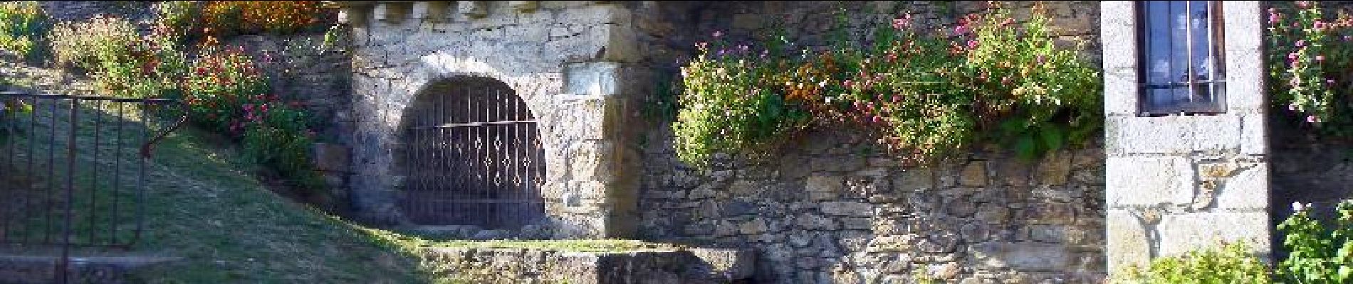
avec auberge à la vinzelle